
A Complete Guide for Hiking and Camping the Pembrokeshire Coast Path in Wales
25 Minute Read
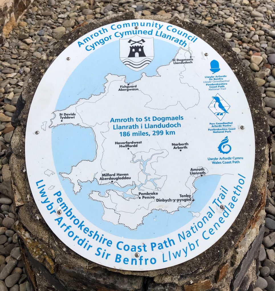
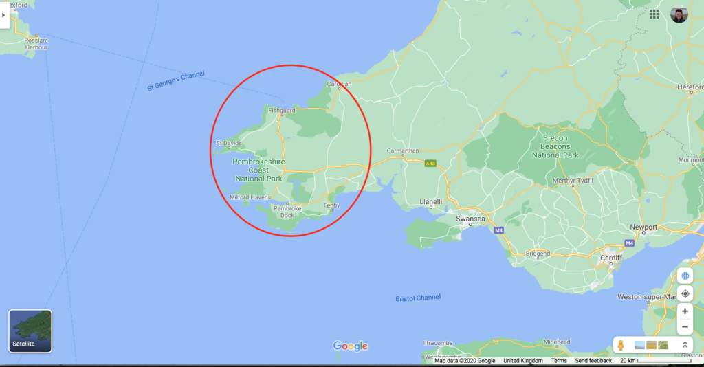
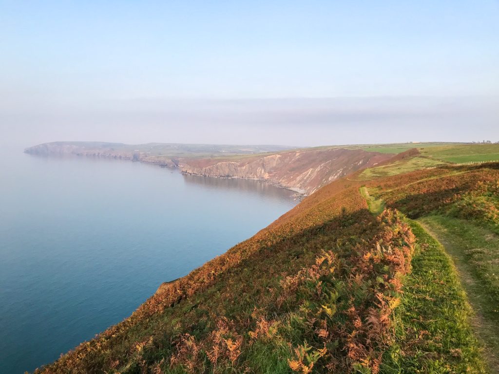
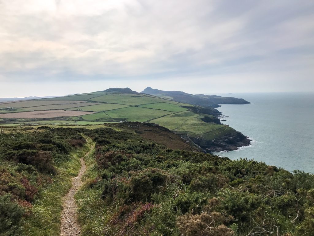
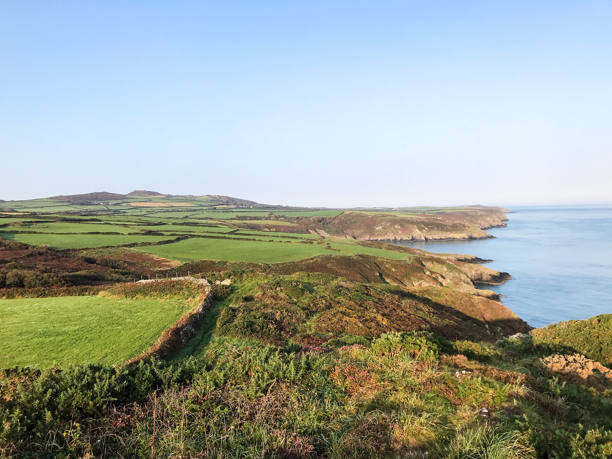
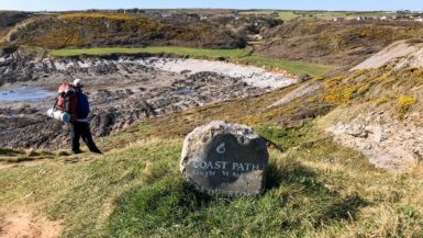
The Pembrokeshire Coast Path is a 186 mile long National Trails path in Wales, UK. The walking path runs from Amroth to St Dogmaels and passes through the Pembrokeshire Coast National Park.
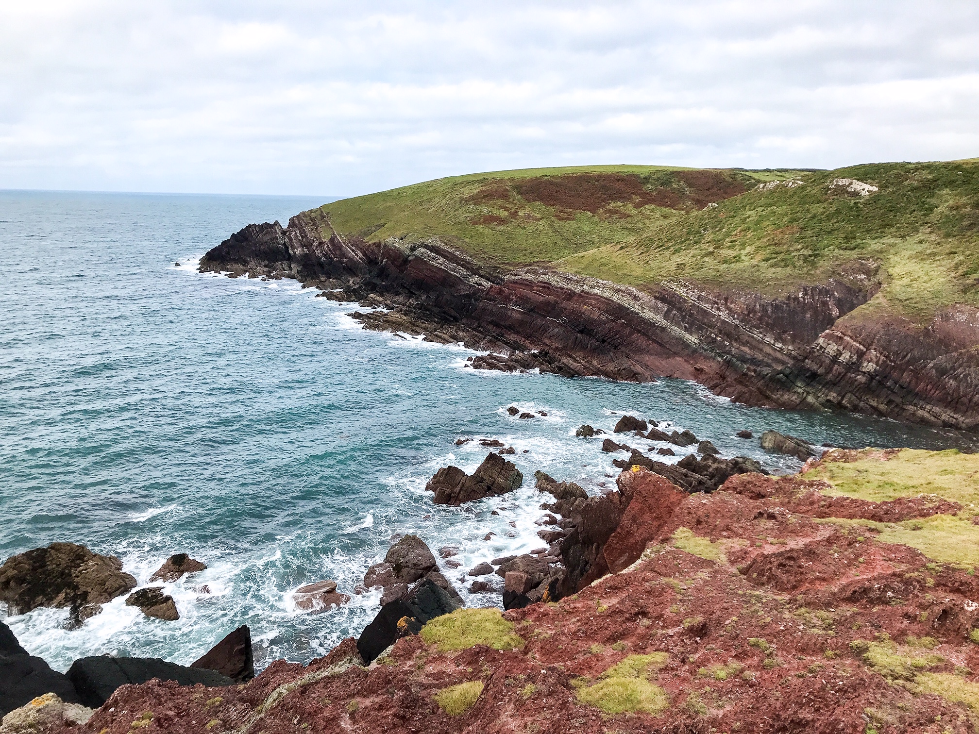
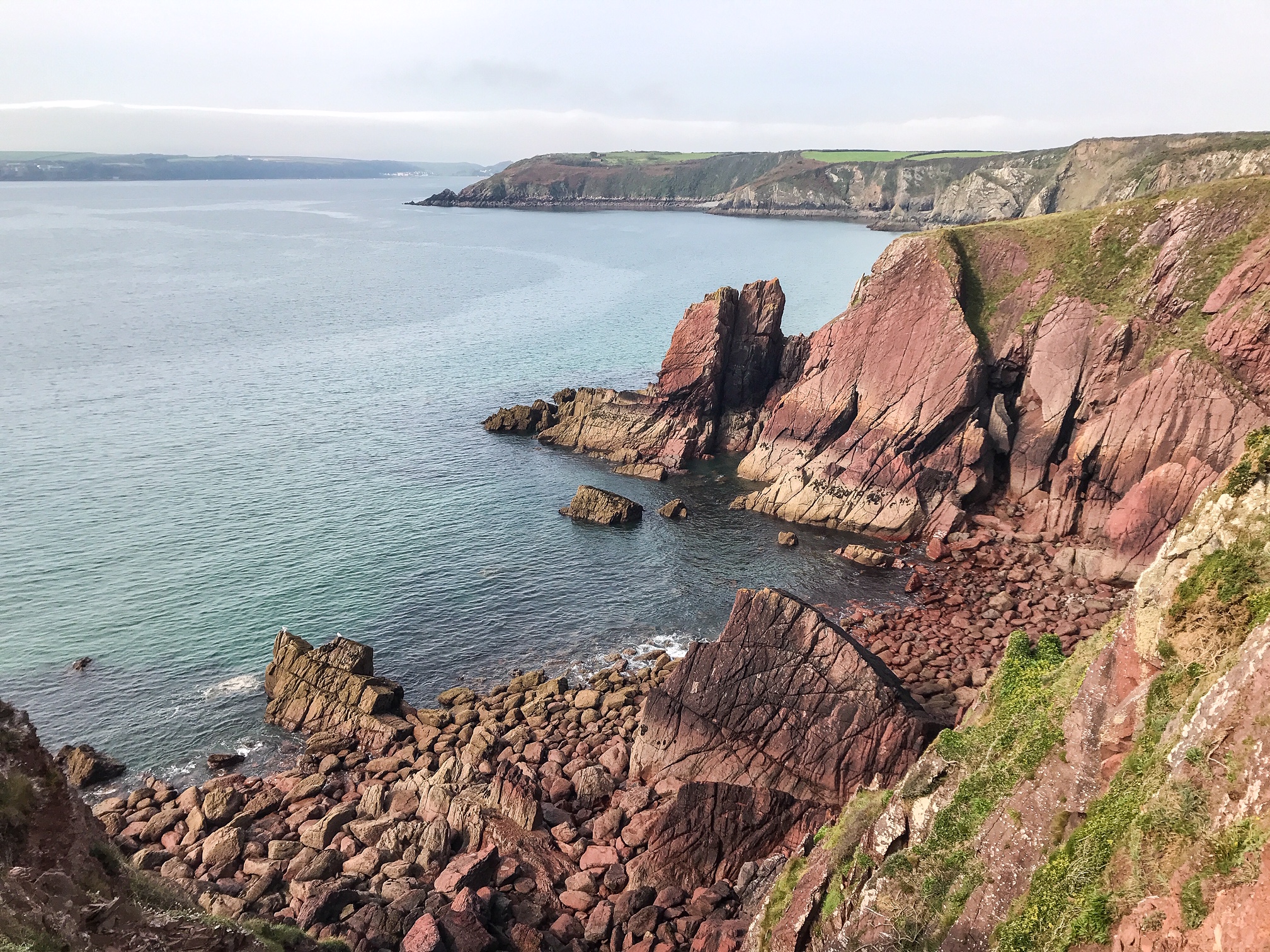
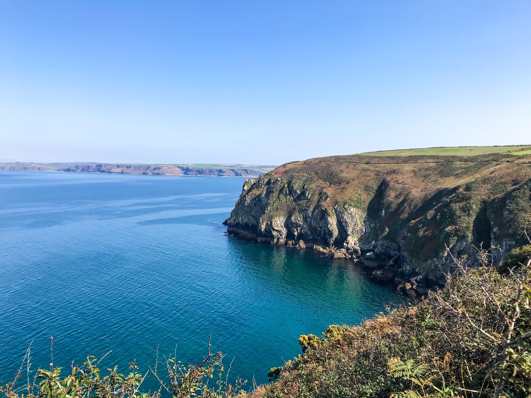
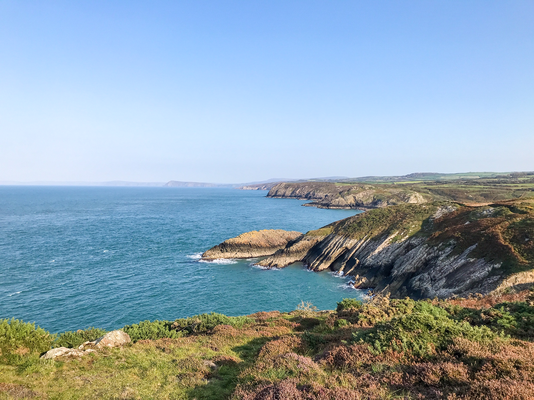
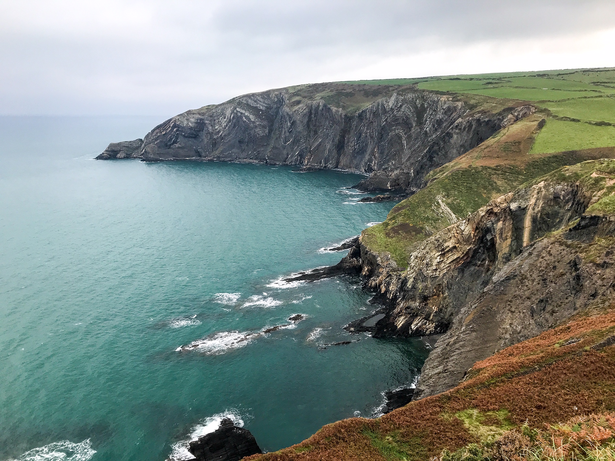
It is renowned for its sweeping beaches, raw beauty, and rugged coast line. There is a range of stunning wildlife to see including RSPB bird nesting sites and seal breeding grounds.
The path takes 12-15 days to walk depending on your fitness levels and crosses through 58 beaches and 14 harbours.
The walk is physically demanding and with all its ascents and descents, covers 35,000 feet – the same height as Mount Everest.
This travel guide will tell you everything you need to know for how to walk and camp the Pembrokeshire Coast Path yourself.
You can either skip to the sections you need information on, if you want to hike only a portion of the trail, or read the whole travel guide to get details on the full Pembrokeshire Coast Path.
- Where to Start?
- How to Get There?
- How to Find Your Way Around?
- Where to Stay?
- What to Pack?
- What to See?
- Is it Safe?
- Food & Drink
- Day to Day Itinerary
- Bonus Tips
This page contains affiliate links. This means I make a commission if you buy a product I have recommended (at no extra cost to you). All recommendations I give are genuine and my own. Thanks for the support!
See also:
Top 5 Best Pembrokeshire Beaches
Top 3 Brecon Beacons Walks
How to Hike the Gower Peninsula Coast Path
1. Where to Start?
First thing to decide is whether you’re going to hike the full trail or just walk a segment. If you’re really adventurous, you can even walk the whole Wales Coast Path which is 870 miles long and includes the Pembrokeshire Coast Path.
If you have time, I recommend challenging yourself to complete the full Pembrokeshire Coast Path trail. It’s physically and mentally challenging but overall an immensely rewarding experience.
In fact, the path is known as “Gwlad Hud a Lledrith” in Welsh, which means “The Land of Mystery and Enchantment” – a very apt name considering the extraordinary landscape!
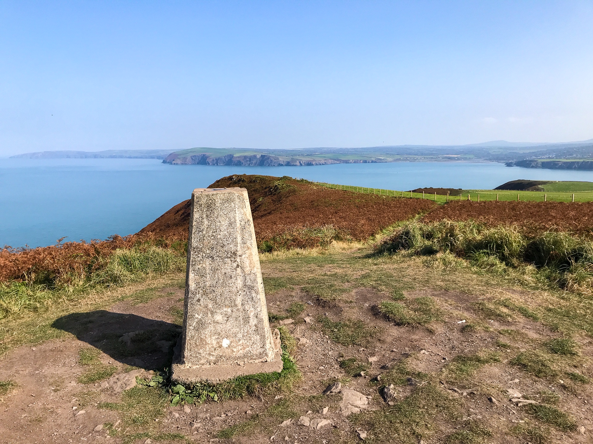
The path is structured with a starting plinth in the north (St Dogmaels) and a finishing point in the south (Amroth). However, I recommend you walk it in the opposite direction (south to north).
This is because the toughest, most remote, and steepest sections of the trail are in the northern part of the Pembrokeshire Coast National Park. Jumping straight into this difficult terrain could take its toll when you aren’t hardened to the trail resulting in blisters, strains, or exhaustion!
Also, leaving the northern section till last means you get the most dramatic views near the end of the walk which in my opinion is a more satisfying way to finish – save the best till last.
2. How to Get There?
Pembrokeshire Coast National Park is in the south west of Wales and faces out across the Irish Sea. The closest big cities are Swansea and Cardiff for transport hubs.
The roads and rail networks are fairly undeveloped heading into the National Park. It’s a very wild part of the UK. Therefore the nature is sublime and untouched but it’s tricky to get to.
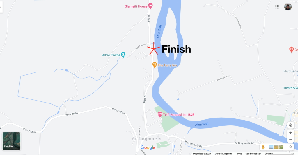
The start and finish points aren’t marked on Google Maps so I’ve included some guidance markers below.
To begin the trail, you can either take a train (National Rail) or bus (National Express or Megabus) to Cardiff. From here catch another train to Kilgetty before getting a bus (number 351) or taxi to the starting point in Amroth.
When you finish the trail at St Dogmaels, continue walking another mile into Cardigan. From the Finch Square A bus stop, get the 460 bus to Carmarthen railway station. Here you can catch a train to Cardiff Central or Swansea and continue onwards to your home destination.
If you’re wishing to walk segments of the trail you might find it useful to take advantage of the bus network to help get around instead (see here for bus options).
Many of the coastal towns are remote and small so if you wish to use any local taxis, book in advance!
There is an international airport operating out of Cardiff if you wish to fly to Wales.
In this case, hiring a car or driving your own doesn’t make much sense as this is a point to point trail. You’ll need to find a space to park your car for 2 weeks (see Your Parking Space for options) and when you finish the trail you’ll need to get back to your car using public transport anyway.
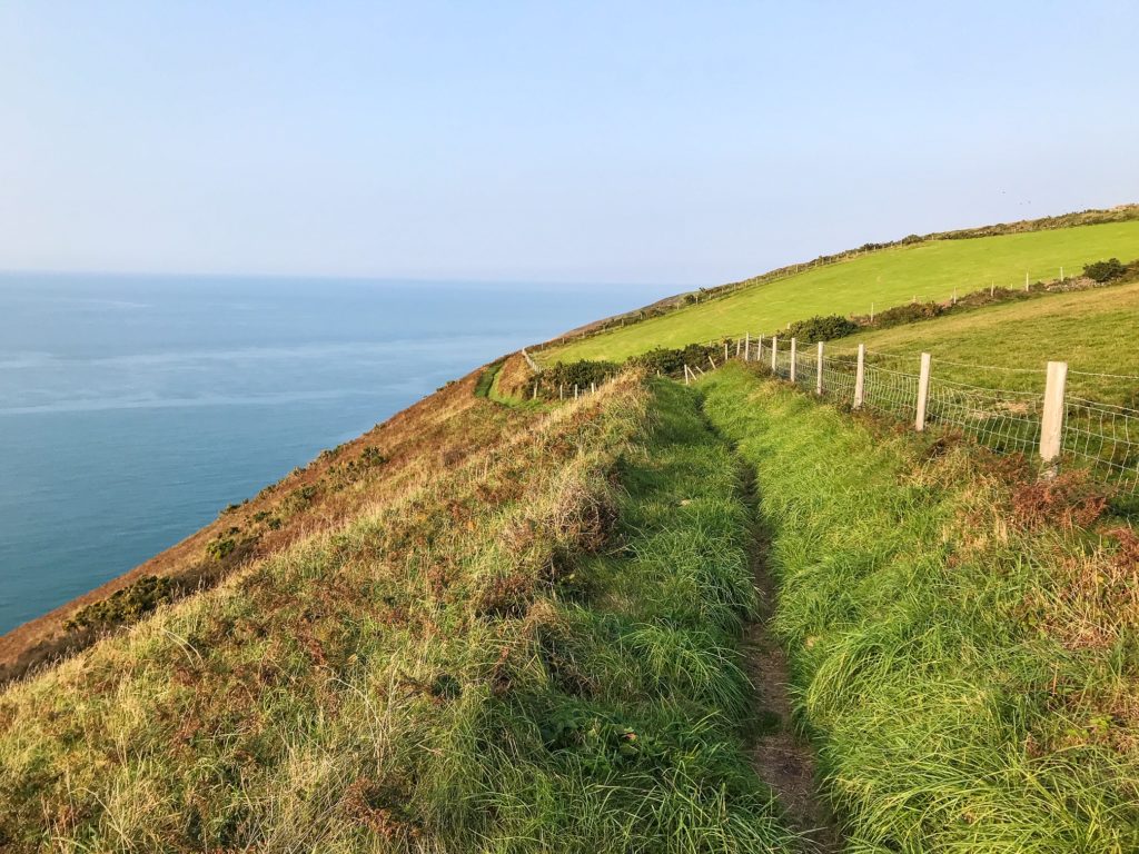
3. How to Find Your Way Around?
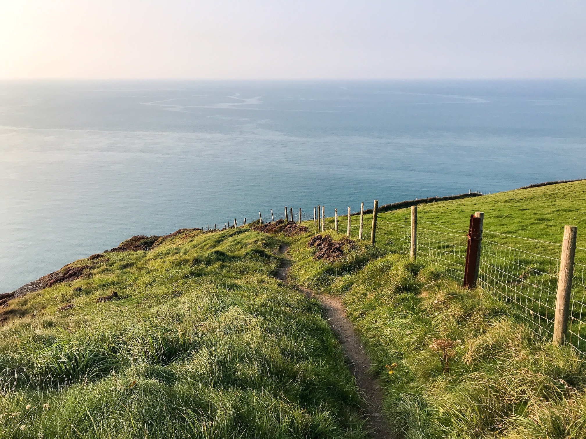
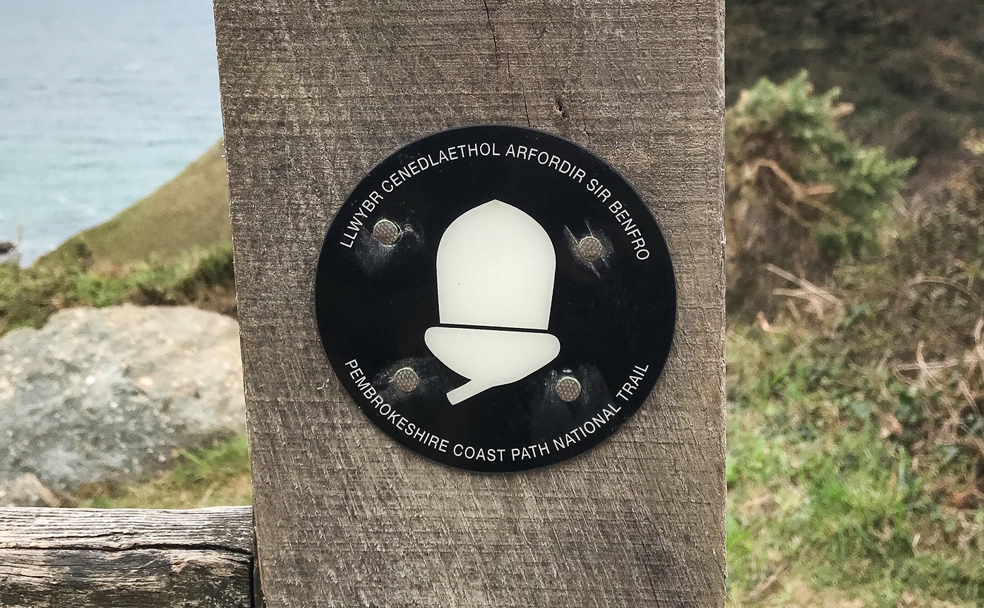
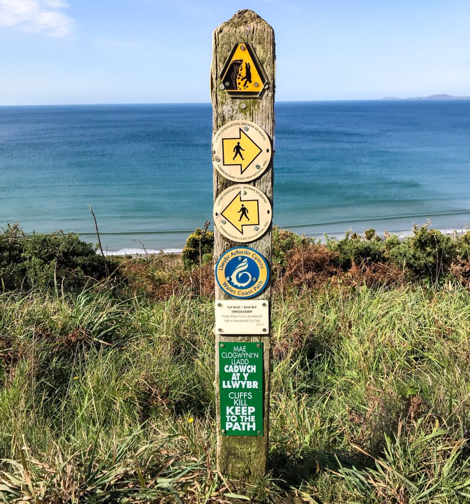
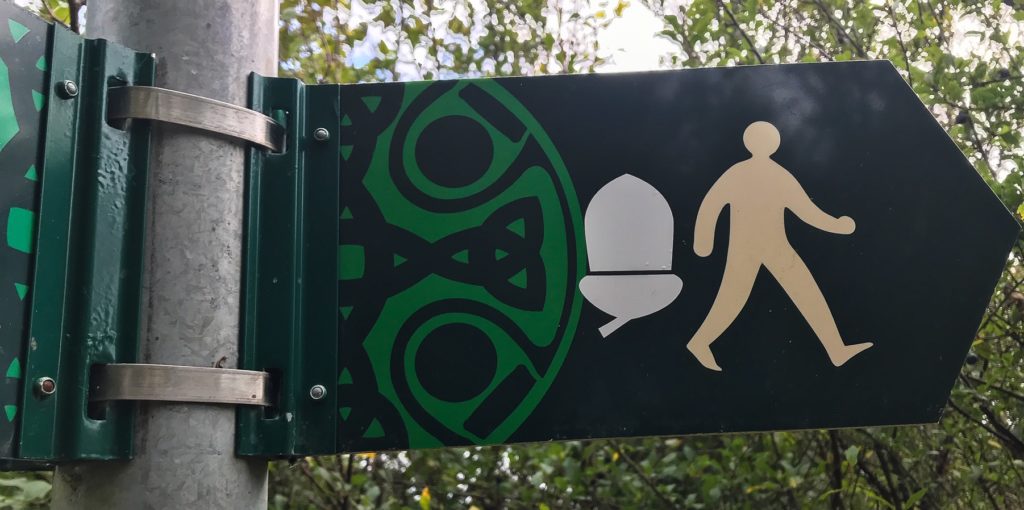
As usual with the National Trails walks in the UK – just follow the acorns!
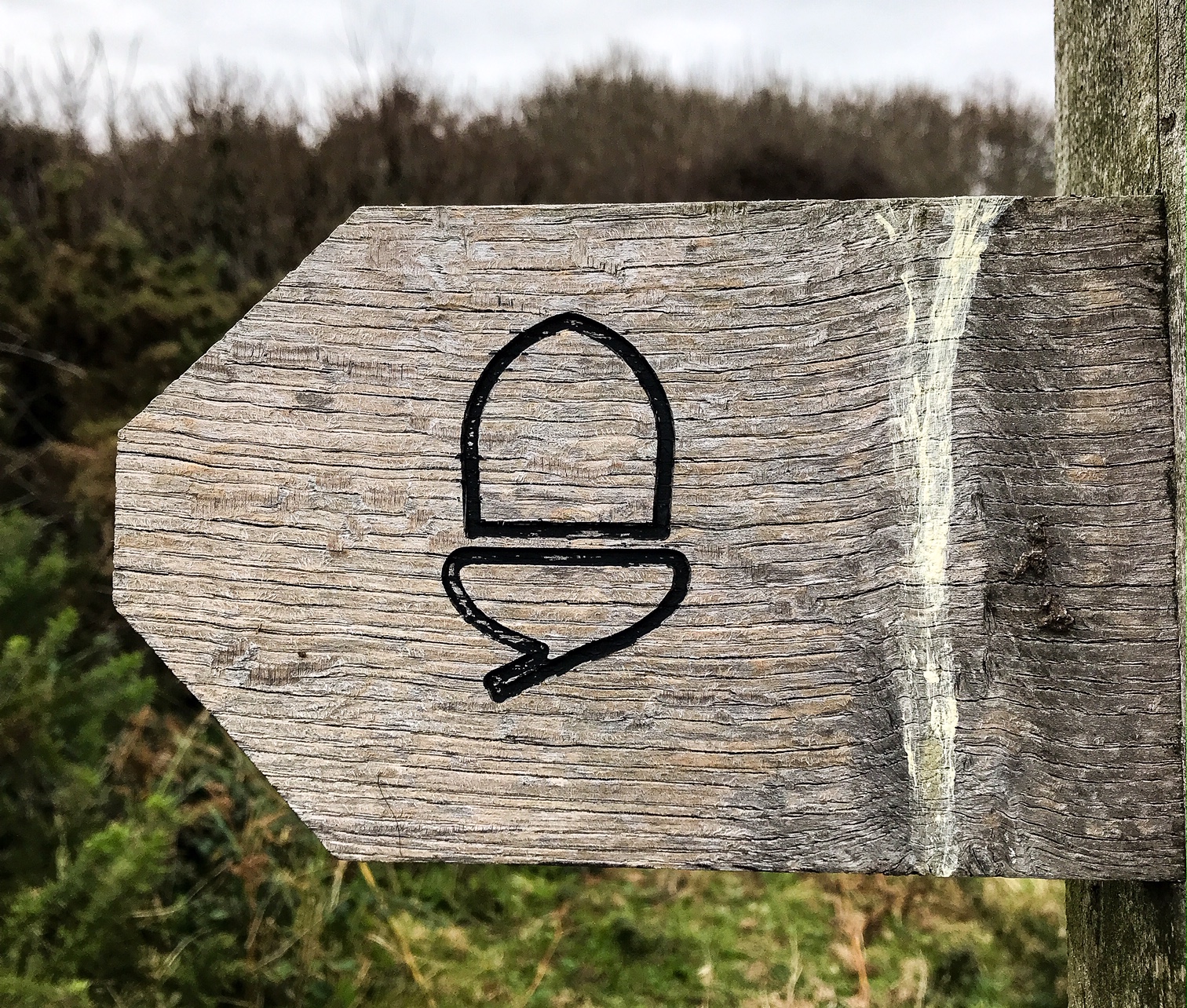
They are the symbol for the National Trails and are emblazoned on every signpost. National Trails also monitor and maintain the path and are in charge of making sure it’s clearly signposted so you don’t get lost – they do a very good job!
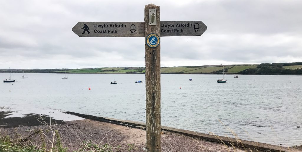
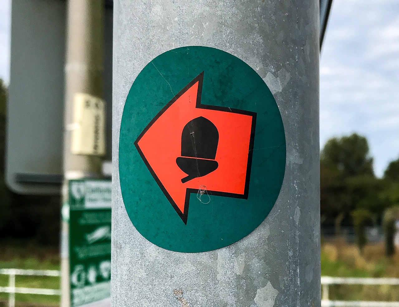
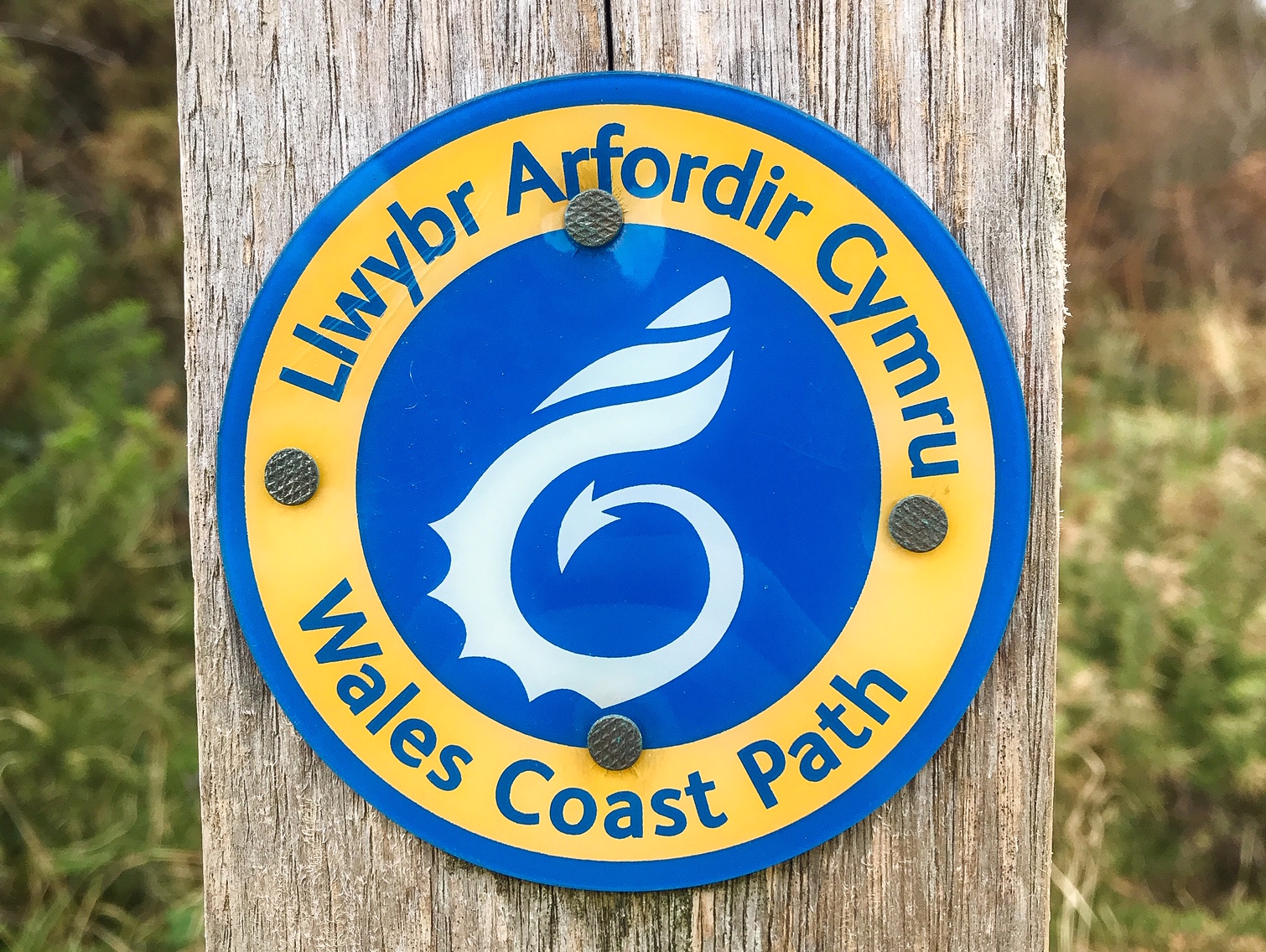
You’ll come across a lot of different signs. The two main ones to follow are the Pembrokeshire Coast Path and the Wales Coast Path as both indicate the same route. One has the symbol of an acorn, the other a shell.
Be careful not to follow a Pembrokeshire Coast National Park sign even though a lot of the time it will indicate the same route because it won’t always follow the same coast path.
In general there’s only really one path, and it’s the one right next to the sea! Keep the waves to your left at all times and it’s hard to get lost.
You can use an Ordinance Survey map if you wish; I tend not to, but I see why people find it helpful to figure out where the next food stop, water point, or challenging terrain is.
I only used the sign posts and didn’t get lost once. Sometimes you lose track of the signs but if you take a moment to walk around and look for the symbols, you’ll quickly find your way again.
I use the AllTrails app to track my walking pace and distance which also helps to guide me should I get lost. However, when there were long periods without signal the tracker would stop working so don’t solely rely on this.
4. Where to Stay?
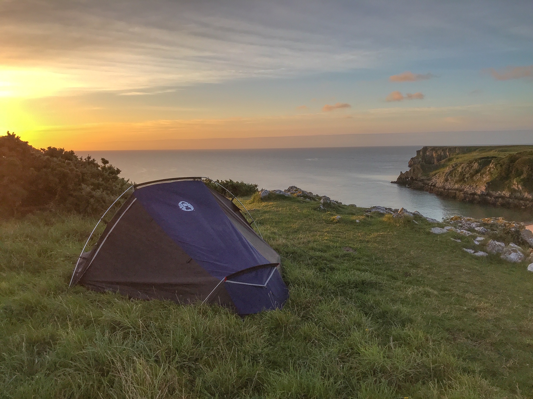
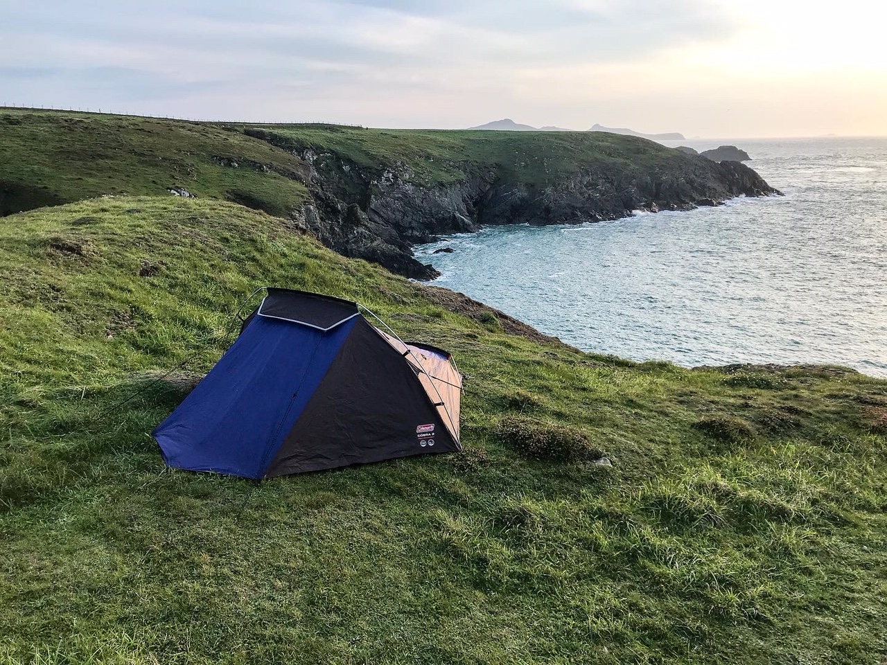
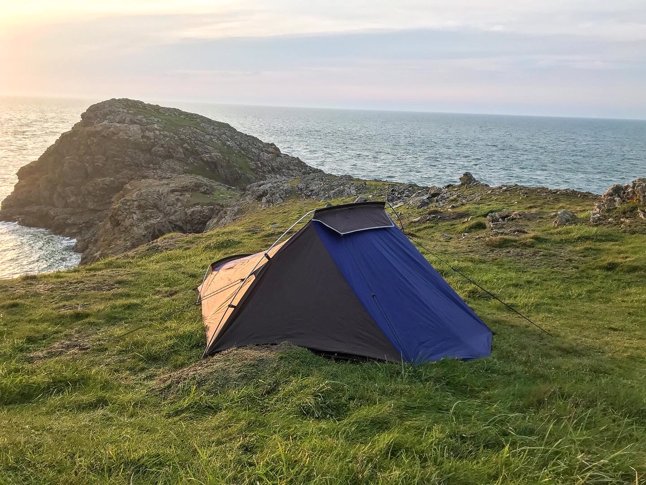
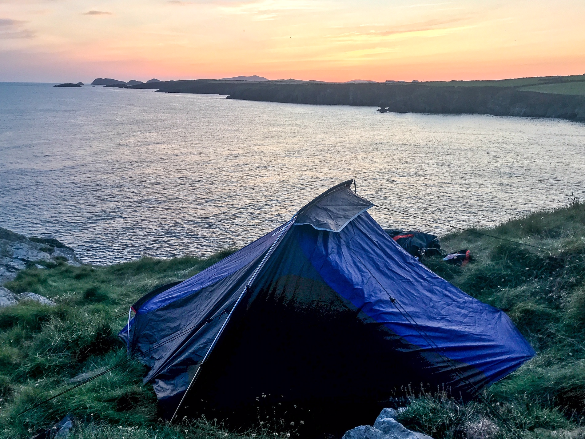
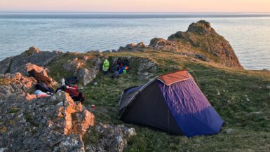
For those of you planning on camping , you’ll be pleased to know there are numerous campsites along the trail and lots of opportunities to wild camp too!
I spent 13 days on the trail. 6 of those nights in a campsite, 1 in a YHA at Broad Haven, and the other 6 wild camping – mostly in the northern sections.
It’s easily possible to walk the whole route and stay in a campsite every night (see Visit Pembrokeshire and National Trails for an accommodation list). If so, it’s worth planning out your walking days before you go as there are some long sections with no campsites where you could find yourself stranded.
Lots of campsites get full over weekends and during summer holidays. Some campsites are also only open seasonally. So it’ll help you no end to plan ahead.
If you’re more nonplussed and don’t mind just turning up to a campsite each night to see if they have space like I did, then that’s fine too. Some sites leave space just for walk ins.
However, be prepared, you might get turned away and have to walk another couple miles to the next place along the coast if they’re closed or full!
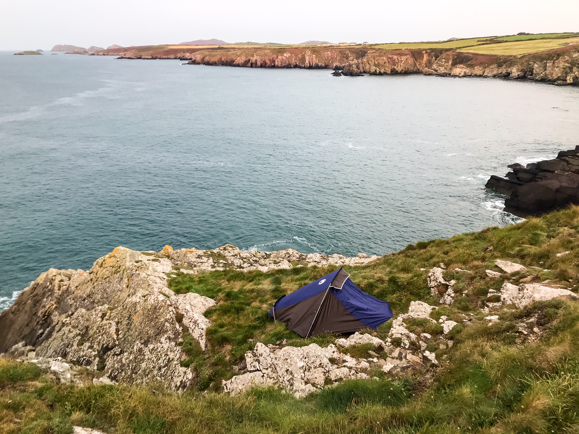
If you want to wild camp then be aware that technically you aren’t allowed to anywhere in the UK other than Dartmoor or Scotland. Of course many people still do, myself included, but you must be aware that it’s not actively encouraged! (Although I’ve never heard of someone getting punished for wild camping in the UK).
Wild camping tips to follow:
- Arrive late and leave early (pitch around sun down and leave just after sunrise)
- Leave no trace (Don’t leave any litter, trash, or evidence that you were there)
- Be discrete (Don’t play music, light fires, or camp in groups. Don’t camp on the path or in a farmer’s field or near a public area. Try to find somewhere a bit secluded and hidden away)
See Also:
How to Wild Camp in the UK
Wild Camping Kit List
Luckily the Pembrokeshire Coast Path has a lot of places that are suitable for wild camping! However, if you chance it each night, like I did, you might find yourself walking extra miles at the end of a long day searching for a suitable place to camp. Personally I think that’s all part of the excitement but it might not be for everyone.
Many of the campsites also double up as caravan and holiday lets so if you want a roof over your head that’s another option. Some of the bigger towns will have BnBs and Inns, but generally the coast path is pretty devoid of indoor accommodation options.
You might look at a map and think that a BnB is close to the path but it ends up being 2 miles inland. Trust me, when you’re walking this much, the last thing you’ll want to do after hiking all day is to add on extra miles to get to your accommodation each night.
5. What to Pack?
This is a windy, rugged section of coastline and your packing should reflect that. During the summer months you can get glorious sunny weather and find yourself ambling along heat baked cliffs and blue sky beaches, but if the weather turns, as it’s likely to, it can be a different story!
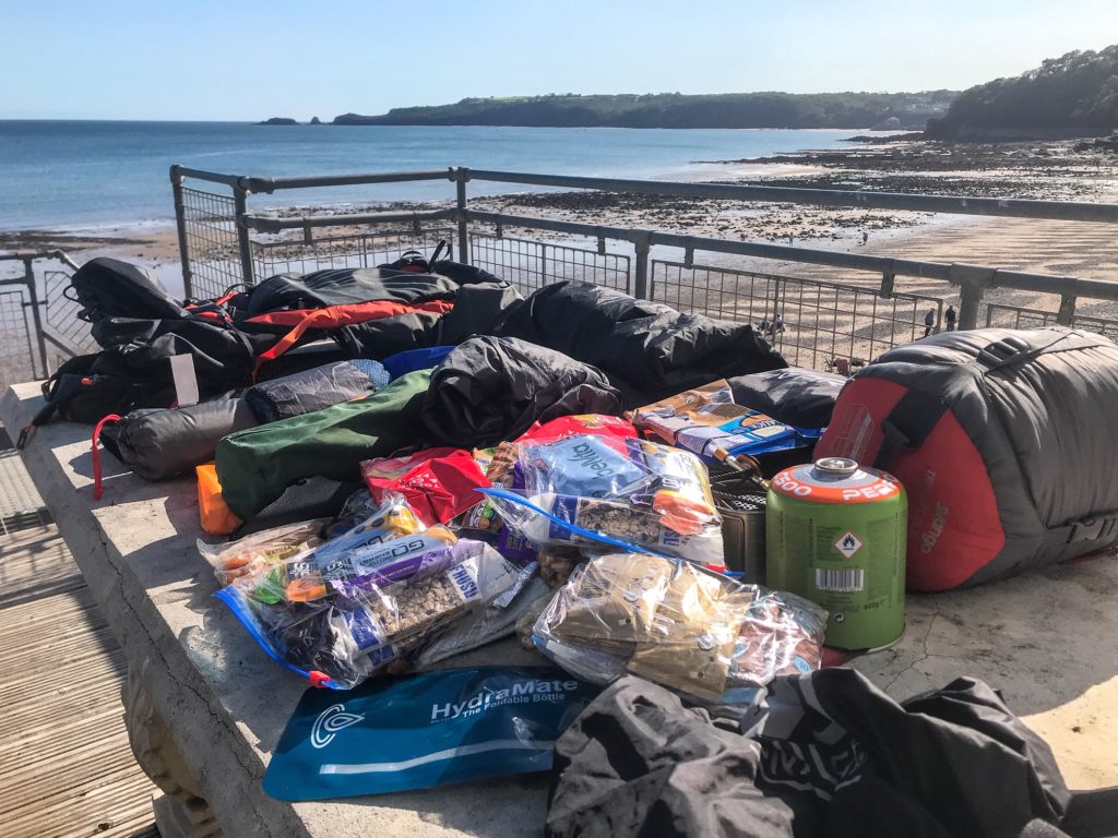
Mist, rain, and big storms can blow off the Irish sea at any moment and it can be deceptively cold and windy. Make sure you are prepared for all eventualities. Of course, you have to think very carefully about how to keep the weight down as much as possible as you’ll feel every gram of it over the 2 weeks.
If you’re worried about the weight Pembrokeshire luggage transfer is a good option that I came across but I believe it’s good to challenge yourself at first and see if you can carry your kit on your own.
See also:
Wild Camping Kit List
Let’s start where you should for any good hike: the footwear. You’re going to be walking along a rock and dust path for most of the route with some sections on sand and shingle beaches. I suggest trail running shoes instead of hiking boots. They’re much lighter for long distance walking and give me fewer blisters than traditional hiking boots.
I use Altra Lonepeak shoes which are incredibly comfortable. With this, I use Injinji socks which keep my toes separated to reduce blisters and are great at wicking away moisture to stop any hot spots from forming.
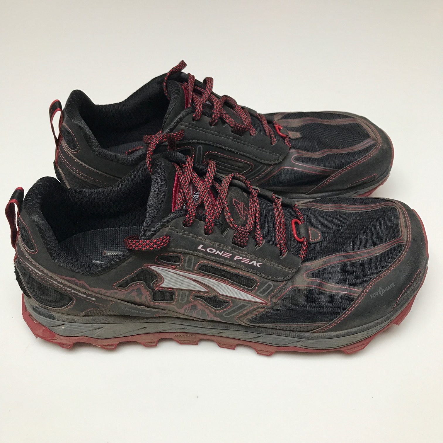

I always bring a spare pair of normal hiking socks to swap with my Injinji socks and another pair of cotton ankle socks to wear to sleep each night.
For your clothing you’re going to want to pack light with lots of multipurpose items. Unfortunately, you’ll have to wear the same clothes again and again in order to keep your weight down as low as possible! Don’t bother bringing lots of changes in clothes. A long hiking trip is not the time to be self conscious about your personal hygiene!
I brought 1 pair of trekking trousers and 2 pairs of underwear. I wore a breathable Under Armour t-shirt to hike in each day and then a casual t-shirt to change into at night.

I had a North Face zip up fleece to wear when it got cold along with an old beanie and a pair of running gloves.


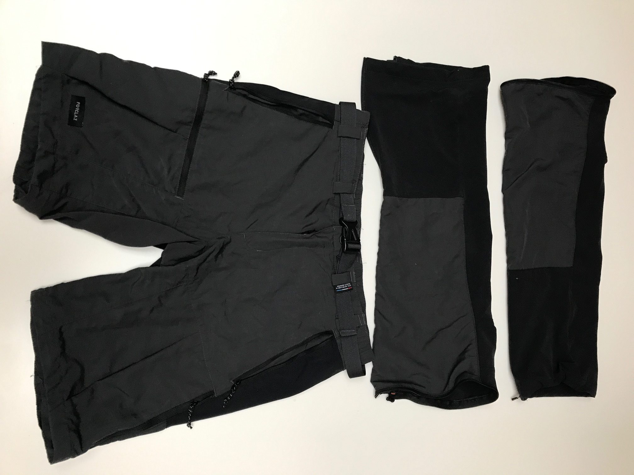
To sleep in, and for an extra layer of warmth, I had a pair of leg thermals and a long-sleeve base layer.
Lastly I also brought a rain poncho with me. I like this because it doubles up as a tarp to sleep on and covers my bag as well as me. Of course you can get a waterproof jacket and trousers instead if that suits you better!
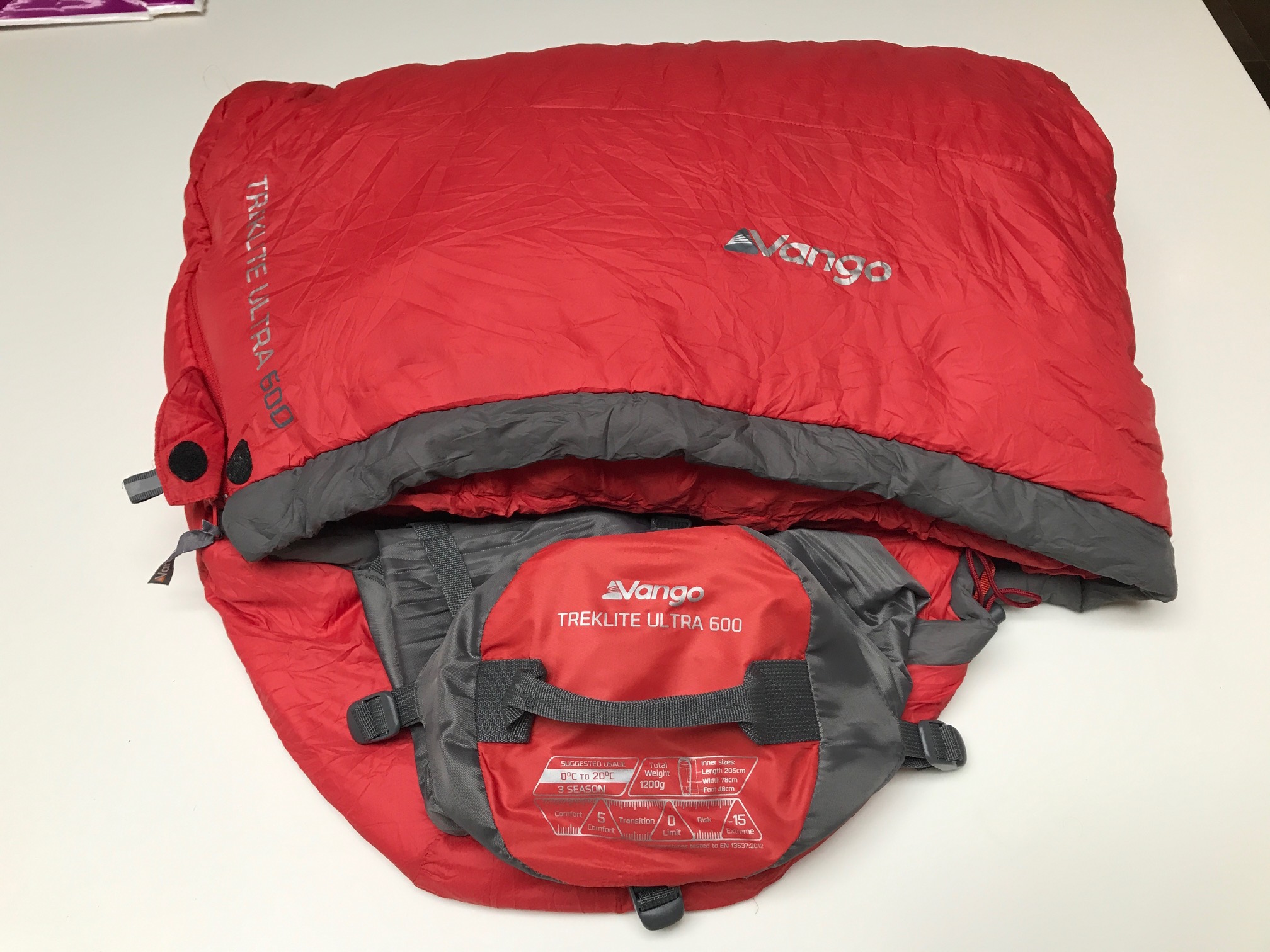
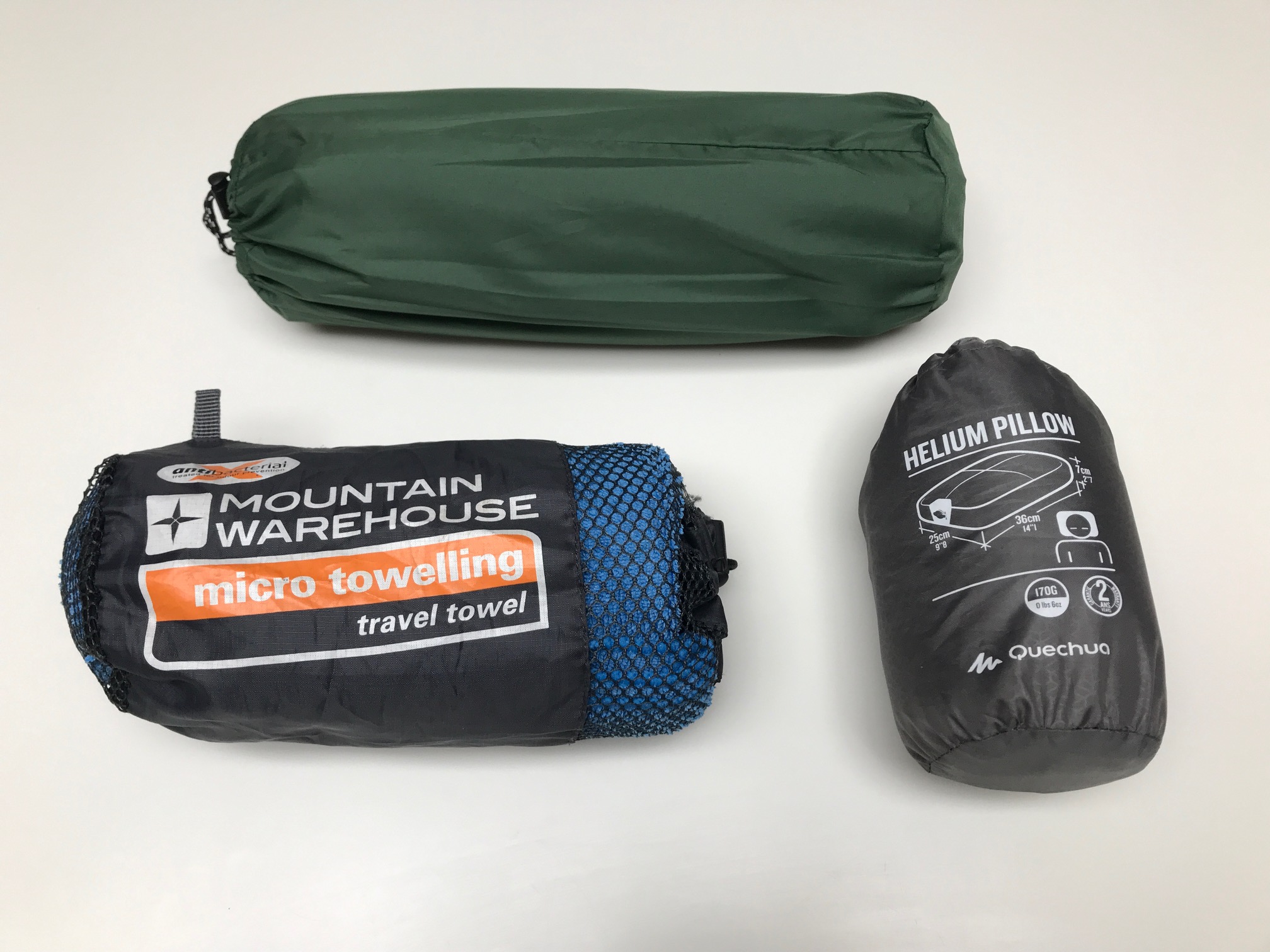
I use a Vango 3-season sleeping bag and an inflatable mat to sleep on. I also bring an inflatable pillow and a microfibre towel.
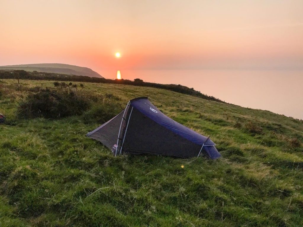
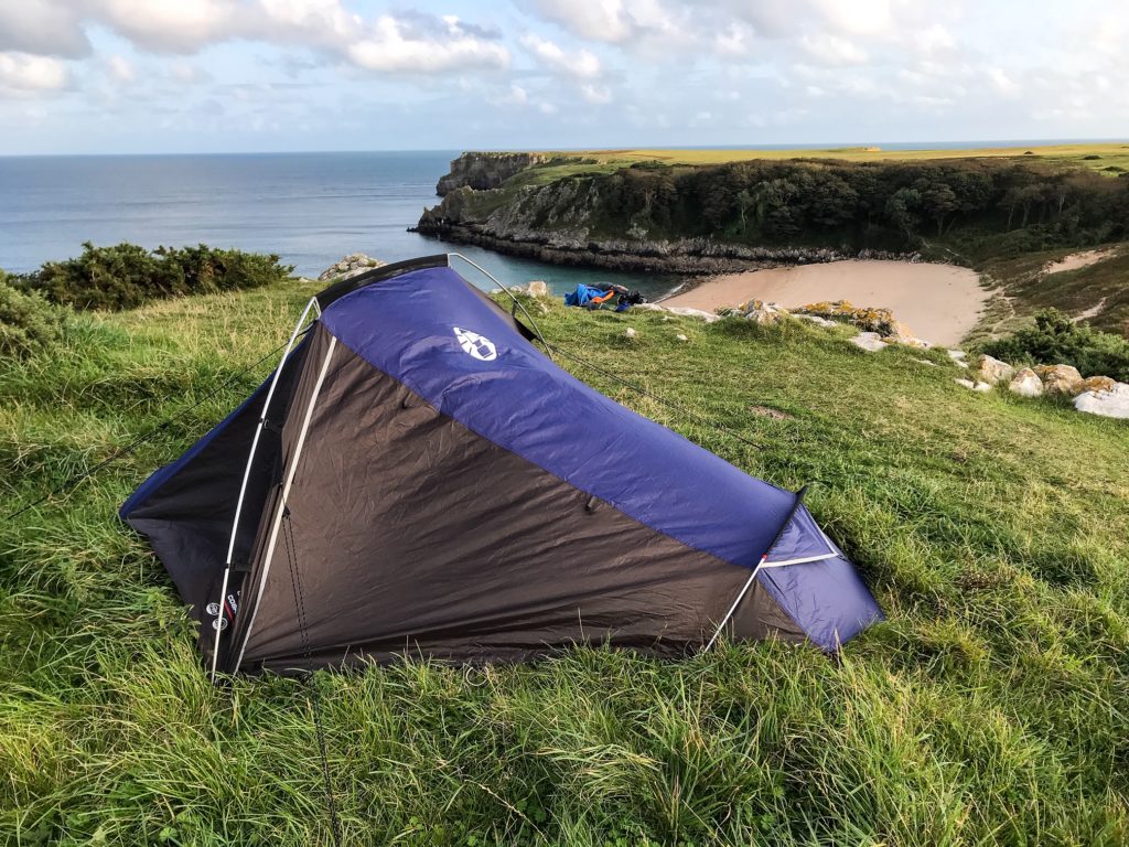
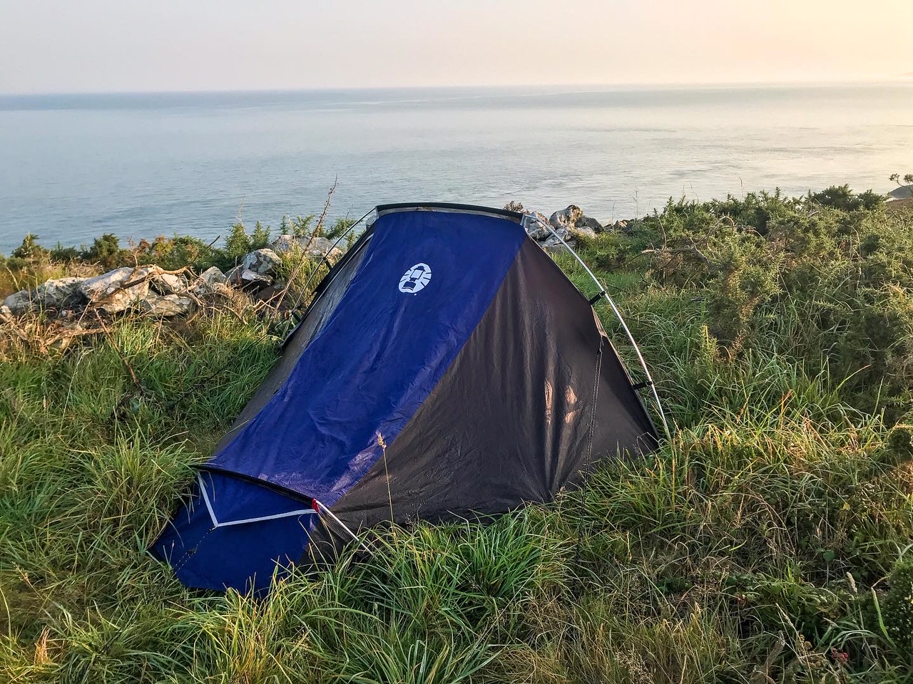
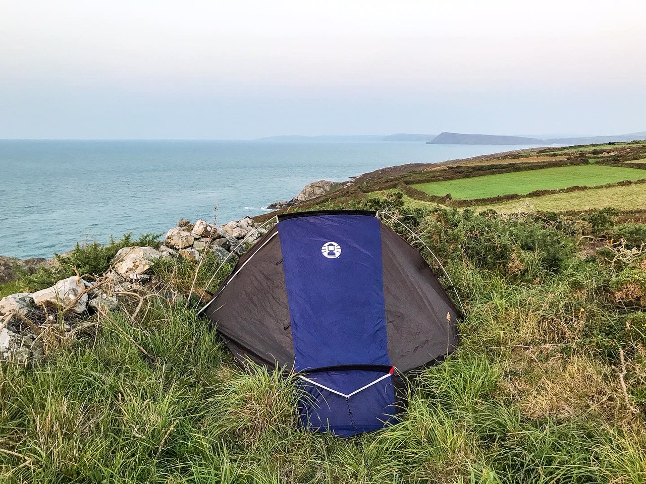
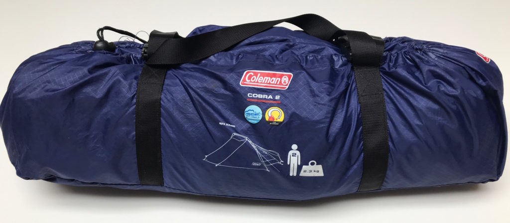
I use a Coleman’s 2-man tent which weighs around 2.3 kg. It’s perfect size for one person and durable in all weather conditions.
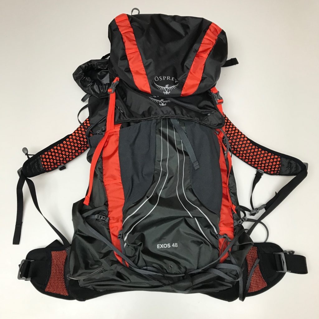
This all goes inside waterproof stuff sacks and then into my Osprey Exos 48 litre backpack with an additional waterproof covering.
See also:
Multi-Day Hike Kit List
Day Hiking Gear Essentials
6. What to See?
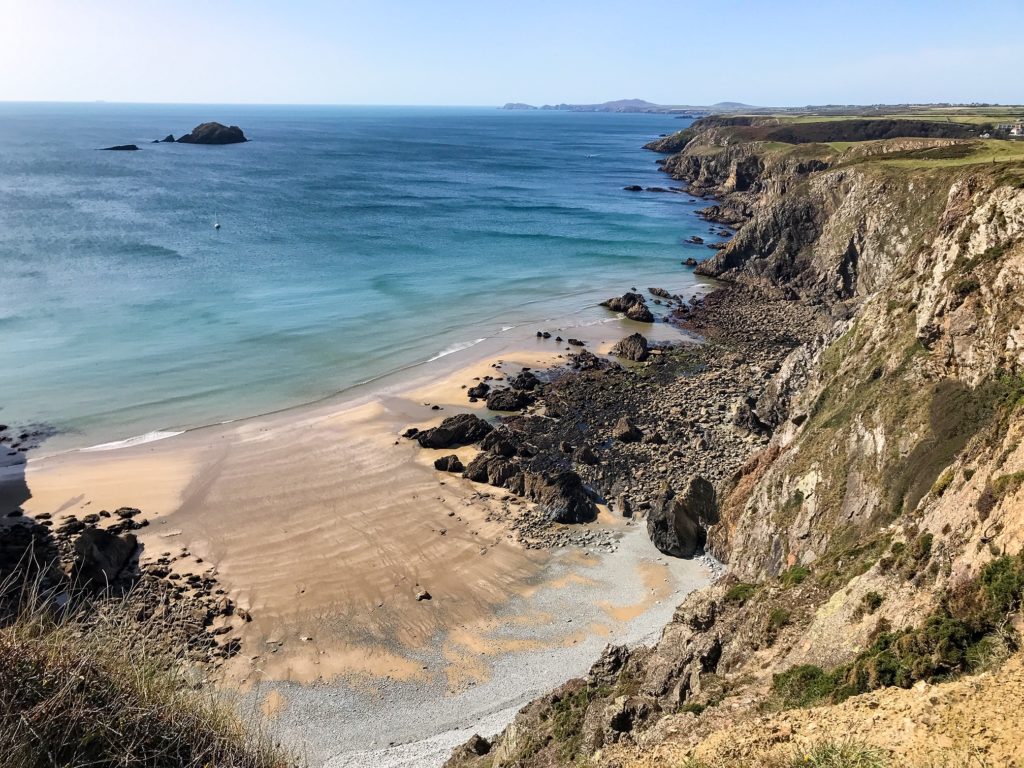
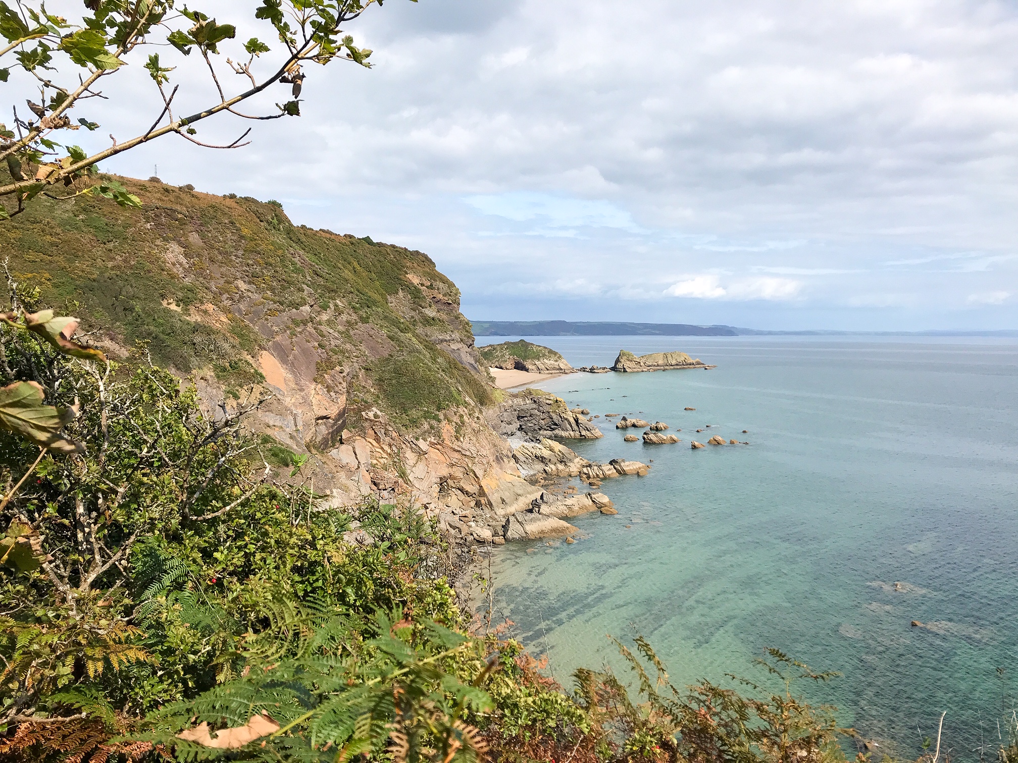
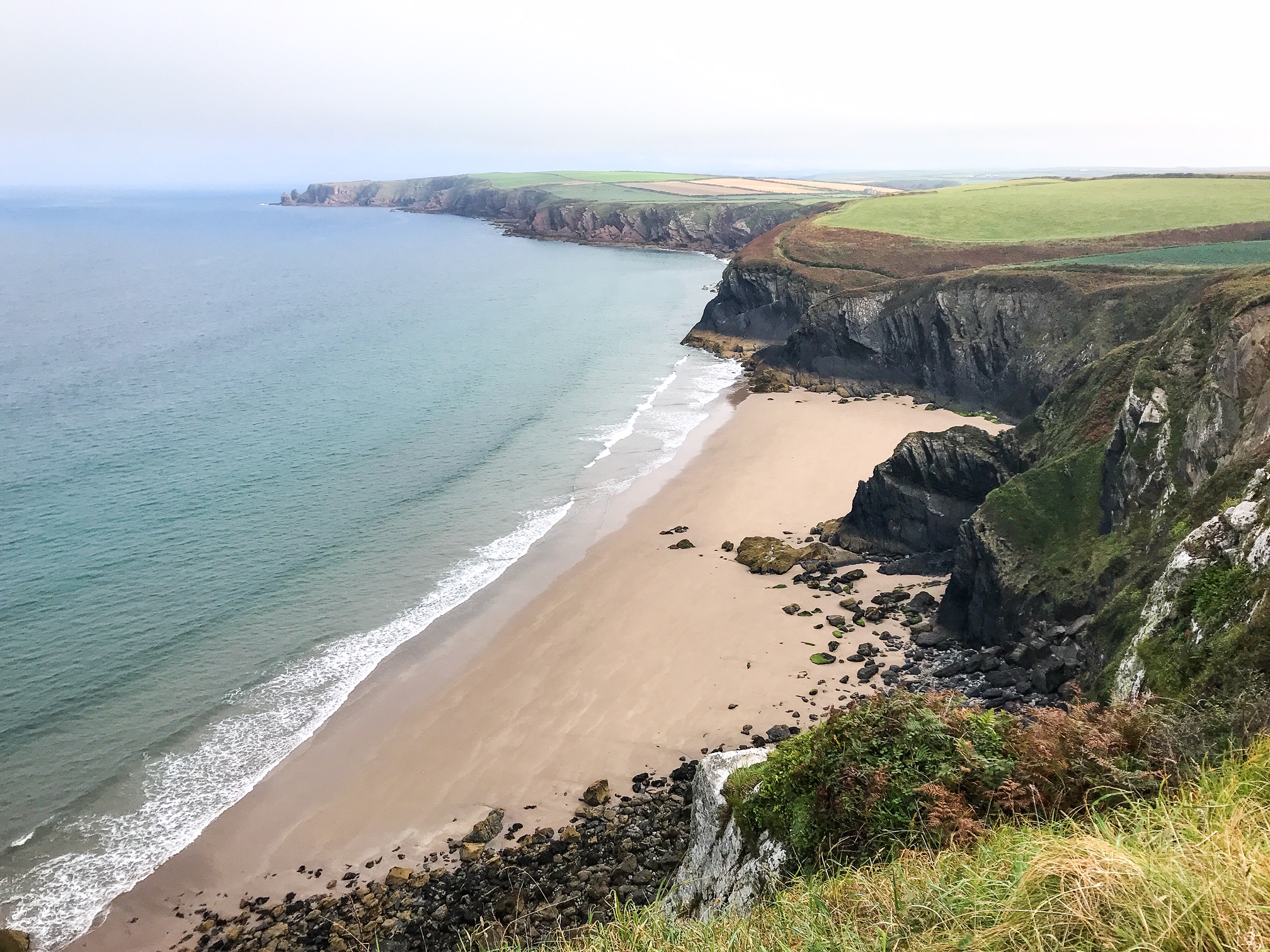
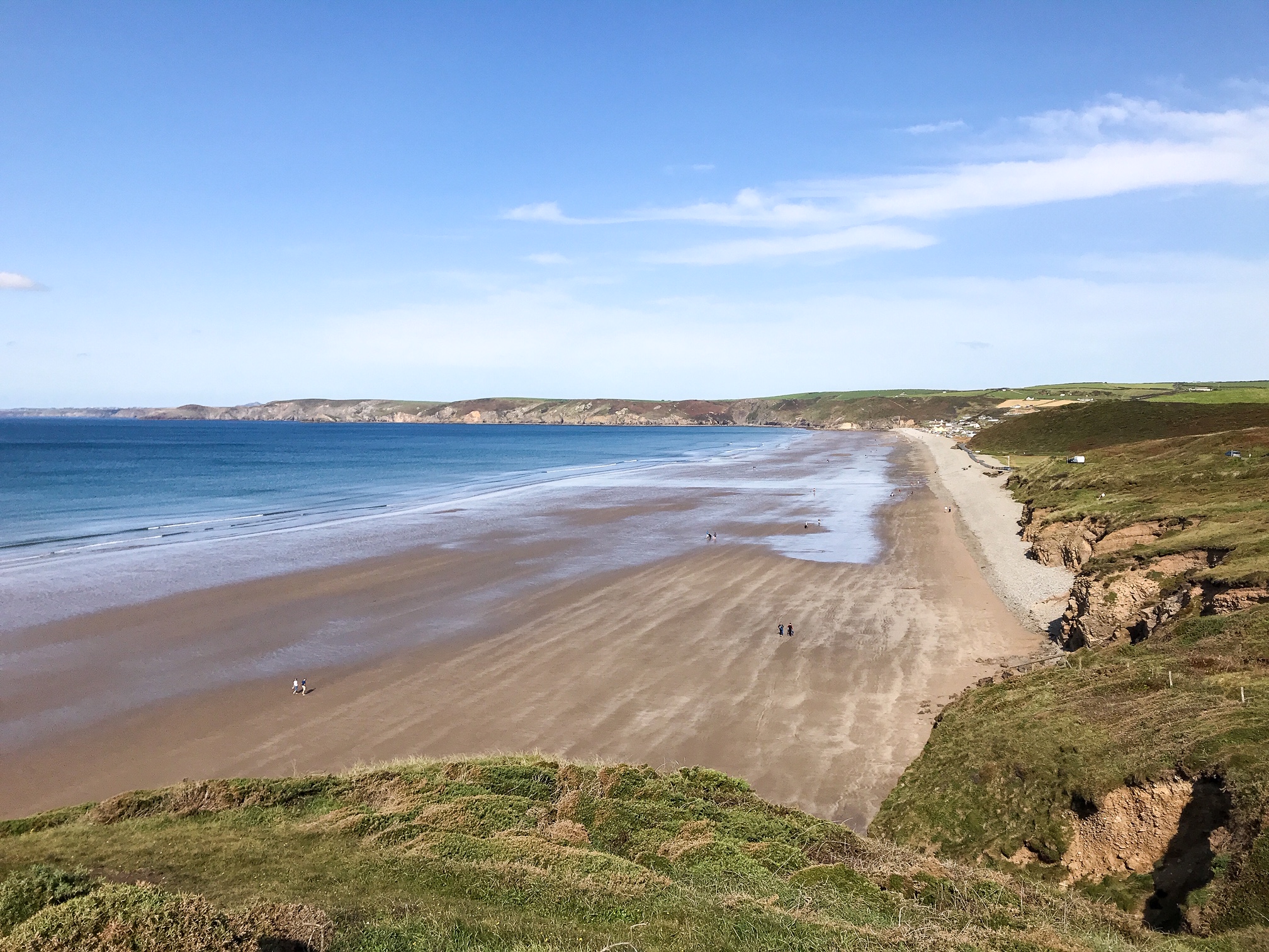
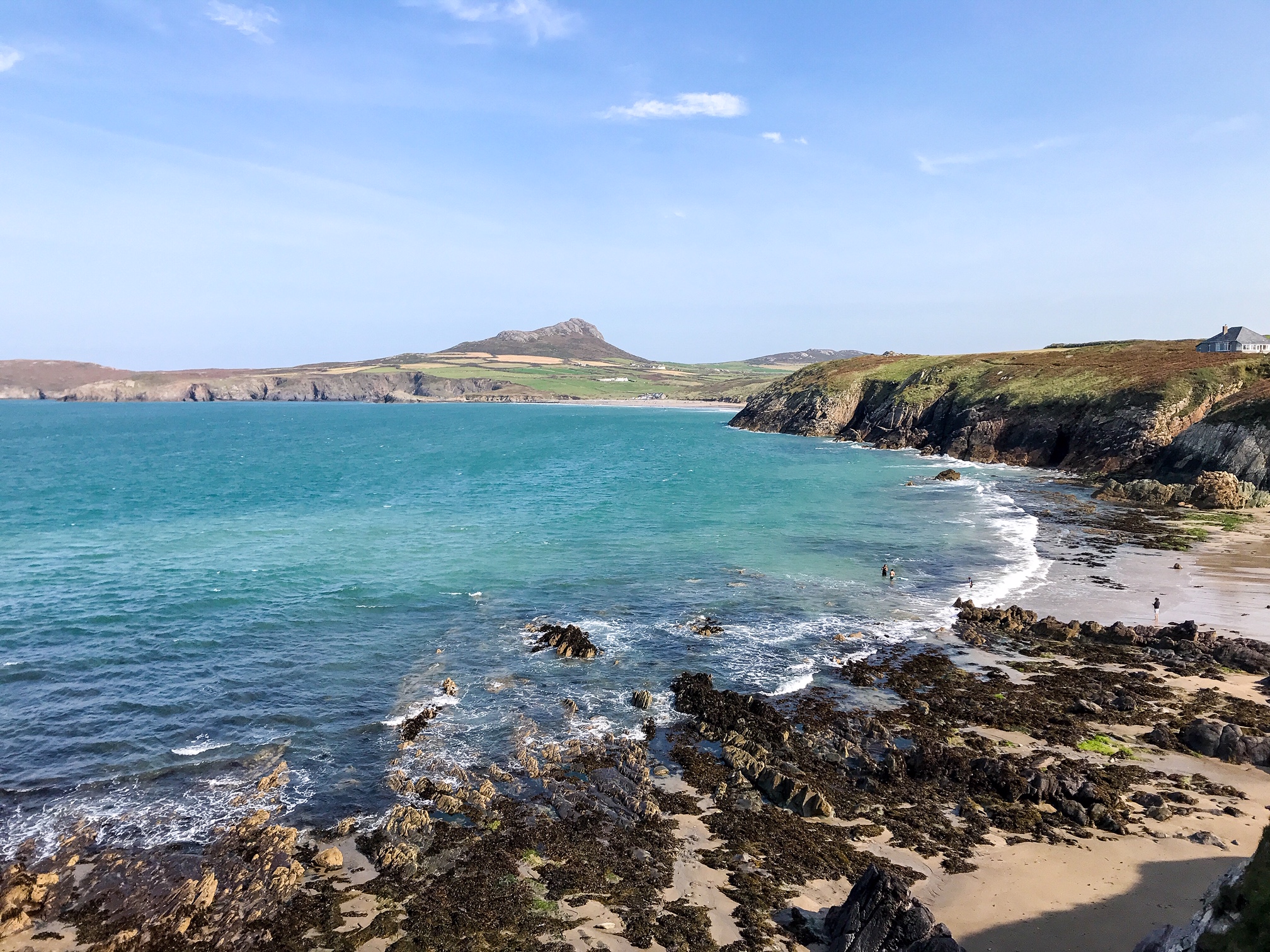
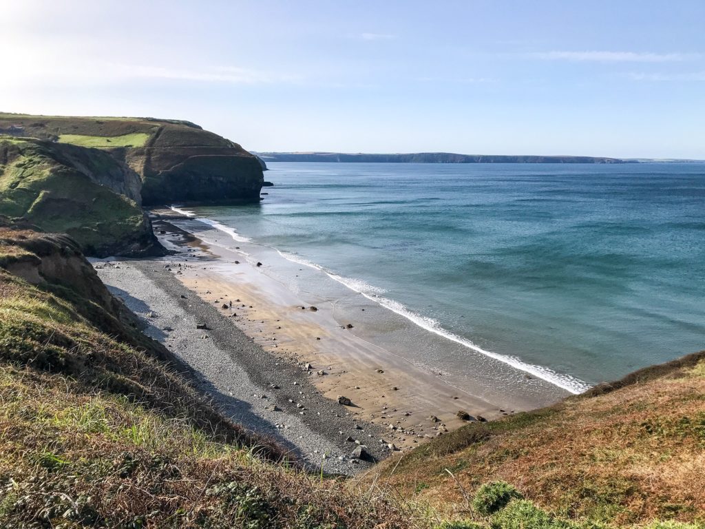
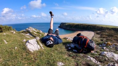
Some of the most beautiful beaches in the UK and sublime sections of dramatic British coastline are in Pembrokeshire. Quaint fishing villages, extraordinary wildlife, and daily sunsets into the sea – to name a few.
The variety of beaches on offer is really quite stunning. There’s something for everyone with great surfing spots, dog walking areas, secluded coves, wildlife havens, and beachside cafes.
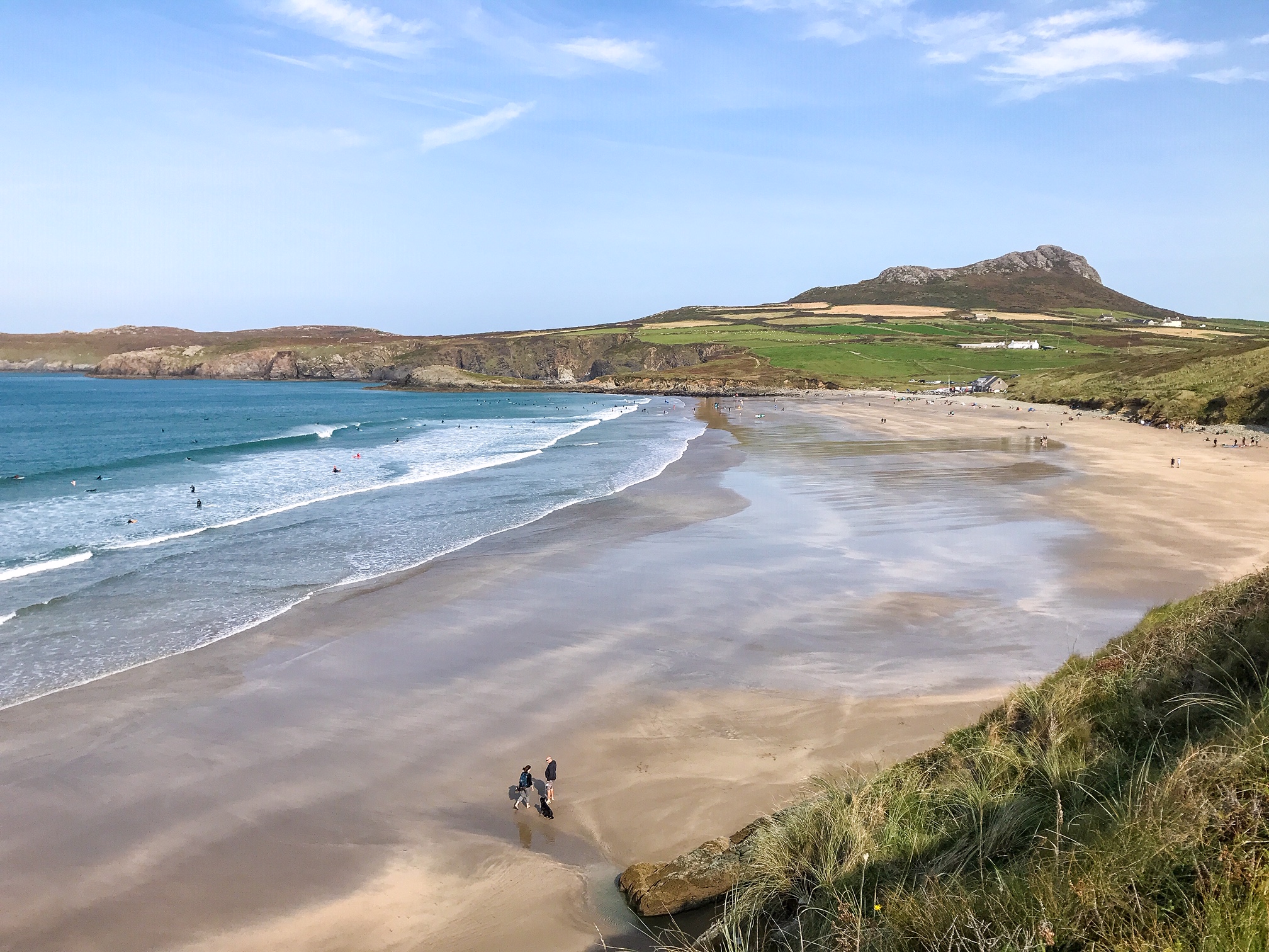
Some of my favourite beaches include: Freshwater West, Barafundle Bay, Newgale, and Whitesands. Having said that, there are simple too many to name and I’m sure everyone will have their own favourites.
See also:
Top 5 Best Pembrokeshire Beaches
In fact, some of the beaches have even made it into Hollywood films! For example, Harry Potter and the Deathly Hallows (2010/2011) and Robin Hood (2010) were shot at Freshwater West and Snow White and the Huntsman (2012) was filmed at Marloes.
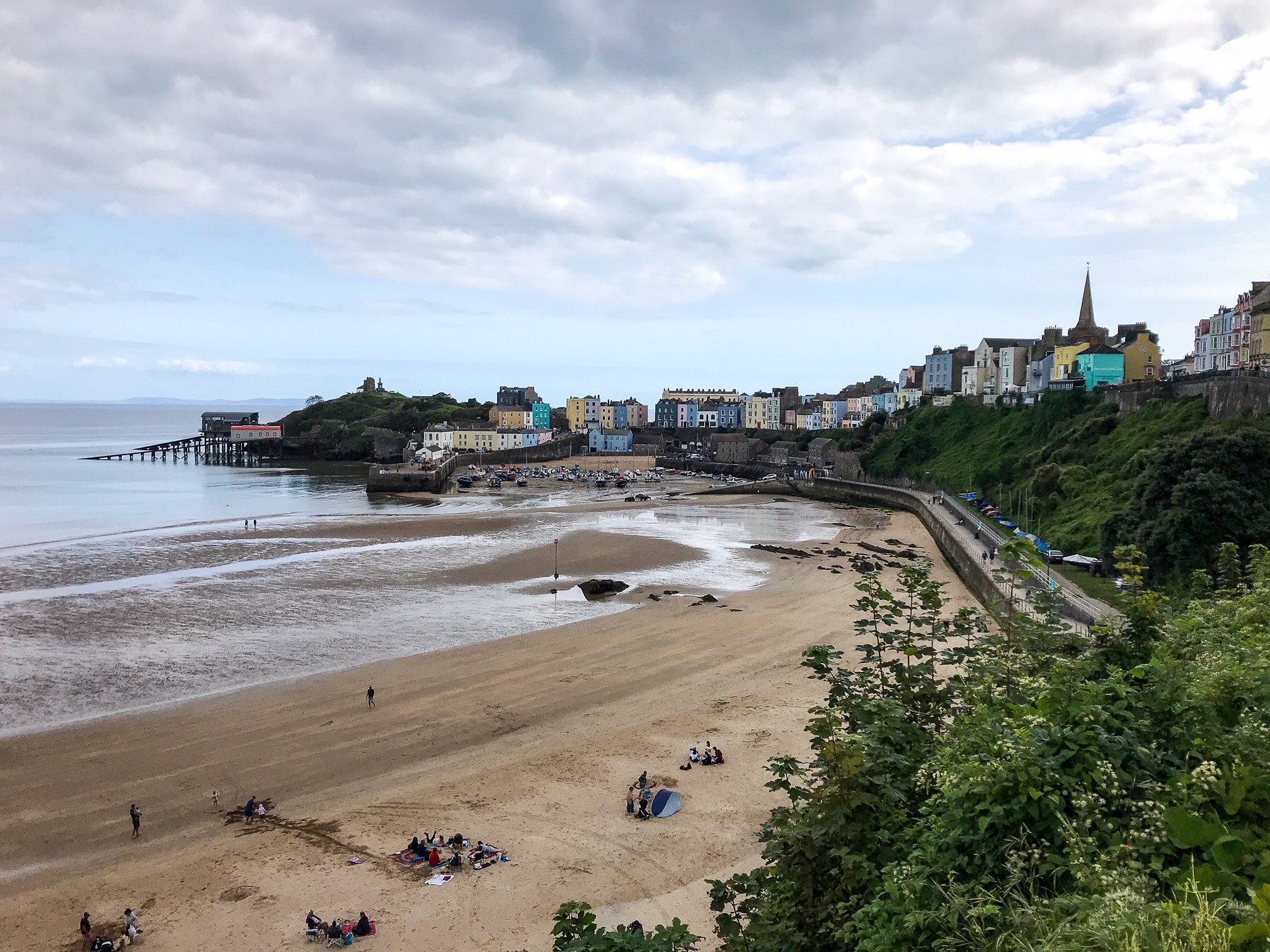
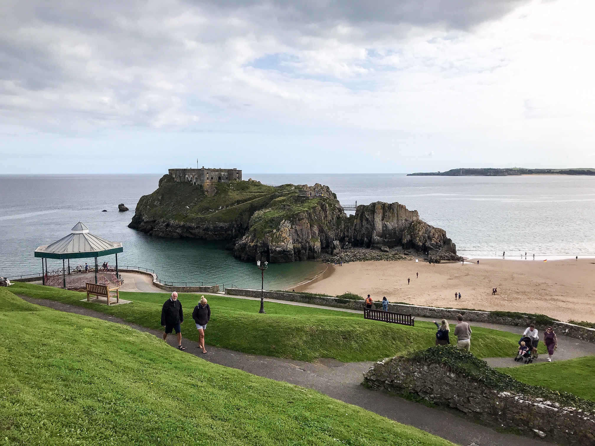
Some of the small coastal ports are wonderfully idyllic. Tenby is sublime with its old castle and multi-coloured houses. Porthgain has a lovely rustic harbour, and Newport a gorgeous river estuary. Solva also has a great selection of pubs and cafes.
St David’s has the curious title of being the UK’s smallest city with its dazzling cathedral. Although, I would say it’s too far from the coast path to visit without taking a taxi or adding on a couple days to walk inland to reach it.
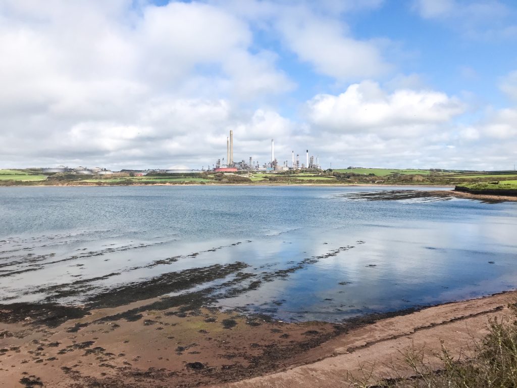
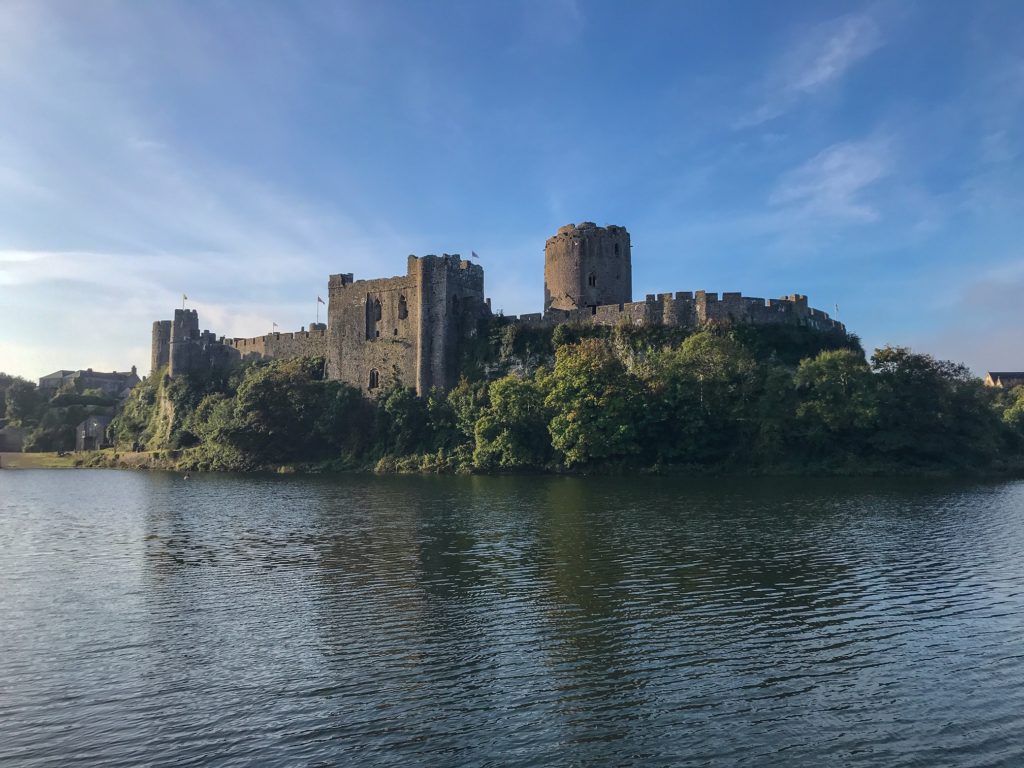
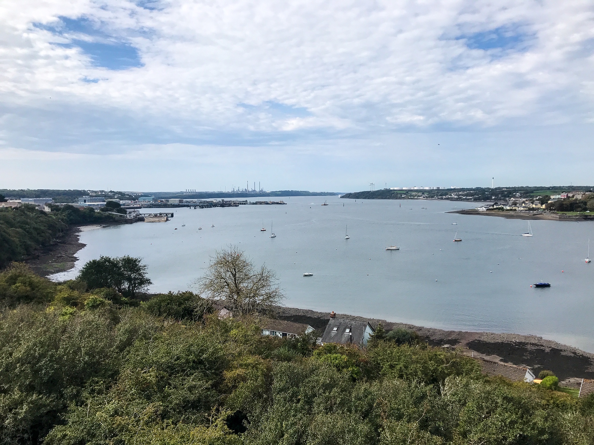
There’s one long section that is less picturesque than the rest. When you cut back inland to Pembroke, you walk past an enormous oil refinery and multiple industrial works beside Milford Haven.
It’s a section that you just have to get through. Use it as a useful point to stock up on supplies and a chance to visit the grand Pembroke Castle – birthplace of Henry VIII.
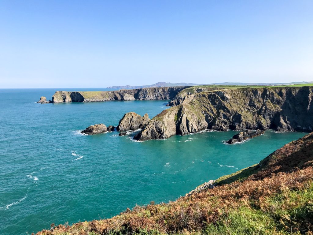
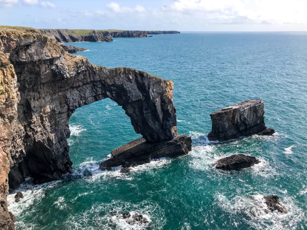
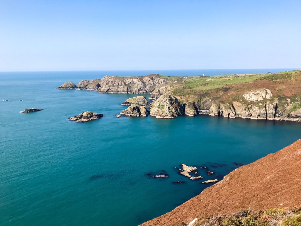
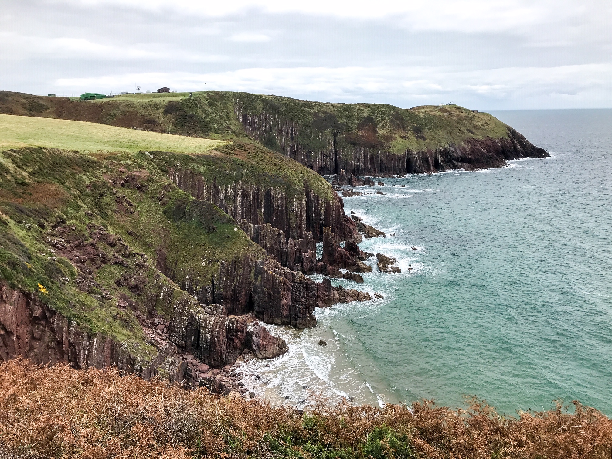
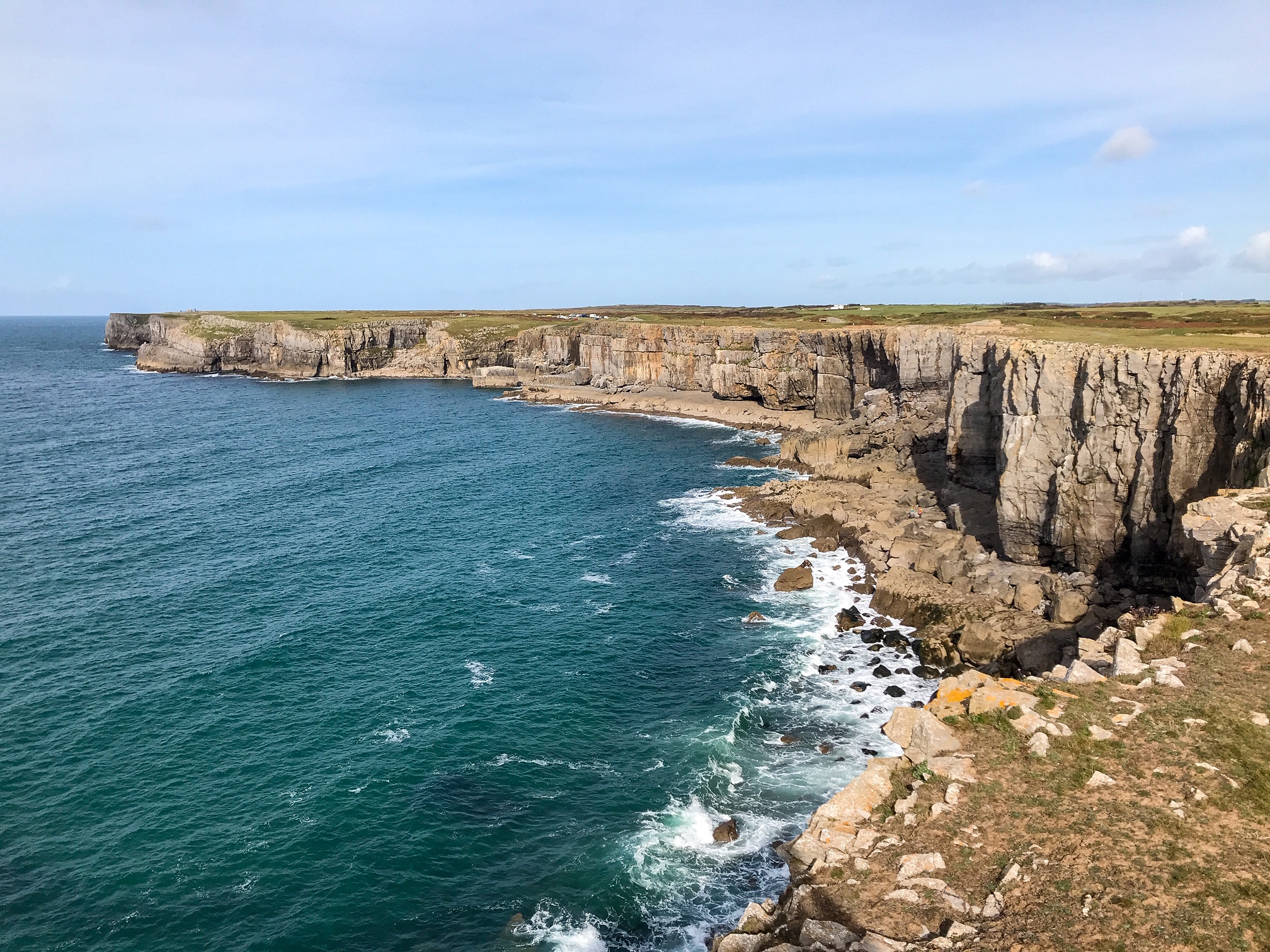
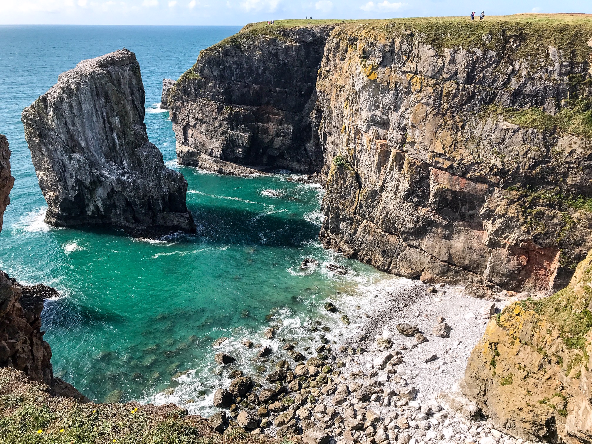
On the southern section, between Freshwater East and Freshwater West, there are some extraordinary arches and rock formations along the soaring cliffs. But there’s also a military base in this area which can cause quite a large detour if it’s active when you’re crossing through.
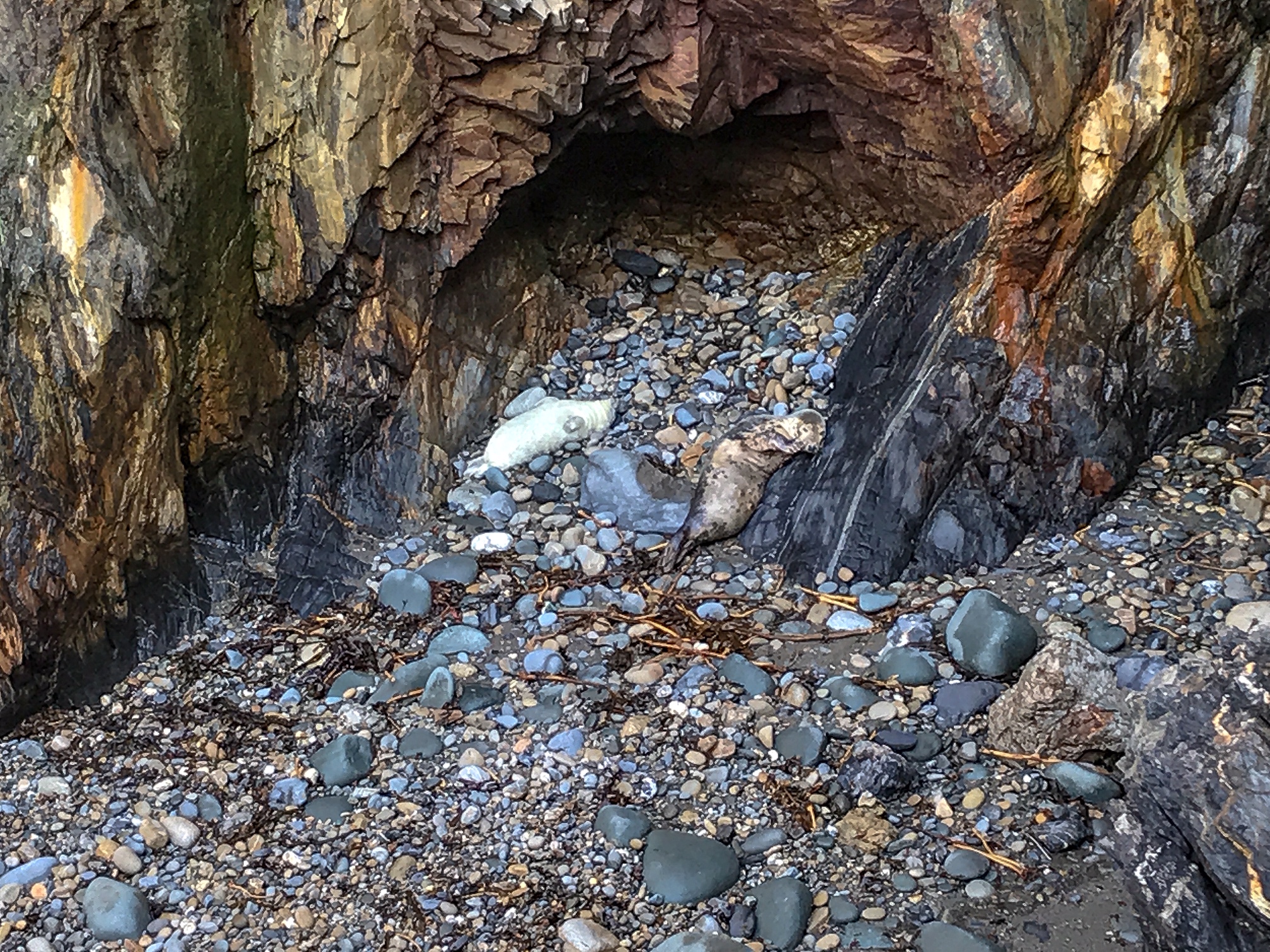
If wildlife interests you, there are many wonderful bird species, seals, plants, and a whole variety of marine life to enjoy along the coast. If you’re an avid naturalist, bring binoculars and an ecology book with you then time your trip to coincide with the species you want to see.
For example seal pups are present in the autumn which is when I hiked the trail and I saw dozens of them. An incredible experience!
It’s also possible to visit some of the surrounding islands by boat to increase your chances of seeing other coastal animals in their natural habitat.
7. Is it Safe?
This walk carries all the usual dangers of being out hiking with the added element of walking along crumbling coast paths and beside sheer cliffs.
National Trails keep the hedgerow and verges trimmed back where possible. They repair crumbling steps and helpfully add in any diversions around dangerous spots such as landslips or rockslides.
Of course it’s still possible to injury yourself purely from the distance you’re walking and the strain you’re putting on your body daily. One way to mitigate this is by doing extensive stretching or even some yoga before and after your day walking.
The more training you put in before you go, the less likely you are to be injured. That includes wearing in your shoes and getting used to the weight of your pack and gear.
I did many practice hikes including a 95 mile hike of the Hadrian’s Wall Path, another UK National Trail. I found my left ankle sometimes tweaks at the achilles. So, I decided to bring an extra ankle support strap with me which came very handy. It’s this sort of preparation that will keep you safe on the trail.
See also:
10 Hiking Safety Tips
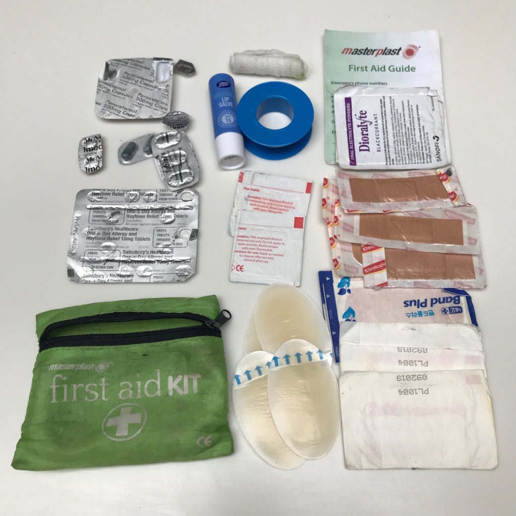
As always on these walks, I recommend you carry a medical kit to deal with injuries.
Some of the items to include:
- Paracetamol – or another painkiller
- Ibuprofen – or another anti-inflammatory
- Hay fever/allergy tablets
- Bandages and gauze
- Lots of plasters (waterproof and durable) – various sizes
- Blister plasters
- Bandaging tape
- Alcohol swaps
- Vaseline or any soothing lip salve (make sure it includes SPF)
- Imodium – or diarrhoea relief
- Rehydration salts
I walked the whole route alone and never worried about my safety. All the campsites I stayed in felt secure and there were plenty of nice walkers and locals I met along the way who were nothing but friendly.
Many times I stopped to chat to other walkers and enjoyed speaking to people working in the restaurants, campsites, pubs, and cafes.
The biggest built up area is around Pembroke but it’s still a relatively small town and I didn’t feel threatened or concerned for my security at any time. I always carry my valuables with me anywhere I go and was never concerned about things getting stolen either.
There are sections where you won’t have phone signal, particularly when down in the coves between the headlands. But enough people walk the path to get help shortly should you need it.
If you are looking for travel insurance, World Nomads has a great reputation amongst travellers due to their specialisation for dealing with backpackers and adventure travellers. Head to the World Nomads website to find out more.
8. Food & Drink
Although you’ll likely spend a lot of your time eating trail bars, pasta pouches, and instant coffee from your camping stove, there’s also multiple opportunities for fish and chips on the beach, a pint of ale whilst watching the sun set, and a hot chocolate to warm you fingers after a bracing swim in the sea.
Before I get into the places you can eat at along the trail I should mention that you need to plan your resupply areas for camp food. There are long stretches without any shops or supermarkets and you can go days without being able to resupply.

I resupplied 3 times at the following places: an ASDA at Pembroke Dock, a Tesco at Milford Haven, and a Londis at Broad Haven.
Each time I bought enough food for about 4/5 days. Good thing too because there were only a few opportunities along the trail to buy food.
See also:
Hiking Food for a Week – What to Eat
Planning your water refill points is arguably the most important advice I can give you. I can’t stress this enough: water points are not readily available. You must ensure you carry enough with you at all times.
There were times when I had to walk throughout the day and by the evening I had found nowhere to refill water. I would wild camp and then have to stretch 500ml of water for the night and the following morning until I could walk to another refill point. Don’t put yourself in this situation.
I don’t mean to stress you, but it’s just important to be aware of this. I made sure that every time I passed a cafe or a campsite to ask if I could top up my water bottles. People are fine with it and I didn’t get turned down once.
You do occasionally pass streams but as they likely contain agricultural run-off I wouldn’t risk drinking it. I had a water filter with me but still opted to stay safe and drink tap water where I could.
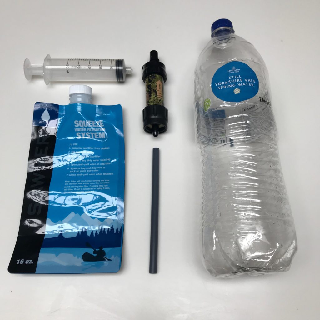
I sometimes filled up my water bottle from the taps in a public toilet and then used my filter to drink through that to ensure it was safe.
Try to carry 1.5 litres with you at all times, and at least 2 litres if you plan to cook in the evenings as that uses a lot of water too.
The food I ate when out wasn’t anything particularly special, but it’s tasty and there are definitely some gems along the way. It’s a lot of pub food, beach kiosks, and cafes – so don’t expect gourmet! I found a hearty full English or a burger to be exactly the thing I needed after all the exercise anyway!
I did have some stand out food at these places (located from south to north along the trail):
- Wisemans Bridge Inn
- The Boathouse Tea Room
- Cafe Môr
- Wavecrest Cafe
- Brown’s Cafe
- Cornerhouse Cafe
- Thirty-Five Mainstreet
- MamGu Welshcakes
- Whitesands Beach House
- The Mill Cafe
- Cresswell’ s Cafe
- Morawelon Waterfront Bar And Restaurant
- Crwst
9. Day to Day Itinerary
How you split the 186 mile walk is completely up to you. You may wish to stretch it out and reduce the distance each day to take the walk at a leisurely pace.
You may want to walk it fast like I did, which means putting in 8-10 hours of hiking each day. Wake at sunrise and walk till sunset. It’s a gruelling schedule but that’s my preferred way to hike!
Below is the day to day schedule I took. I actually wild camped for 6 of the nights but I’ve included campsites so that you can walk similar splits to what I did but stay in a proper camping spot.
You can just walk some of these sections or add on diversions to stay in certain towns, visit other beaches, and explore other areas of the Pembrokeshire Coast National Park.
Visit Pembrokeshire also offer a good 15 day itinerary with descriptions of each section of the trail if you wish for a longer route.
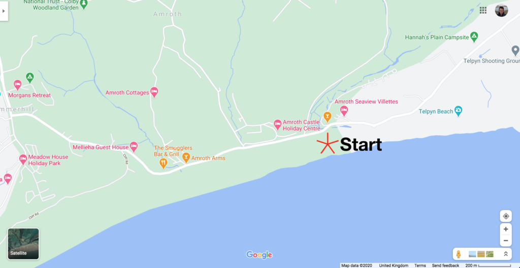
Day 1: Amroth to Penally – 12 Miles
Becks Bay Campsite
Enjoy walking through the woodland on this first section of the trail as there aren’t many other opportunities to do so on the rest of the Pembrokeshire Coast Path. You’ll follow a lot of promenades through Saundersfoot and into Tenby. Take your time to visit the cafes and walk around the towns as there’s not much of this the rest of the way!
Visit Tenby Castle and walk the length of Tenby South Beach, along the sand, pressed up against the waves.
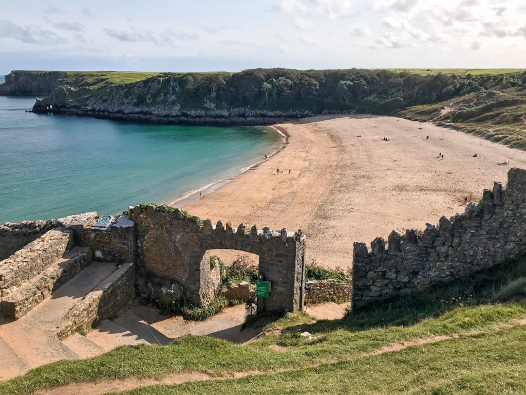
Day 2: Penally to Barafundle – 12 miles
Trefalen Farm Campsite
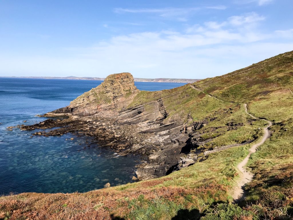
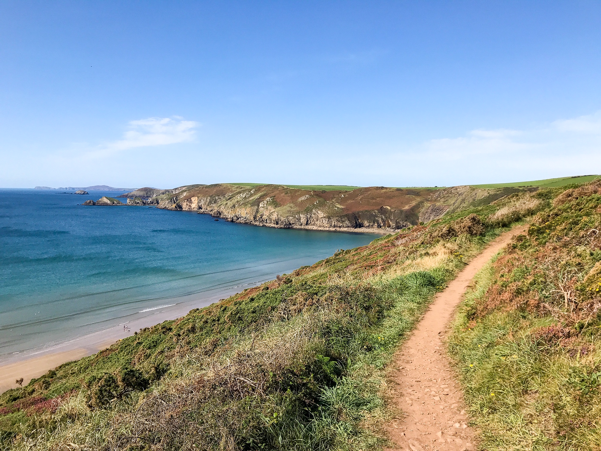
Along this stretch, the path becomes much more dramatic with a host of fantastic geological features and unusual rock formations in the cliffs. Make sure not to miss the beach that holds Church Door Cove!
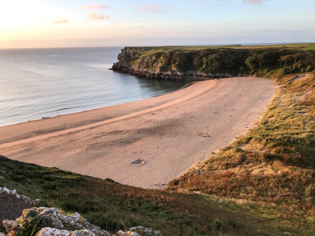
There will be a lot of ups and downs between headlands and beaches but that’s something you may as well get used to for the rest of the walk! Towards the end of the day you’ll reach Barafundle Beach which is regularly called one of the UK’s most beautiful beaches.
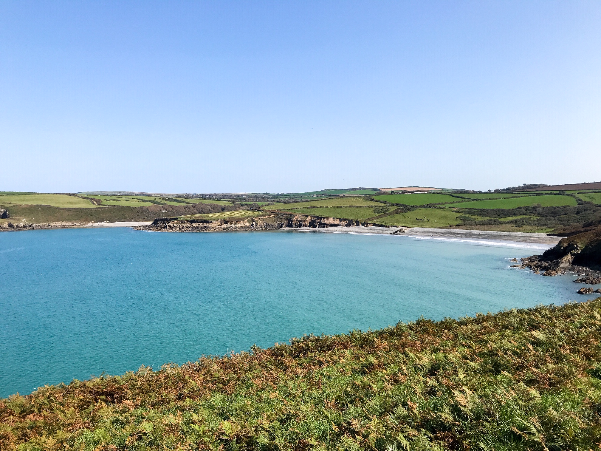
Day 3: Barafundle to Freshwater West – 13 Miles
Gupton Farm Campsite
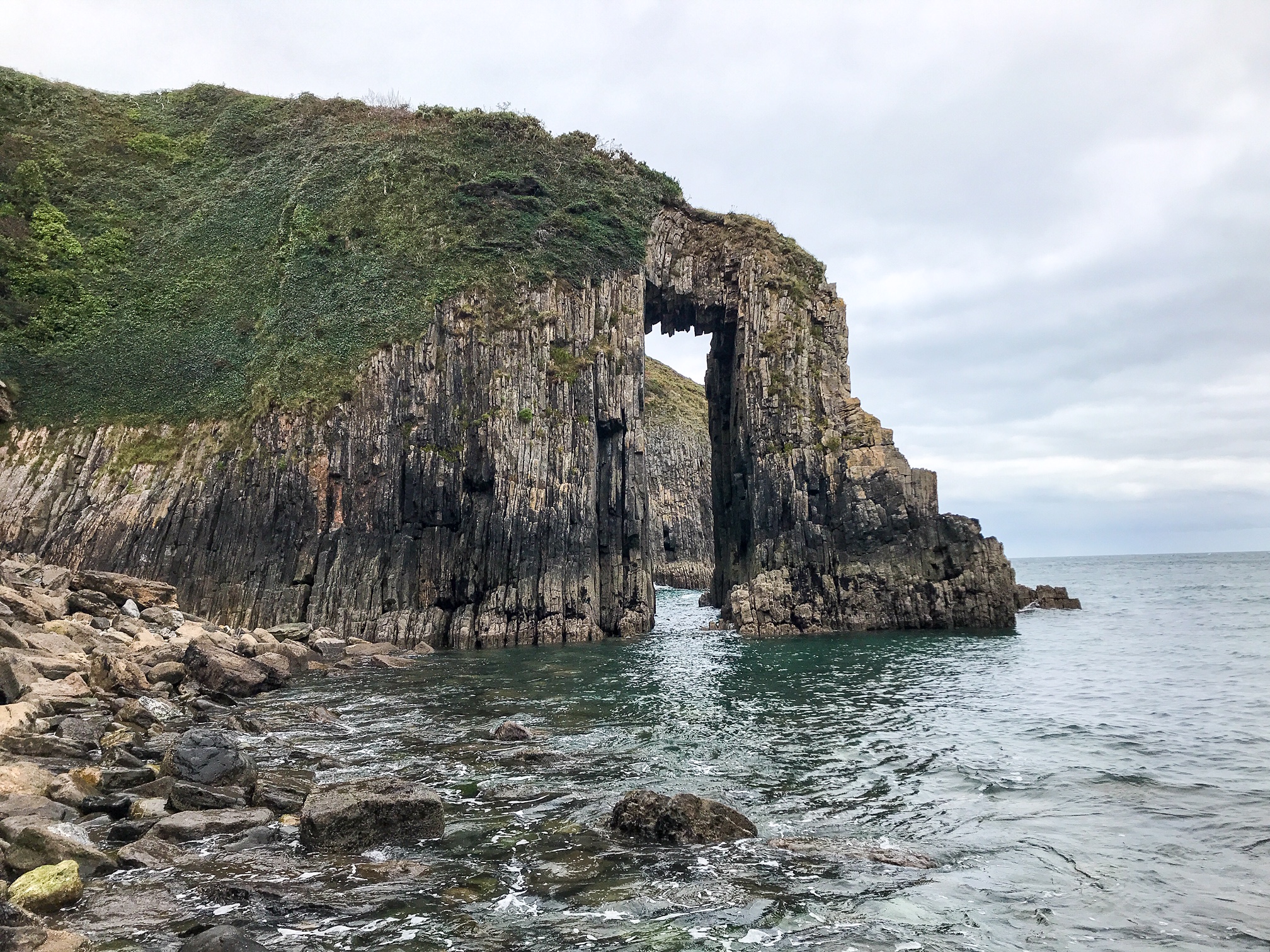
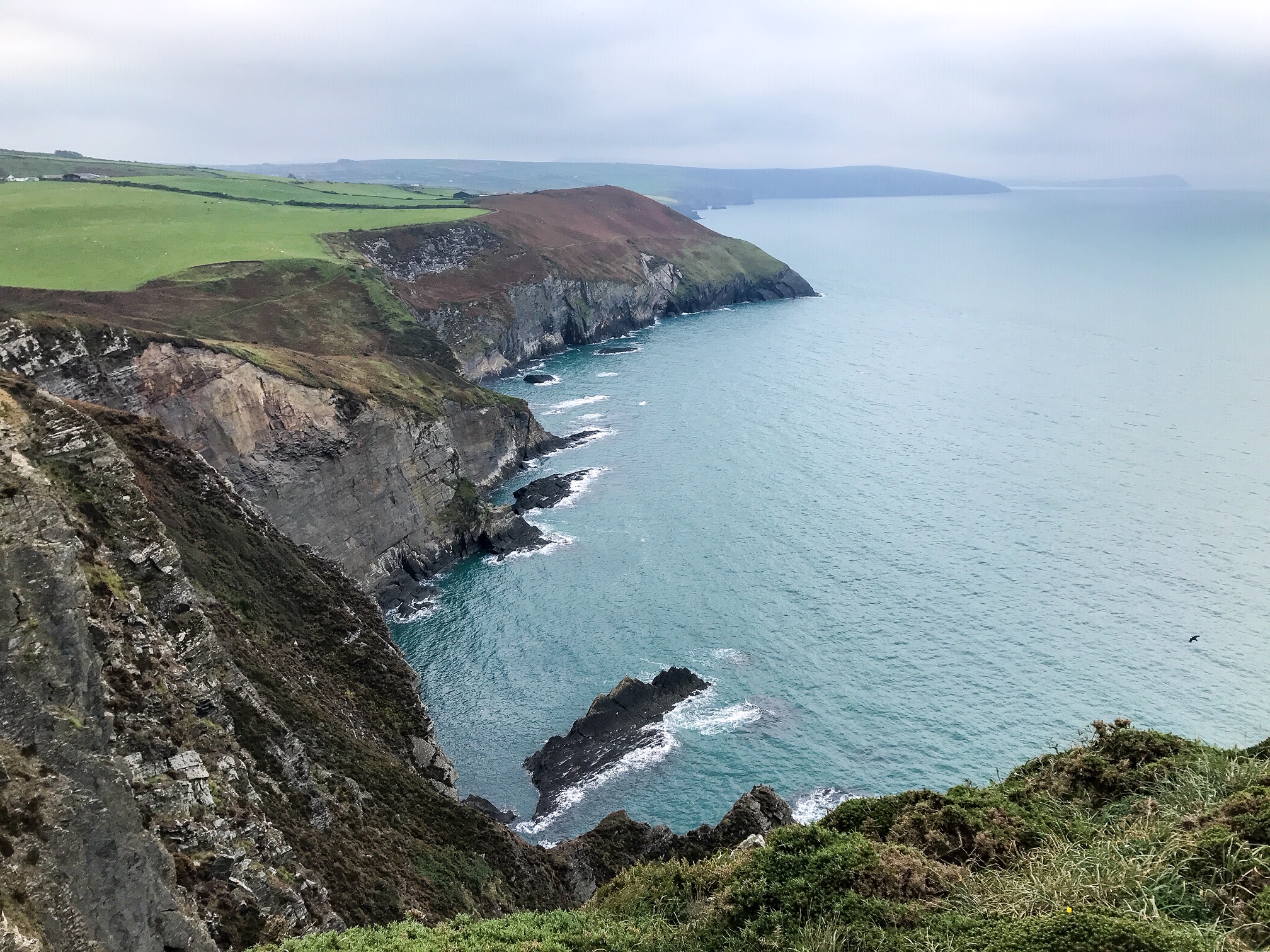
Today there’s a stark change in the landscape as the cliffs rise precipitously upwards before cutting down to a sheer drop into the sea. Because of the rock structure in this section you’ll likely pass many rock climbers attempting to scale the soaring cliffs. You’ll pass famous Pembrokeshire features such as: Saint Govan’s Chapel, Huntsman’s Leap, Green Bridge, Elegug Stack, and The Cauldron.
I spent a long time wandering through this section just marvelling at the fabulous rock stacks, caves, and arches. One note is that you must pass through a military base which can cause you a long detour if they’re firing before rejoining the trail on the far side.
Day 4: Freshwater West to Monkton – 21 Miles
Greenfields Pembroke Campsite
In some ways this is one of the hardest days on the Pembrokeshire Coast Path. The day starts with your first truly remote section from Freshwater West to West Angle Bay. This is a long stretch with no places to turn off or areas to get refreshments. The path is steep and rugged but the landscape beautiful.
Once you begin heading east and inland towards Pembroke the views are quickly sapped away by the ominous oil refinery burning in the sky. Wherever you look it seems to be stuck in your vision. For that reason I recommend just pushing on and walking as far as you can towards Pembroke to get through.
Luckily, the path is flat and follows fields and tarmac paths making it possible to really rack up the miles.
Day 5: Monkton to Herbrandston – 17 miles
Pigscot Farm Campsite
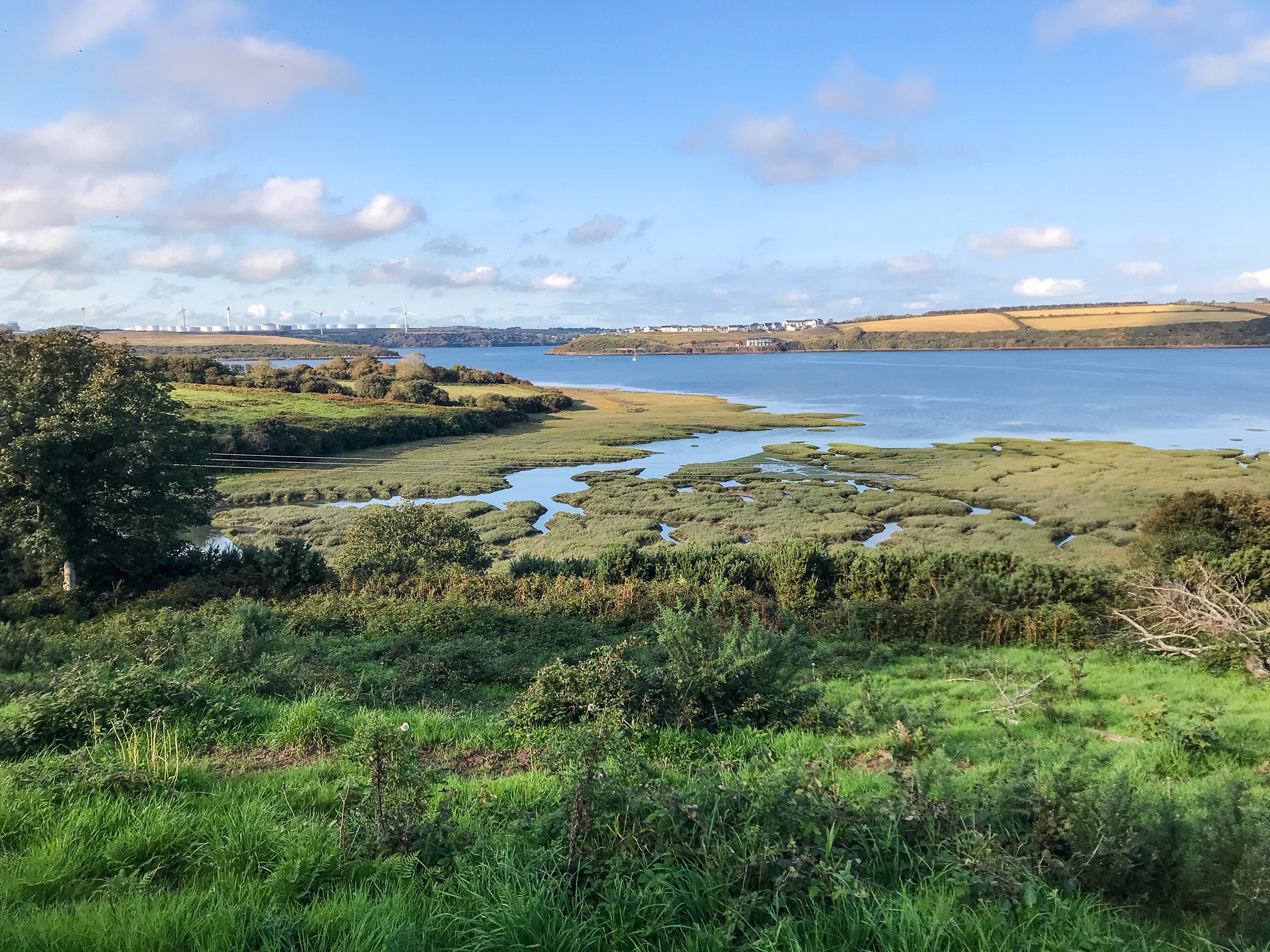
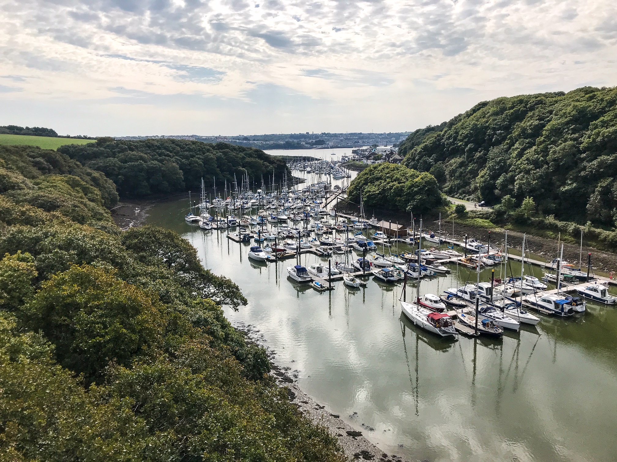
Today is another day similar to before. You’ll pass through Pembroke and Pembroke Dock giving you the opportunity to restock your supplies. Cross over the Cleddau Bridge and loop back on yourself before heading out of Milford Haven along the opposite shore.
Unfortunately again you’ll pass through more power stations with the oil refinery still visible on the horizon. Once you pass through Milford Haven though you’ll be back in the Pembrokeshire Coast National Park and on your way to seeing more of the sublime nature!
Day 6: Herbrandston to Martin’s Haven – 18 miles
West Hook Farm Campsite
Today you’re back on the proper coast path trail and will see some gorgeous sections of the coast around St Ann’s Head, Dale, and up towards Martin’s Haven. Make sure you time the start of your day right as you cross the Sandy Haven tidal estuary. At high tide it’s impassable and you’ll be faced with a 4 mile detour.
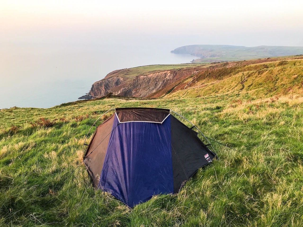
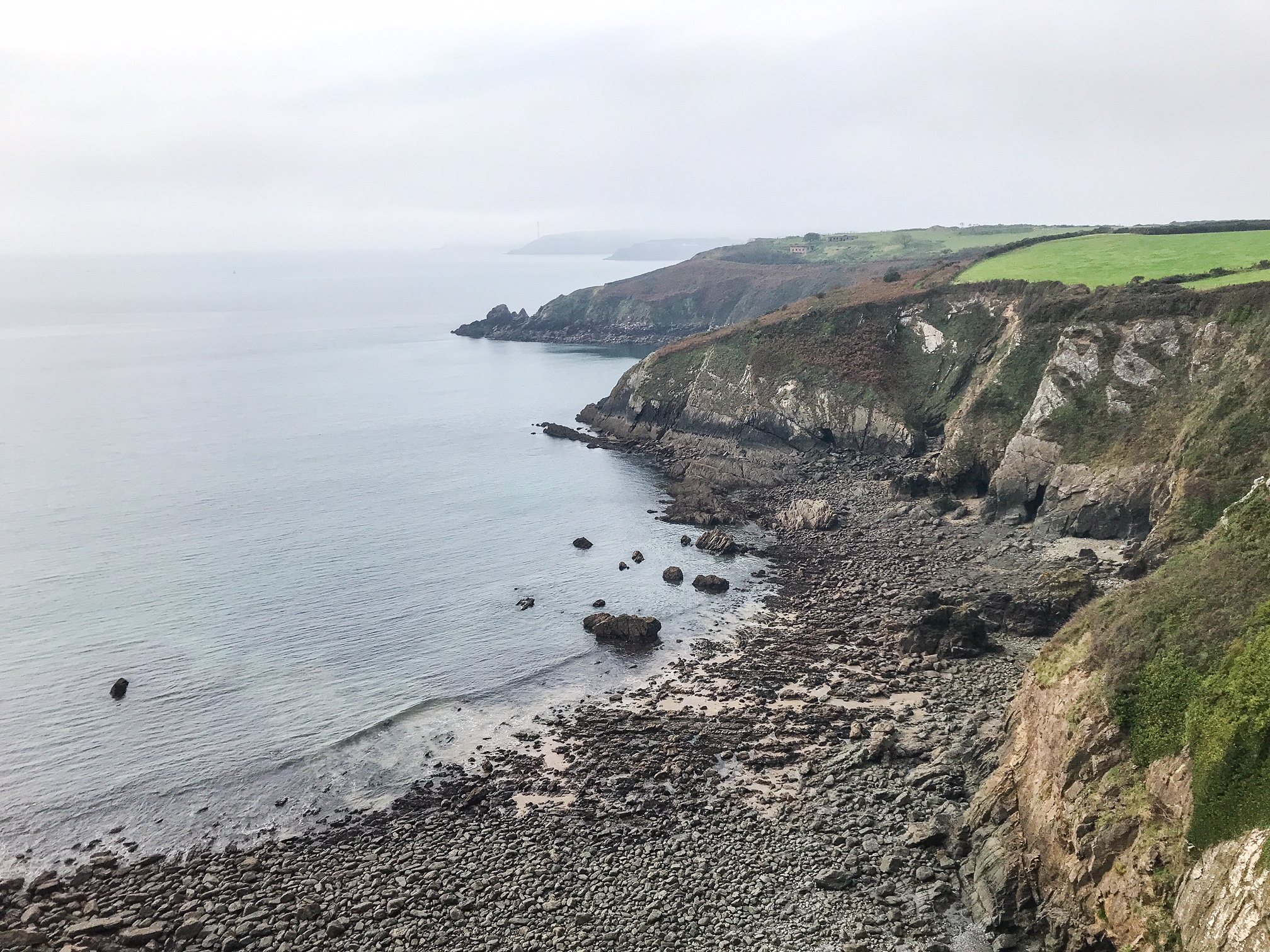
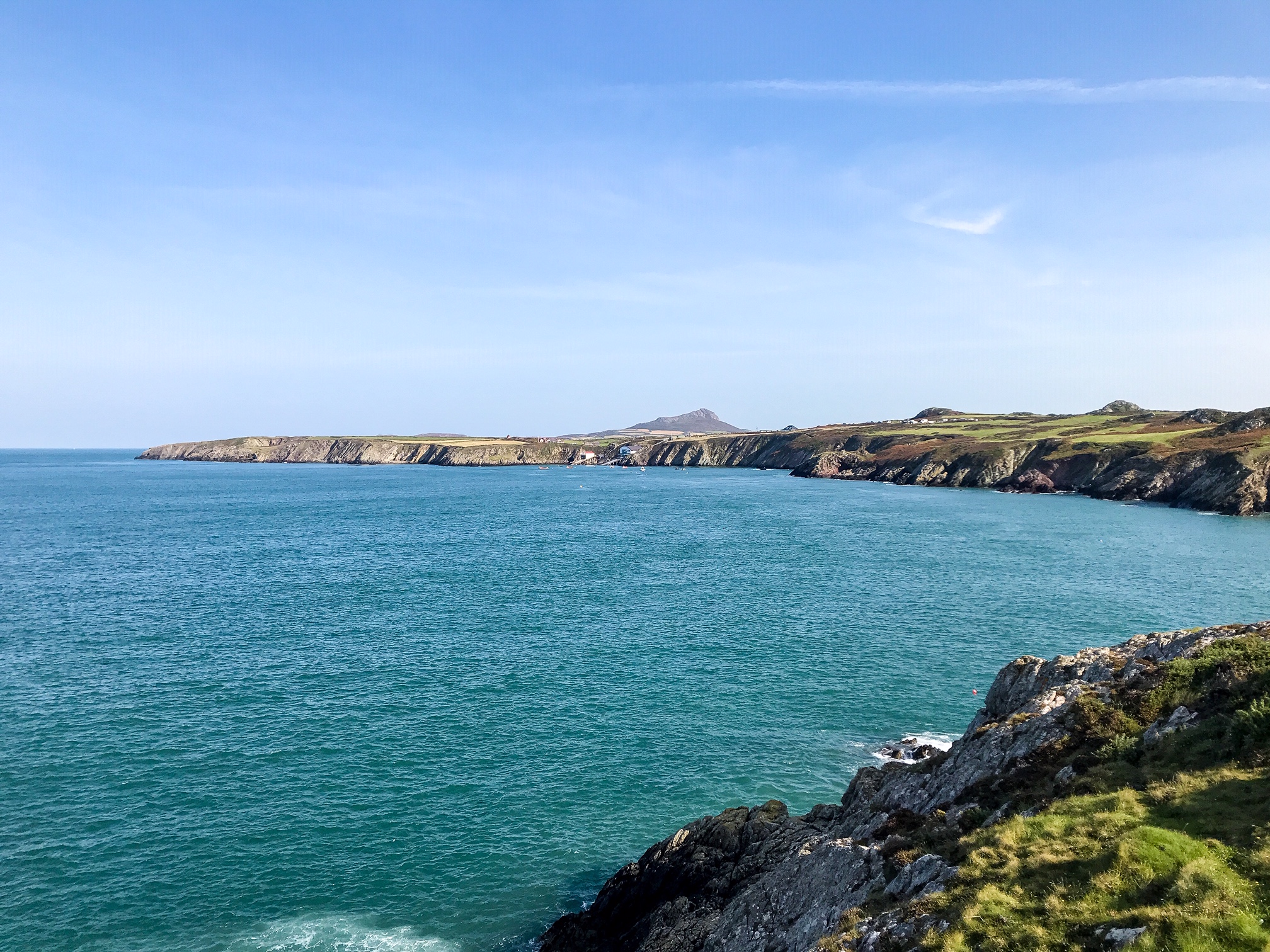
There’s a wild feel to this section with many of the beaches and coves being unreachable from the path. The trail keeps to the cliffs and headlands for much of the day providing you with spectacular views across the Irish Sea and to the islands of Skomer and Skokholm.
It’s a busy day and there are sites to see at Dale Castle and St Ann’s Head Lighthouse. You’ll also get to see the famous Marloes Sands beach.
Day 7: Martin’s Haven to Little Haven – 10 miles
Little Haven Campsite
A shorter day today. You’ve hiked 56 miles in the last 3 days and will probably feel close to collapsing. That’s why I suggest ambling along this lovely section and really taking your time to enjoy the views over the lofty St. Brides Bay. It’s easy to walk with your head down, pushing through every mile, but I suggest on this day you appreciate where you are!
There aren’t any cafes or major towns along this 10 mile stretch. Just you, the sea, and the coast path.
Day 8: Rest Day
YHA Broad Haven
Day 9: Broad Haven to Caerfai Bay – 17 miles
Caerfai Farm Campsite
After your day’s rest you should feel fit and back on form, ready to tackle the trail again. The water in this part of the coast is astonishingly clear and when the sun’s out, it shines with a miraculous bottle green.
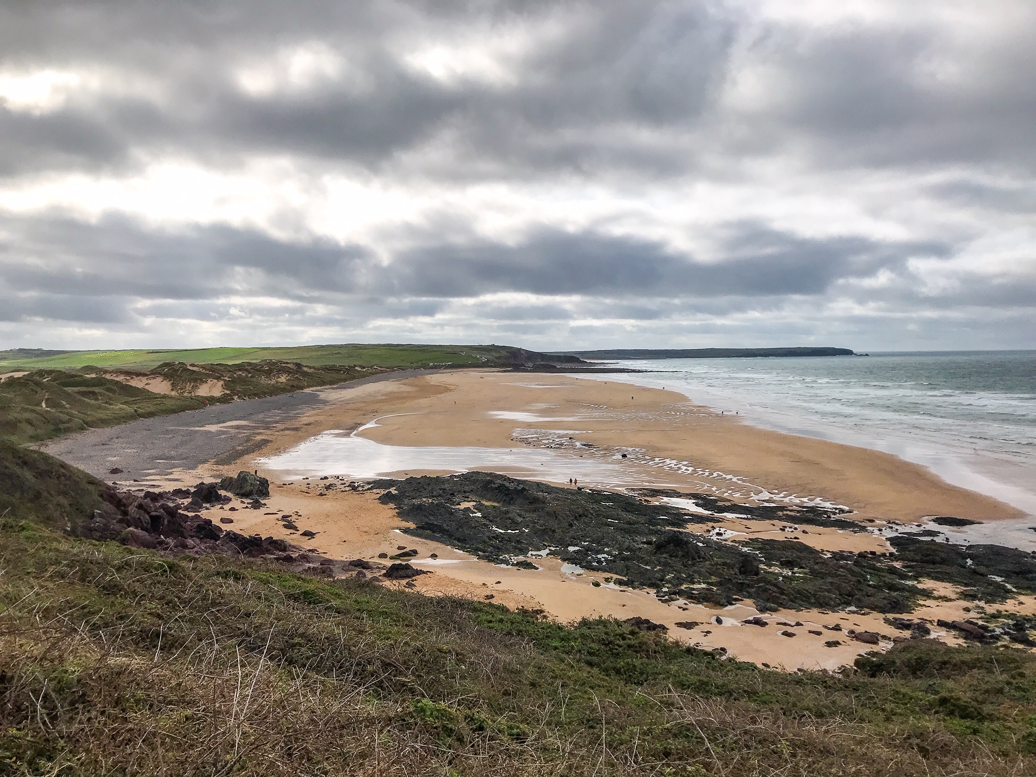
If the tide’s low you can enjoy a stretch walking along Newgale Beach! Make sure you stop off in Solva for a snack or some lunch as there are multiple great cafes and restaurants.
Day 10: Caerfai Bay to Abereiddy – 16 miles
Celtic Campsite
From this day onwards you will walk through my favourite part of the whole Pembrokeshire Coast Path and my favourite beach in the area (Whitesands Bay).
You can divert inland to St Davids, but I believe this is too far out the way to be done in a day. Instead, take in the views of Ramsey Island which is an RSPB Nature Reserve. If you’re lucky you’ll see The Bitches in full force, some of the most ruthless tidal surges in the whole of the UK.
After you leave Whitesands Bay, things get really wild. A set of peaks climb higher above the cliffs creating even more spectacular scenery than what you’ve already seen.
Head to the Blue Lagoon early morning or after your hike for a bit of cliff jumping into the old submerged quarry!
Day 11: Abereiddy to Tresinwen – 19 miles
Hillfort Camping
If I had to choose my favourite day on the whole Pembrokeshire Coast Path it would be this one.
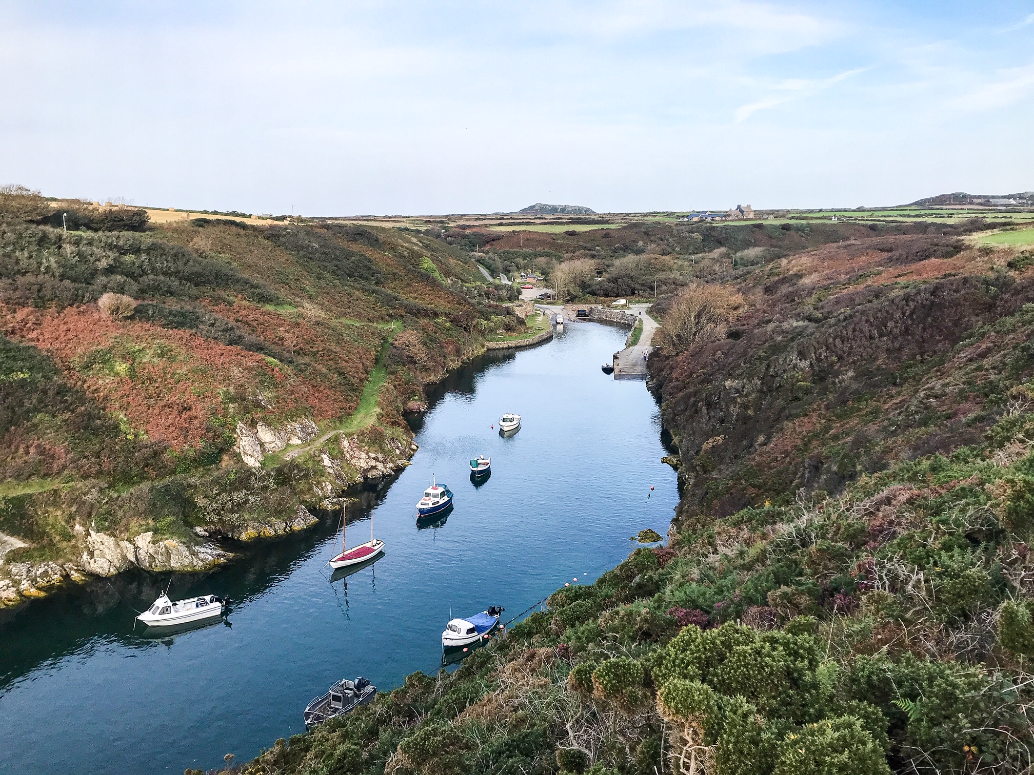
Things begin slowly with an amble through Porthgain Harbour and Trefin where you can stop for food and a hot drink in both places. After leaving Abercastle, that’s when the fun starts.
The landscape leading up to Strumble Lighthouse has to be some of my favourite natural scenery in the whole of the UK. It’s honestly stunning and although this day is going to be long and tough you’ll be so taken aback by the views it’ll hardly matter.
Day 12: Tresinwen to Newport – 17 miles
Morawelon Campsite
As you turn east and inland, you’ll find yourself on the home straight but with a few hurdles to cross yet. There’s a deceptively tiring crossing through Fishguard and out around the Ynys Dinas headland. I thought I’d be able to race through this section considering the distance and terrain I’d already been covering.
However, the combination of extensive road walking followed by a long, steep climb round the crumbling headland is super tough – both on the feet and the knees.
Enjoy the beach at Newport as that’ll be your last sunset on the Pembrokeshire Coast Path!
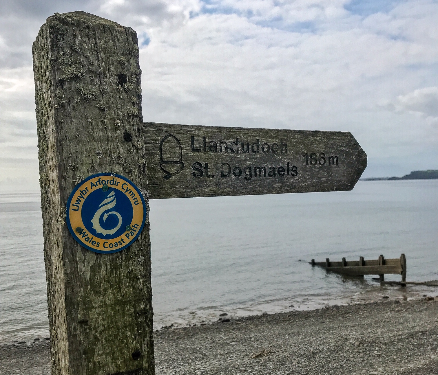
Day 13: Newport to St Dogmaels – 14 miles
The final stretch, and it’s a tough one. By this point you should be used to the long miles and the endless ups and downs. But even despite that I found this day difficult. Perhaps because the closer you get to completing your goal the harder it is to make that final step.
I loved the remote section leading up to Poppit Sands and didn’t pass another person in the 3 hours of walking. The final stretch down a long, long tarmac road was the hardest part. The last hour to St Dogmaels is tough.
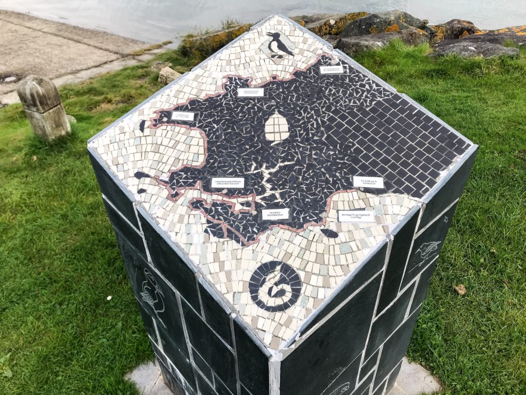
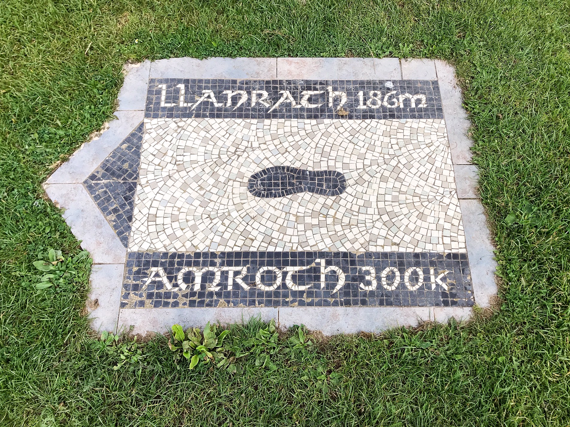
Then suddenly you’re there, and it’s over. You’ve done it. All there is to commemorate is a small plinth marking the completion of the trail.
Congratulations, you’ve just completed the Pembrokeshire Coast Path!
10. Bonus Tips
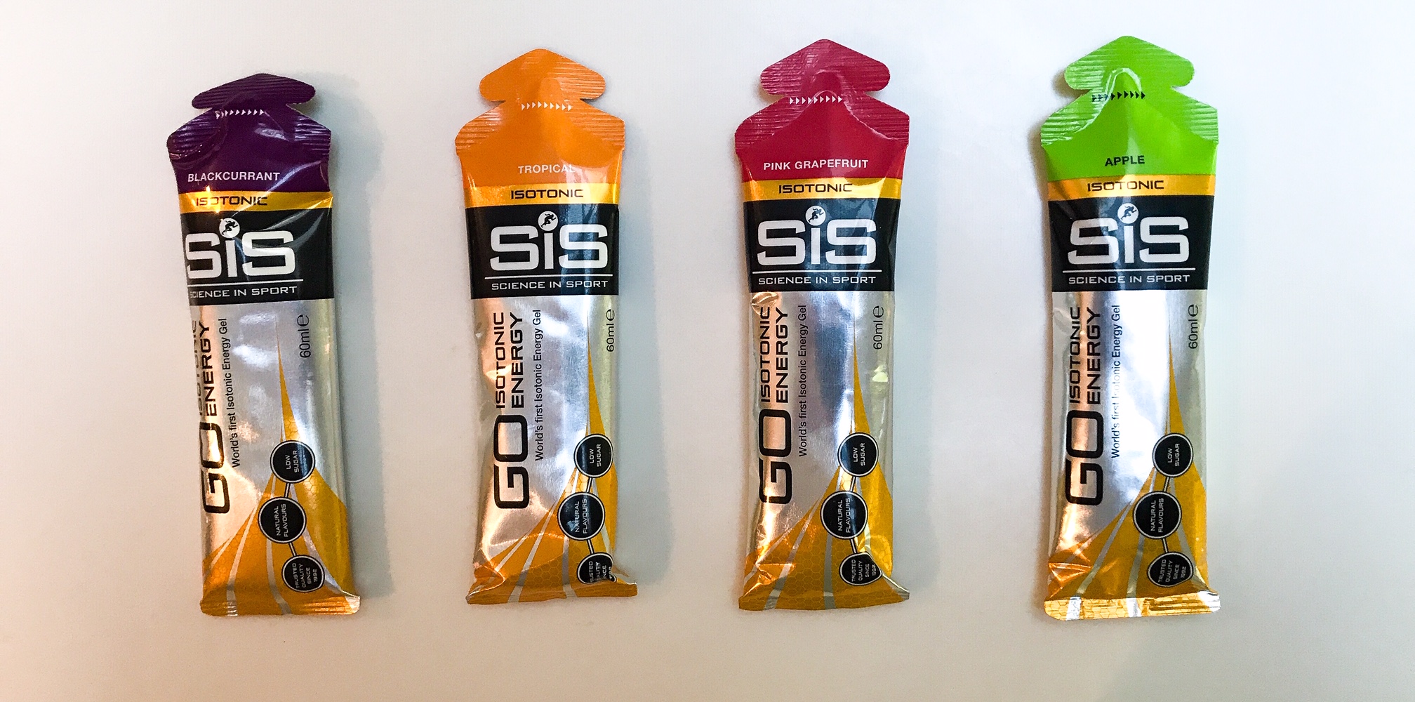
Bring Back up Energy
There are going to be days where you’ll feel like your legs can’t take the strain anymore or you’ve completely run out of energy. You’ll likely be burning 3,000 calories a day and that means at times you’ll just feel like you can’t go on. There might be nowhere to camp nearby or you need to reach a water source 2 miles farther along.
For this reason I recommend bringing some energy gel packets to give you a boost on those really long days. I found them very useful a couple of times when my legs were gone. Alternatively some gummy sweets or any candy that can give you a sugar rush and quick burst of energy. Either are a great option to have up your sleeve!

Manage Your Injuries
In many ways this is an endurance event. You’ll be walking an excess of 13 half marathons consecutively – except with more difficult terrain, more inclines, and a heavier pack. This will undoubtably take it’s toll on your body.
Don’t ignore any niggles, strains, or hot spots. Start treating them the moment they become uncomfortable because they’ll only exacerbate if you don’t.
Stop regularly to clear grit from your shoes, dry your feet, let them air, and plaster up any hotspots before they turn to blisters.
Every time you put on your bag, undo all the straps then re-do them to make sure the fit is right, avoiding shoulder and neck pain.
Each time you take a break do some slow stretches to ease out any overworked muscles or tendons.
Take anti-inflammatories or painkillers in the evening if you need to reduce swelling or buy ice if available to sooth any overworked muscles.
Strap up and bandage any areas you think may need extra support.
This walk is hard on your body. Look after it and it’ll look after you.
Watch Out for the Tides!
There are sections of the walk that cross tidal estuaries or run along the edge of a beach. If you get the tides wrong you may find yourself with a long detour inland or having to wait a few hours till the tide changes.
One such spot is at Sandy Haven (tide times) and another is at Newport (tide times).
In addition to this, some of the most beautiful beaches can only be fully appreciated at low tide. If the tide is in, and lapping against the rocks, it’s hard to experience the full expanse of the sweeping sands.
If there’s a particular beach you’re excited to see then it’s worth checking the tide times before you go to make sure you get it right!
Do Warm Ups and Warm Downs
I can’t over-stress how important this is. I went many years only doing occasional and half hearted warm ups. On this trip I made absolutely sure not to start or finish my day without doing at least 20 minutes of stretching at either end. What a difference it made to my fitness levels.
Limbering up not only reduces the chance of injuries, it also makes you feel much fitter whilst walking. You rid yourself of the aches and cold muscles and ensure you hit the ground running (or walking). This also avoids you stiffening up and having an awful night’s sleep at the end of a long day!
I’m not promising this will heal all aches and ailments but it’ll go a long way to keeping you in peak condition.
Wear in your Shoes Before you Go
Don’t buy a pair of shoes and take them to the trail unused. Your skin will blister to ribbons and you’ll have to drop out of the trail early, feet in tatters. I’m not exaggerating here. This happened to my sister on the Camino de Santiago, and this was after she’d already done some test walks in the shoes to wear them in, but unfortunately not enough.
You have to be comfortable with your footwear. Know your feet and where any hotspots are so you can prevent blisters from arising. Make sure your shoes work for you and that way it won’t be an uphill battle trying to wear them in and get them to fit en-route.
See also:
How to Train for a Long Distance Hike
Only Pack Essentials
Be frugal in your packing. Only take essentials with you. Lay everything out before you go and scrutinise every item, leaving behind everything that isn’t a necessity.
Out on the trail you’ll thank yourself for every tiny bit of weight you can save. This begins at the early packing stage. Do you really need that extra jumper, spare book, or clunky torch? When was the last time you used that compass or coffee pot on a hike?
Go through a process of elimination to narrow down your pack. Maybe it’s time to upgrade and invest a little money to get some lighter items. If you’re doing a hiking trip this long I’d say the investment is worth every penny.
Being economical without spreading yourself too thin is a fine balance but something you’ll learn over time. In this case, follow some of my packing advice above to help get you started and for more information see my multi-day hike kit list.
Tell Someone Where you are Going
For the majority of my trips, I hike alone. This means there’s no safety net if I get lost or hurt and my phone has no signal or is out of charge. The way I cover myself is by letting 1 or more family members / friends know where I’m going and what my planned itinerary is.
That way, should anything go wrong, I know help can be on the way and there are people looking out for me. This can be a big moral boost if you’re wild camping and feel nervous about being alone in the wilderness. You don’t want an Aron Ralston situation from 127 Hours!
Of course you can always walk in pairs which is advisable for a number of safety reasons but this isn’t always possible. Sometimes you need to just get out there and have a solo adventure!
Sleep in One Layer Only
I’m surprised how few people actually know this tip. Common sense says if you’re cold you should pile the layers on before crawling into your sleeping bag like you would when exposed outdoors. But this stops the insulation from doing its job and you’ll actually be colder!
I sleep in a pair of ankle socks, thermal leggings, a long sleeve thermal base layer and sometimes a beanie hat. All these things are light and pack down small. You can roll them inside your sleeping bag to keep them dry and every night you’ll have something warm and cosy to sleep in.
Take a Rest Day
Trying to walk the full trail without a rest day would be unwise. Not just because it’s difficult, but because you’ll enjoy it a lot less as you’ll be so worn out.
A day off to rest and let your muscles recover can help no end. After break you’ll hit the trail with a spring in your step and be so thankful you took the time to let your body get stronger!
I also used the day off to pile on some more calories and get my body back out of the huge deficit it was running off. Over the 2 weeks I lost nearly 2 kilograms and considering I’m a pretty slim guy as it is, that should tell you how physically demanding the Pembrokeshire Coast Path is. You need your rest!
Bring Washing Powder
As mentioned in the packing list, you don’t want to bring too many changes of clothes. This of course means what you wear will quickly get filthy and stay that way.
Lots of campsites I went to didn’t have washing machines and this wasn’t an option when wild camping either. If you bring some washing powder with you, you can wash a pair of socks in the sink one evening and hang them to dry from your bag as you walk the following day.
It will make such a big difference. I was sick and tired of wearing the same horrible t-shirt and socks every day. They won’t be completely clean but it will to make you feel clean enough to go on again!
Before You Go
Thanks for reading my Pembrokeshire Coast Path travel guide. If guides like this interest you, head over to my travel guide page to find more!
I recently wrote a travel guide for another National Trails walk: Hadrian’s Wall Path. This is another stunning long distance hike you can explore in the UK.
If you are new to Walk Wild, visit the About Me page to learn about who I am and what made me want to be a travel writer.
Have I missed anything out? Please comment below, let me know what you think and ask if there’s anything else you want to know.
For more hiking and adventure travel, follow me on Twitter and Instagram.
[…] hike to a different part of the country. This time choosing a renowned beach destination: the Pembrokeshire Coast Path in […]