How to Hike and Wild Camp the Gower Peninsula Coast Path
14 Minute Read
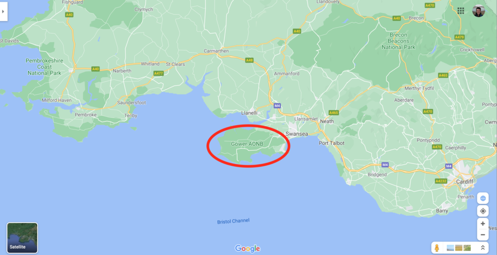
The Gower Peninsula Coast Path is a hiking trail in Wales, UK. It is in the the Gower Area of Outstanding Natural Beauty (AONB) near the city of Swansea.
It is not an official hiking trail, but acts as a section of the 870-mile Welsh Coast Path. The peninsula is one of the most famous coastal areas in Wales, along with the Pembrokeshire Coast, and is loved for its beautiful seascapes, rugged beaches, and craggy headlands.
The path runs from Mumbles in the south to Crofty in the north. This trail is 41 miles, although it can be longer or shorter than this depending on a variation of paths you chose to take.
The Gower Peninsula Coast Path can be walked over 3 or 4 days and is an excellent trip to do some wild camping.
In this guide, I will tell you everything you need to know for how to hike and camp along the Gower Peninsula Coast Path.
- Where to Start?
- How to Get There?
- How to Find Your Way Around?
- Where to Stay?
- What to Pack?
- What to See?
- Is it Safe?
- Food & Drink
- Day to Day Itinerary
- Bonus Tips
This page contains affiliate links. This means I make a commission if you buy a product I have recommended (at no extra cost to you). All recommendations I give are genuine and my own. Thanks for the support!
See also:
How to Walk the Pembrokeshire Coast Path
Top 5 Beaches in Pembrokeshire
Top 3 Brecon Beacons Walks
1. Where to Start
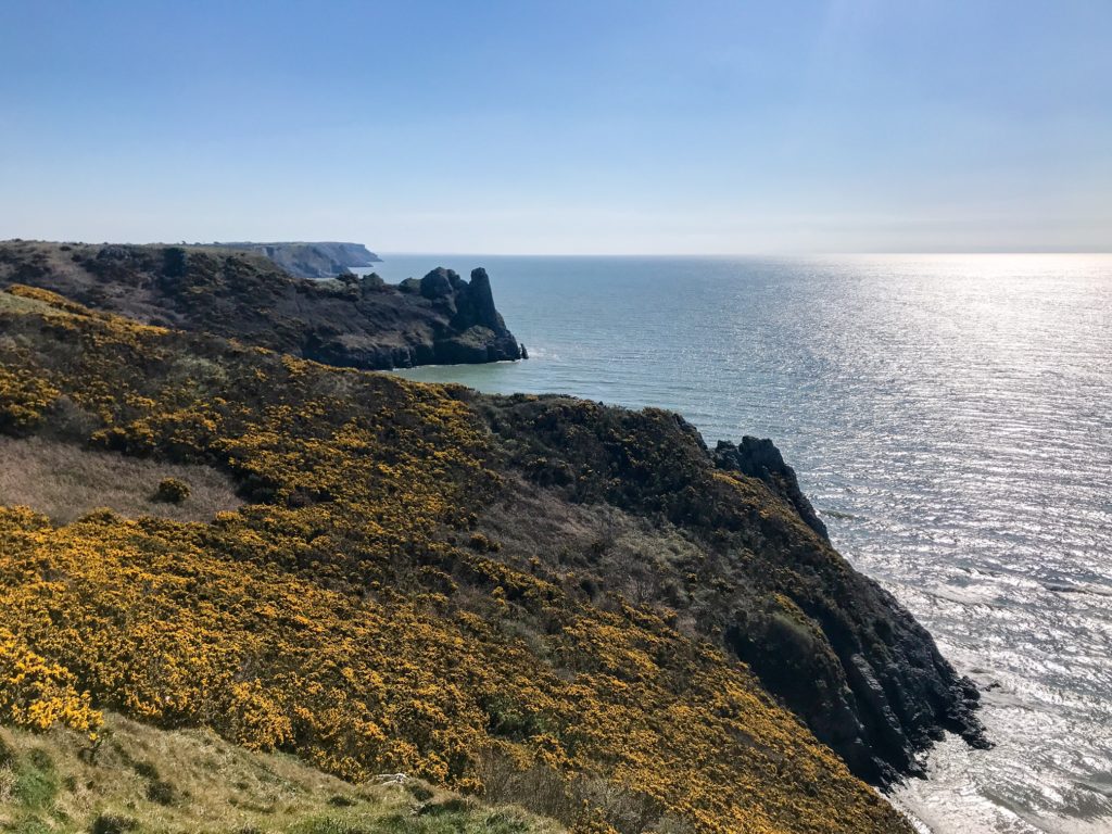
First let’s look at the Gower Peninsula. This was the first designated AONB in Britain and it’s not without good reason. It is a stunning nature area with an incredibly varied landscape. There are rolling fields, heathland, sand dunes, salt marshes, hidden coves, vast beaches, and numerous rock features that line the limestone coast.
The peninsula isn’t particularly large and covers an area of 70 square miles. This makes it the perfect size to explore on foot via the walking paths that criss cross all over the AONB.
The main feature of the peninsula is its coastline. The best way to see it is by following the Gower Peninsula Coast Path that winds its way around the whole AONB to take in the best of what the peninsula has to offer.
You can either start in Crofty or in Mumbles (or even further out if you so desire, but this will then be outside the AONB) and work your way around the Gower Peninsula Coast Path over a few days.
This guide is going to focus on the trail from south to north as that is the direction I walked it in.
2. How to Get There?
The Gower is tucked into a little corner of the south west of Wales and juts out into the Bristol Channel. It is within touching distance of the city of Swansea which will be your main transport hub for getting to and from the Gower.
As this is a point-to-point trail, it’s hard to circle back on yourself and you will need to find transport to and from the trail heads. Having said that, I parked my car near Mumbles and decided to walk inland back across the peninsula to pick it up after I finished my hike but this adds on almost 10 miles so it might not be for you.
You can reach Swansea from all over the UK by train and bus. Swansea train station is in the city centre and offers direct trains from London Paddington and Manchester Piccadilly via National Rails.
You can also fly to Cardiff airport if you are coming from abroad before taking public transport to get to Swansea.
Bus
There is a bus and coach station to the south-centre of the city which has National Express bus lines linking up transport hubs throughout the country.
You can then catch the 2A or 3A bus from bus station W in Swansea to Oystermouth Square in Mumbles. The journey lasts about 30 minutes and you can begin your hike from there.
There is no train station in Mumbles, so bus or taxi is your only option. You can walk along the promenade looking out over Swansea Bay but it is nearly 5 miles and you have quite a bit of walking to do on this trip already!
You can then catch the 116 bus from Crofty which takes you back to Swansea in under an hour when you’ve completed your hike.
Car
As mentioned, you can park your car and walk the trail over 3 or 4 days but then you need to get back to your car after you’re finished. One way to do this is to park in Swansea or as close to the trail as you can get, then follow the public transport as mentioned above to get to and from your car.
Be careful where you park. Many beach car parks clearly state they don’t allow overnight parking and if you try to pull into a lay by you could get slapped with a parking fine.
I recommend using either Your Parking Space or Just Park and book in an official parking spot for your trip. It’s a little expensive but you know that your car is in a designated spot where you won’t get any fines.
I parked my car near Mumbles and walked the Gower Peninsula Coast Path to just outside of Llanrhidian before I cut across the Peninsula to walk back to my car. I didn’t mind walking a few extra hours but this can be a bit of a hassle as the views aren’t as great and it’s mainly via country roads.
3. How to Find Your Way Around?
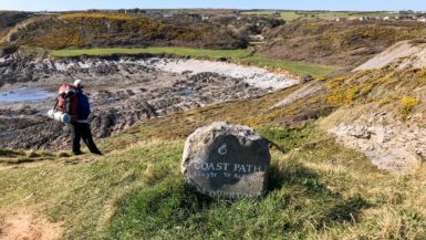
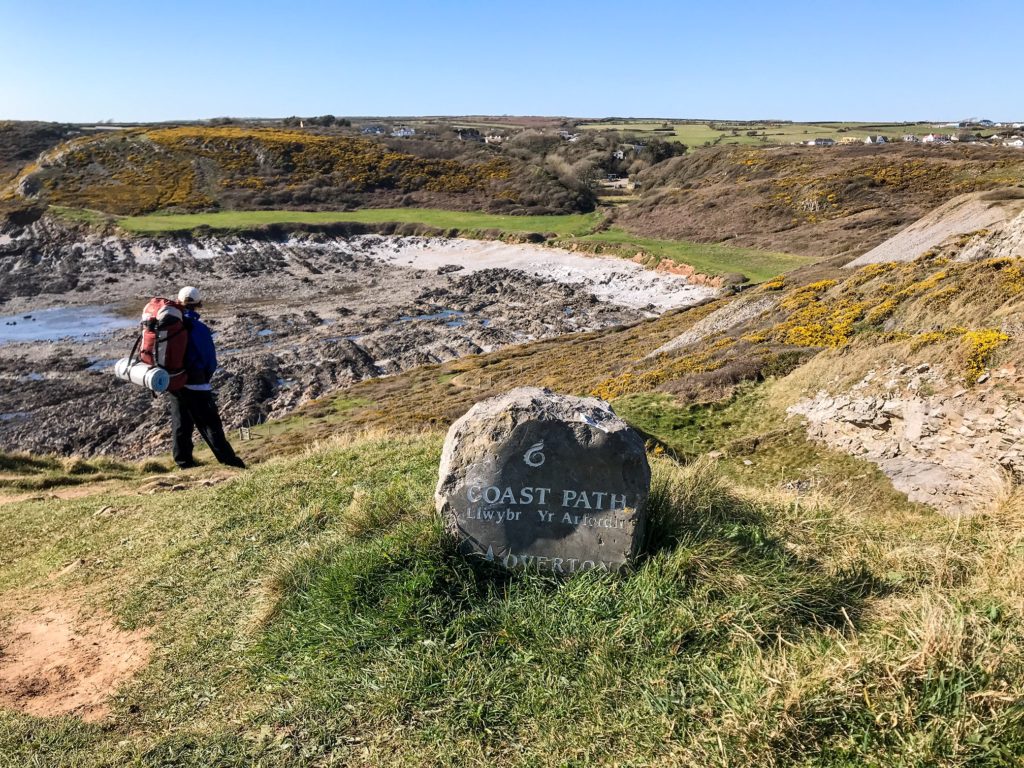
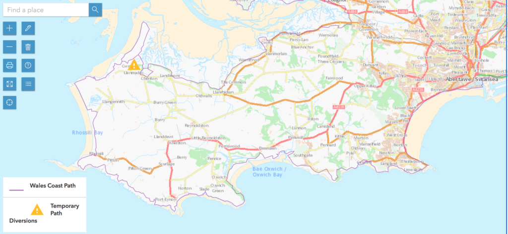
As discussed, there is no official Gower Peninsula Coast Path. However, to walk the trail, all you need to do is follow the signs for the Welsh Coast Path and that will get you there.
The symbol of the Welsh Coast Path is a seashell. These signs are posted all throughout the walk on fences, gates, and posts and can be used to guide you on your way.
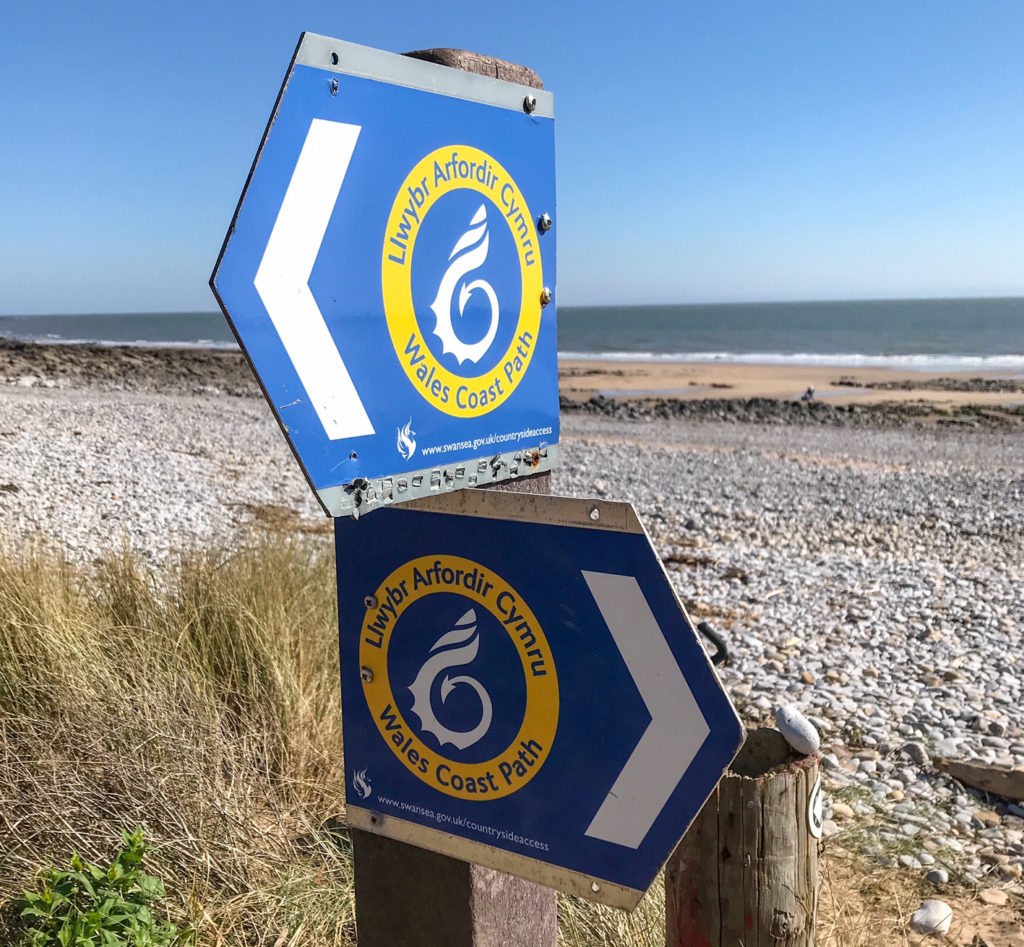
They are usually easy to spot but sometimes you need to have a search for them if you can’t find one. Always keep the sea to one side and you can’t get lost!
There are lots of other public footpaths along the peninsula but often they join up with the coast path again so don’t worry if you divert slightly.
The only time when there is variation is if you are taking a higher/lower route (along the beach or over a headland), which is just down to personal preference.
You can use an OS map if you like, but I tend not to. I think it’s easy enough following the signs!
I do use my AllTrails app sometimes which helps track my distance and speed. You may want to consider using the app to guide you along the trail instead.
4. Where to Stay?
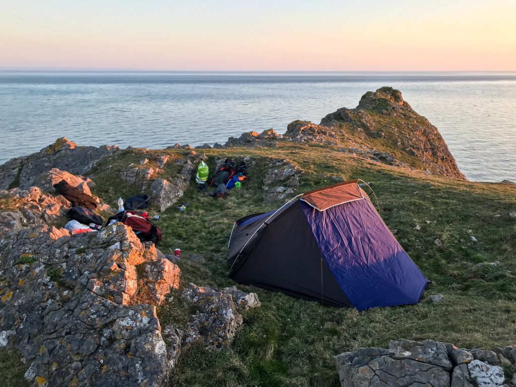
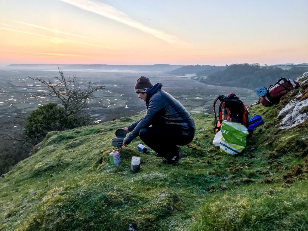
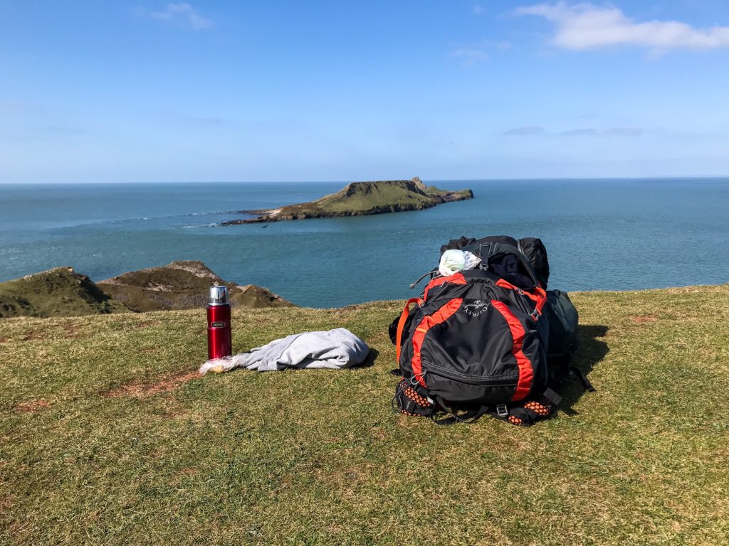
The Gower Peninsula Coast Path is perfect for wild camping. I walked the path in 3 days and found 2 excellent wild camping spots.
The stretch that runs from Port Eynon up to the Worm’s Head is excellent for wild campers and you will have little issue finding a good place to pitch a tent.
It’s a remote area with lots of headlands that have small hollows and reasonably flat areas of grass where you can set up a tent looking out to sea. An added bonus is that the sun sets into the water on the western horizon!
I’ve not done it, but I imagine you can camp on Rhossili beach, Rhossili Downs, and the heathland/dunes up around Spaniards Rocks.
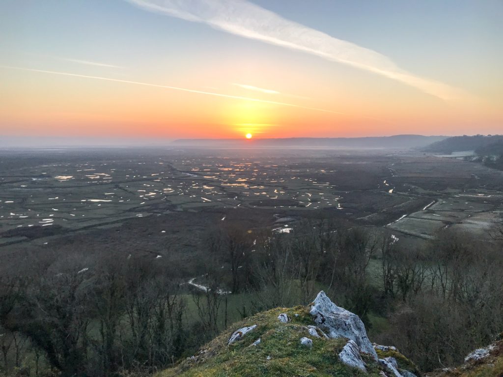
Where you might struggle is turning inland along the salt marsh beside the River Loughour. I perched on top of an escarpment above Landimore but there are more houses, farmer’s fields, and tidal marshes to contend with. You will have to be more inventive to find a good camping spot!
See also:
How to Go Wild Camping in the UK
If you are wish to stay in campsites, there are a number of good ones along the coastline. Here are a few I saw signposts for along the trail:
If you want to see your options, type “campsite” into Google Maps and have a look around to find what suits you best!
There are many lovely BnBs, caravan parks, and holiday lets if you are looking for a more sturdy location to spend the night. AirBnB and Booking both offer lots of accommodation options.
Search the following towns for places to stay: Mumbles, Oxwich, Port Eynon, Rhossili, Llangennith, Llanmadoc, Llanrhidian.
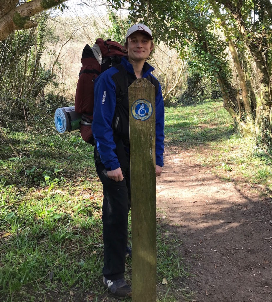
5. What to Pack?
Your packing list will depend on whether or not you are planning on camping or staying at indoor accommodation.
One thing to note is that you will not need hiking boots. The trail is along hard and dry paths. It is rocky underfoot and rarely waterlogged. Trail running shoes are much more suitable!
In either case you will need to bring plenty of water (2-3 litres per person per day) and some snacks for the trail.
It is windy and exposed on the Gower Peninsula Coast Path, so make sure you pack gear to reflect this. Bring suncream, sunglasses, and a sun hat.
The weather is changeable and it can get cold fast or rain can blow in off the Irish sea, so make sure you bring some extra layers with you. A fleece and a rain jacket are both good ideas.
See also:
Day Hiking Gear Essentials
If you are wild camping make sure you bring a warm hat, some gloves, and a down jacket as it gets cold at night.
For your sleeping gear: tent, camping mat, sleeping bag, sleeping bag liner, inflatable pillow.
I bring a small pot and stove with me to boil water for hot drinks and pasta/rice pouches. Don’t forget a spare lighter and make sure you bring enough camping gas.
See also:
Hiking Food Ideas
Miscellaneous items include: water filter, trash bag, waterproof stuff sacks, a kindle/e-reader, portable charger, camera, spork, thermal underlayers, hand warmers, medical kit.
Try to keep your bag as light as possible and make sure you have a good backpack no bigger than 40-50 litres. After you have packed all your essentials, try to leave out all the unnecessary items to keep your kit lightweight!
See also:
Multi-day Hike Kit List
6. What to See?
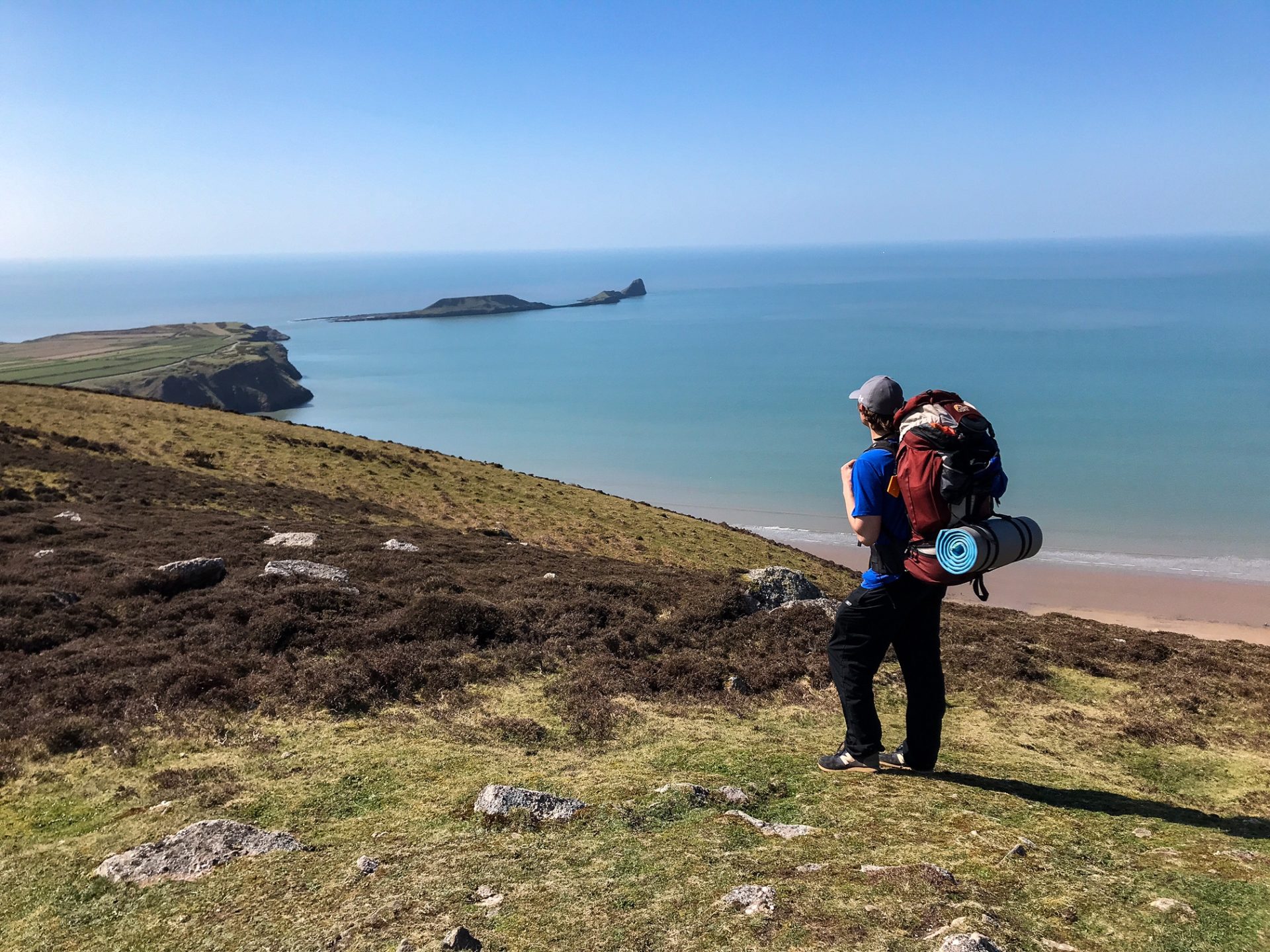
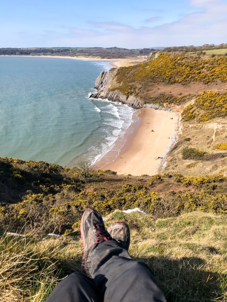
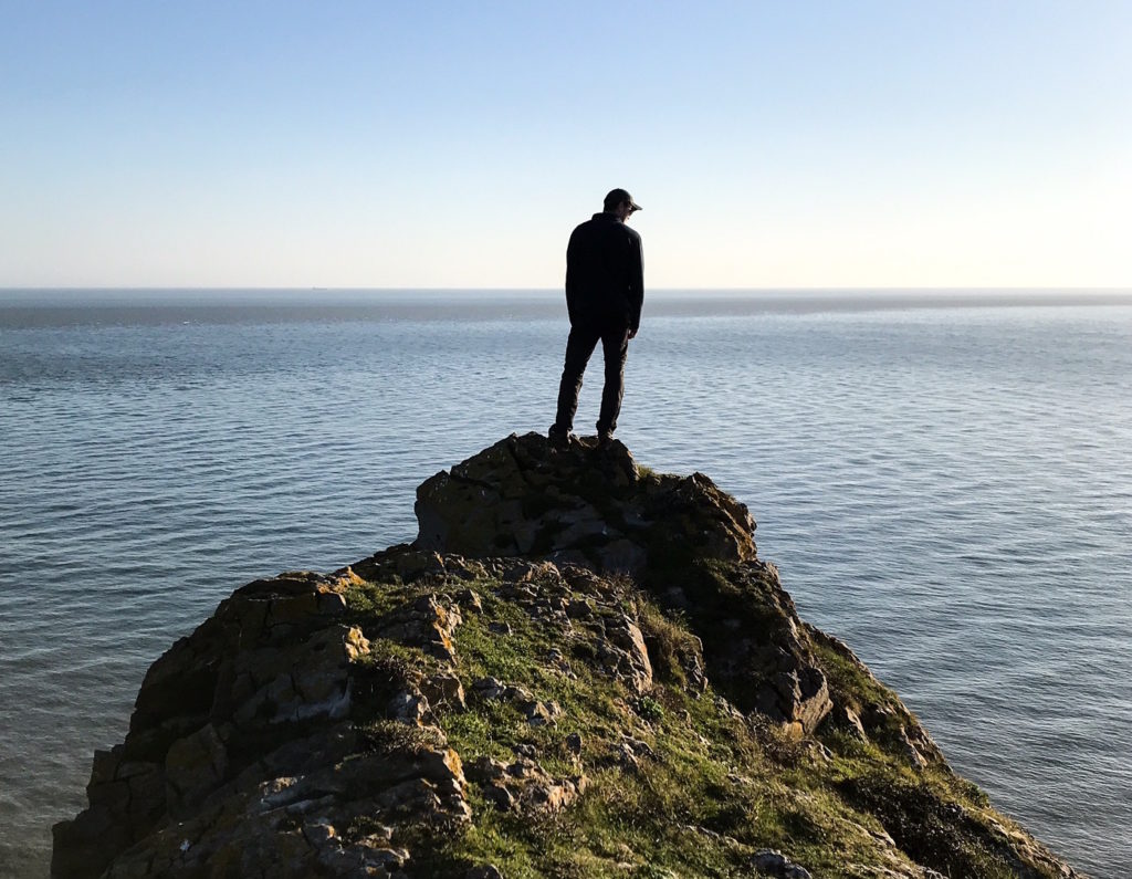
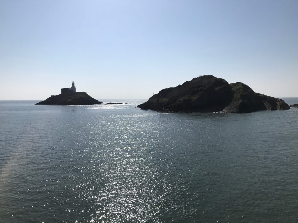
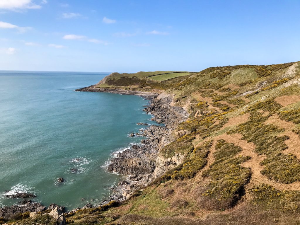
One of the main features along the Gower Peninsula Coast Path is the Worm’s Head. It is a mile-long limestone structure that is split into three islands. It snakes out from the headland near Rhossili and is a magnificent natural feature.
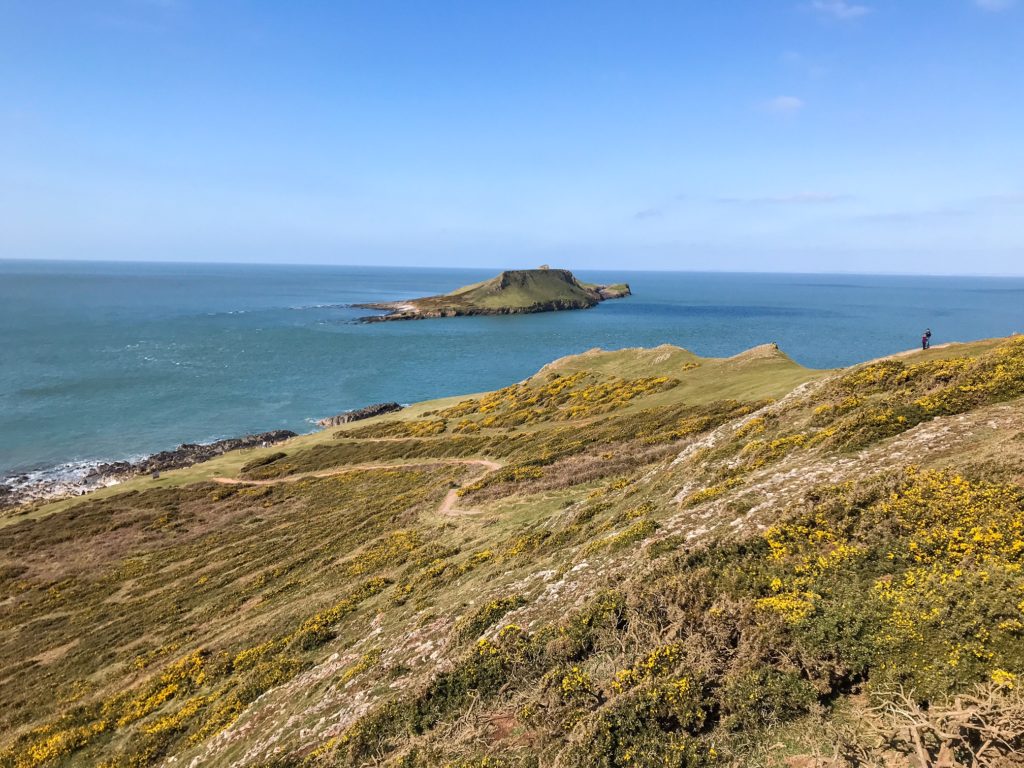
It can be reached 2.5 hours either side of low tide. The walk to the Worm’s Head is cut off at high tide so if you are set on reaching it, make sure you time it right!
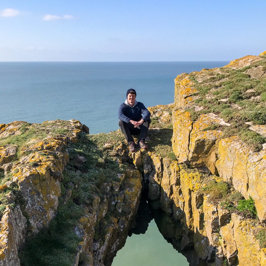
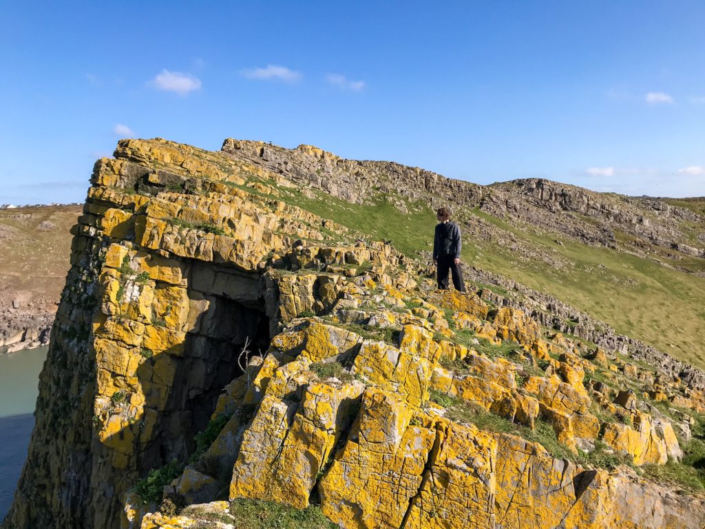
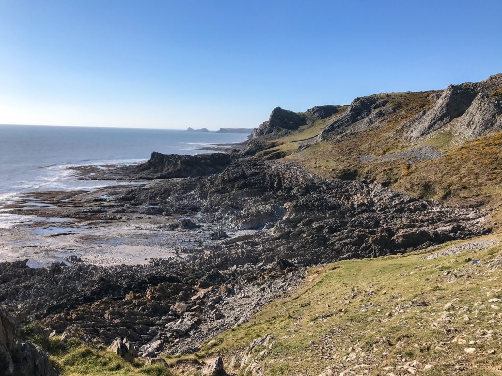
There are numerous other rock features, stacks, arches, and limestone layers all along the coastline. Caving is very popular and many outdoor enthusiasts spend time exploring the underbelly of the coastline.
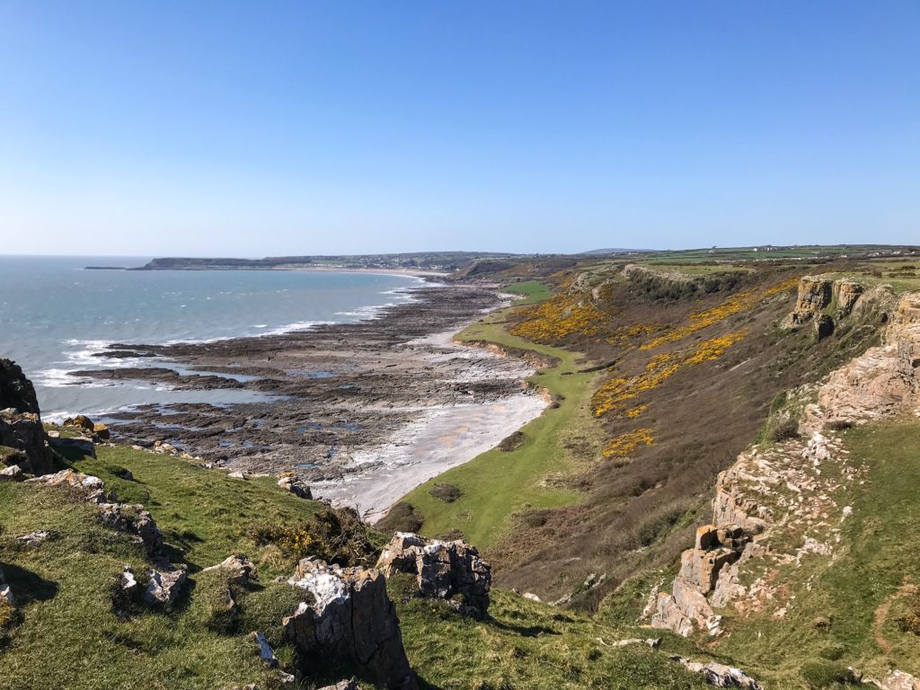
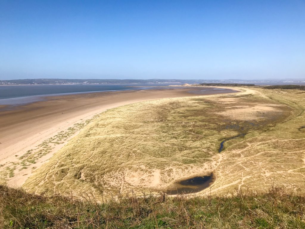
The beaches of the Gower are famous, particularly Rhossili which is 3 miles long. Surfers descend on this spot during a big sea swell to surf the curling waves that rush into the bay.
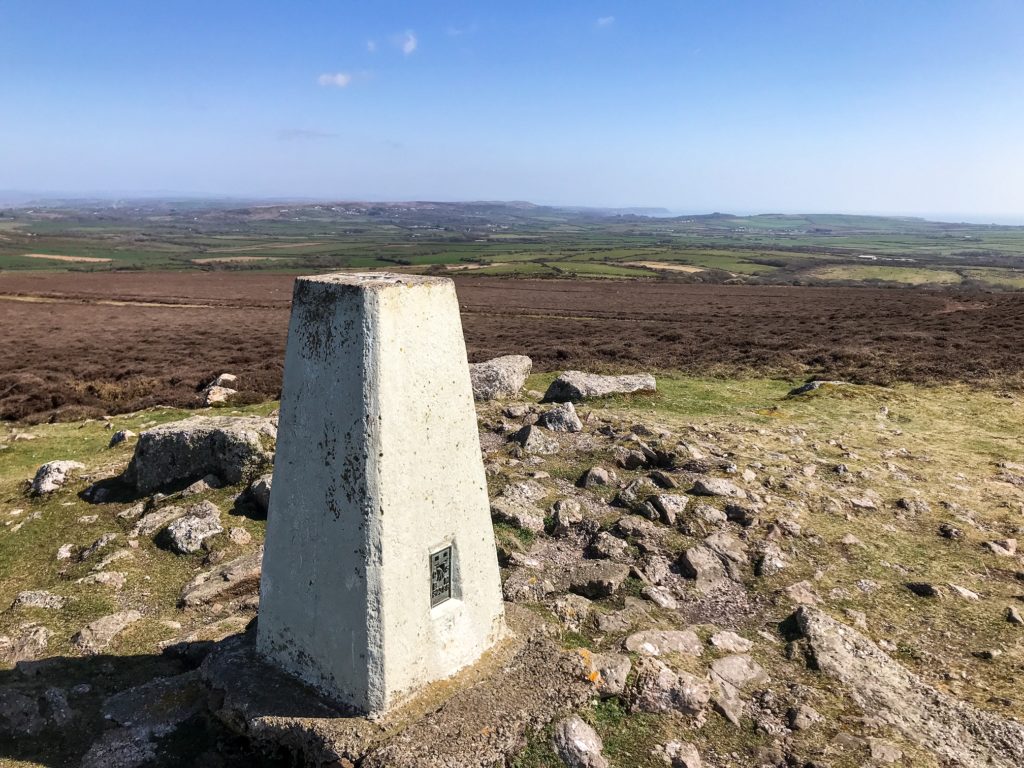
Cefn Bryn and Rhossili Down rise above the inland hills to soar over the coastline providing fantastic views towards Pembrokeshire and even over the Bristol Channel to Exmoor in the distance.
There are multiple Wildlife Trust Reserves, Sites of Special Scientific Interest, National Trust Sites, and Special Areas of Conservation along the Gower Peninsula Coast Path.
This allows you to see many protected species of flora and fauna. Seals, dolphins, and porpoises can all be seen in the waters around the coastline. Llanrhidian Sands and the salt marshes are a paradise for birdwatchers. There are numerous hideouts to spend the day spotting birds.
7. Is it Safe?
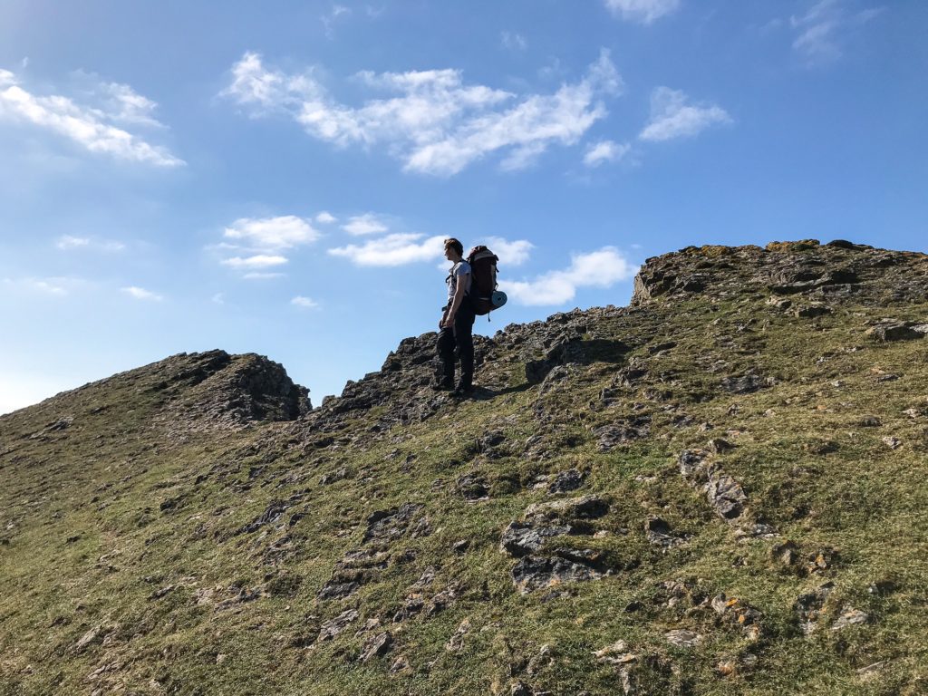
As this is a coast walk, there are a few things to be aware of. First is that there are lots of cliffs and steep gullies which you could potentially fall into.
In fact, I saw someone being heli-evacuated near the Worm’s Head during my hike.
As usual, exert caution when you are walking the Gower Peninsula Coast Path. Be wary of crumbling verges and don’t walk or camp too close to the cliff edges.
For the most part, if you follow the coast path, you will be safe. The trail is monitored and maintained and there are diversions put in place should the path become dangerous from collapse or a rock fall.
Another point to be aware of is the tides. As discussed above, crossing to the Worm’s Head is very limited by tide. Don’t try to reach it if the tide isn’t right!
Also, don’t walk out onto the salt marshes if the tide is on the rise. You could get stranded!
There are plenty of walkers and hikers you will meet along the route and you don’t need to worry about being too isolated should anything go wrong. Just get stuck in and enjoy this fantastic trail!
See also:
10 Hiking Safety Tips
8. Food and Drink?
It’s always worth bringing enough food with you to last the duration of your trip. You particularly want to bring hiking snacks that you can eat along the trail. Try to get foods that are rich in energy and have some protein or slow burning carbs.
Good snacks include: trail bars, protein bars, jerky, snickers, nuts, nut butters, wholemeal bread, dried fruit, flapjacks.
Luckily, there are a few places where you can stop to get refreshments along the way. Lots of the beaches and coastal towns have cafes and pubs where you can break for a drink, ice cream, or some hot food.
The following towns all have refreshment options:
- Mumbles
- Oxwich Beach
- Port Enyon
- Worm’s Head
- Rhossili
- Hillend
- Llangennith
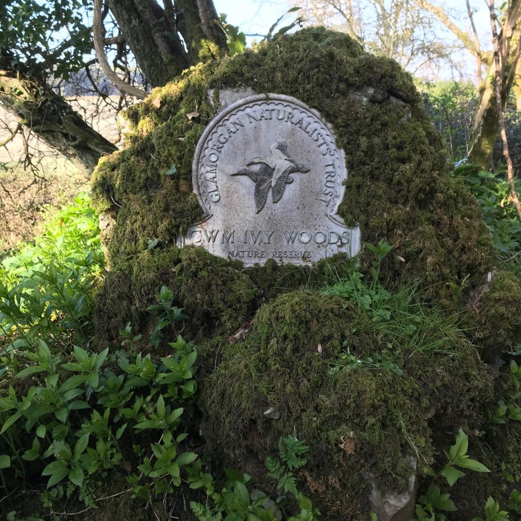
- Cwm Ivy
- Gower Heritage Centre
Carrying enough water for the trip is slightly more problematic. If you are wild camping, you need to ensure you have enough water for hiking during the day, cooking dinner and breakfast, and for the following morning.
I carry a water filter with me just incase I need to fill up from a stream or water tap in a farmer’s field. However, I try to plan my water stops in advance.
There were a few free taps for walkers to use at the:
- Port Eynon YHA
- Worm’s Head National Trust toilets
- Worm’s Head ranger’s station.
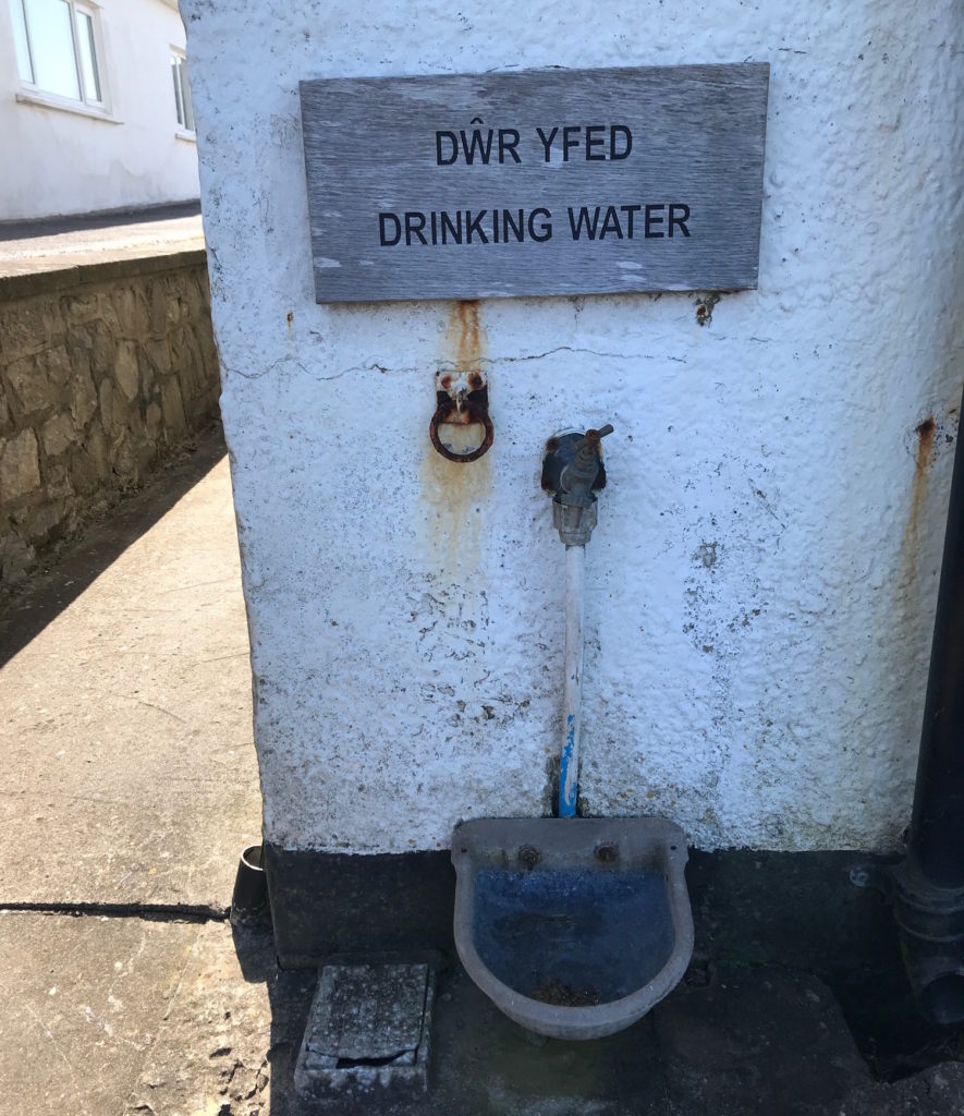
Have a look at Refill which shows you all the free places around the world where you can fill up your water bottles.
Alternatively, you can buy bottles of water when you stop at cafes. Occasionally they fill bottles up for you if you ask nicely!
I sometimes fill up water in public toilets or using the taps at campsites but I try to only do this as a last resort.
9. Day to Day Itinerary
I walked the Gower Peninsula Coast Path in 3 days but you can complete it in 4 or even longer. There’s really no rush but luckily the trail isn’t so large that it seems daunting or impossible to complete.
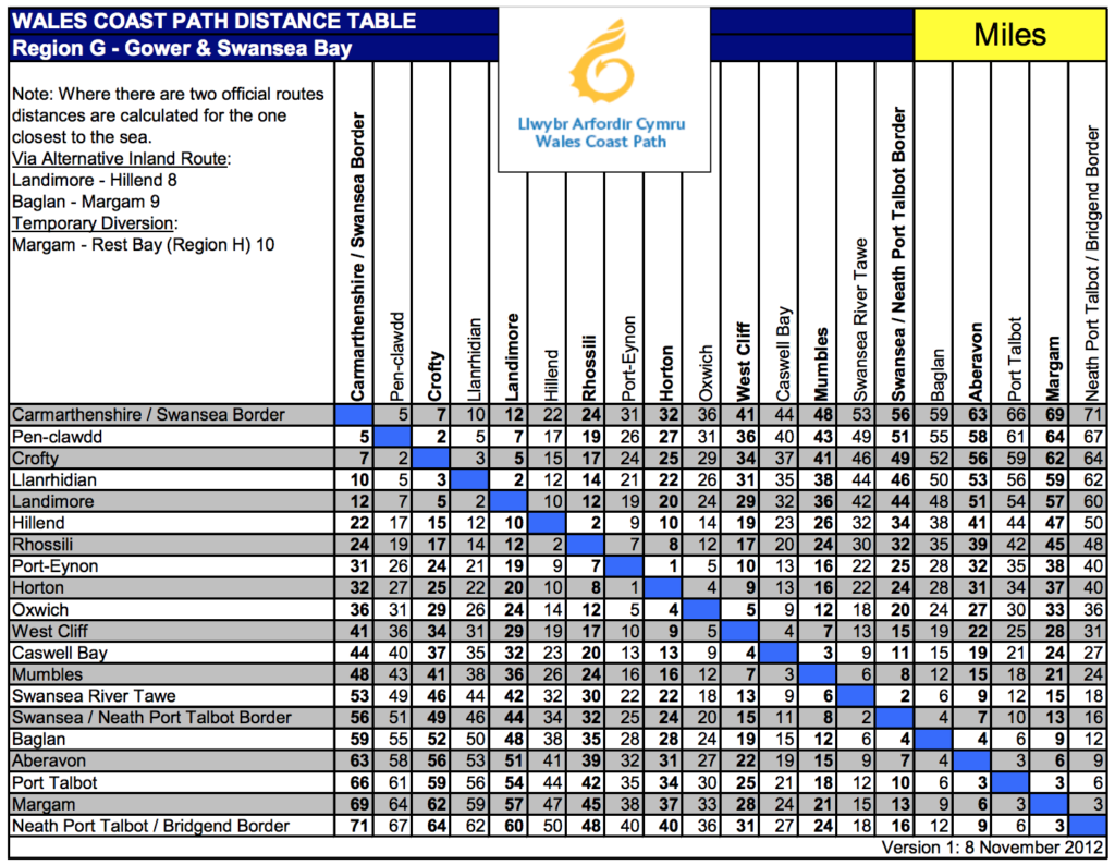
This is a general itinerary, but I recommend you look at the distance table below from the Wales Coast Path and decide how far you want to walk each day to complete the trail.
Day 1: Mumbles to Oxwich Headland – 14 Miles
The trail begins looking out over Swansea Bay at Mumbles. Follow the path along the pier and up to Mumbles Lighthouse.
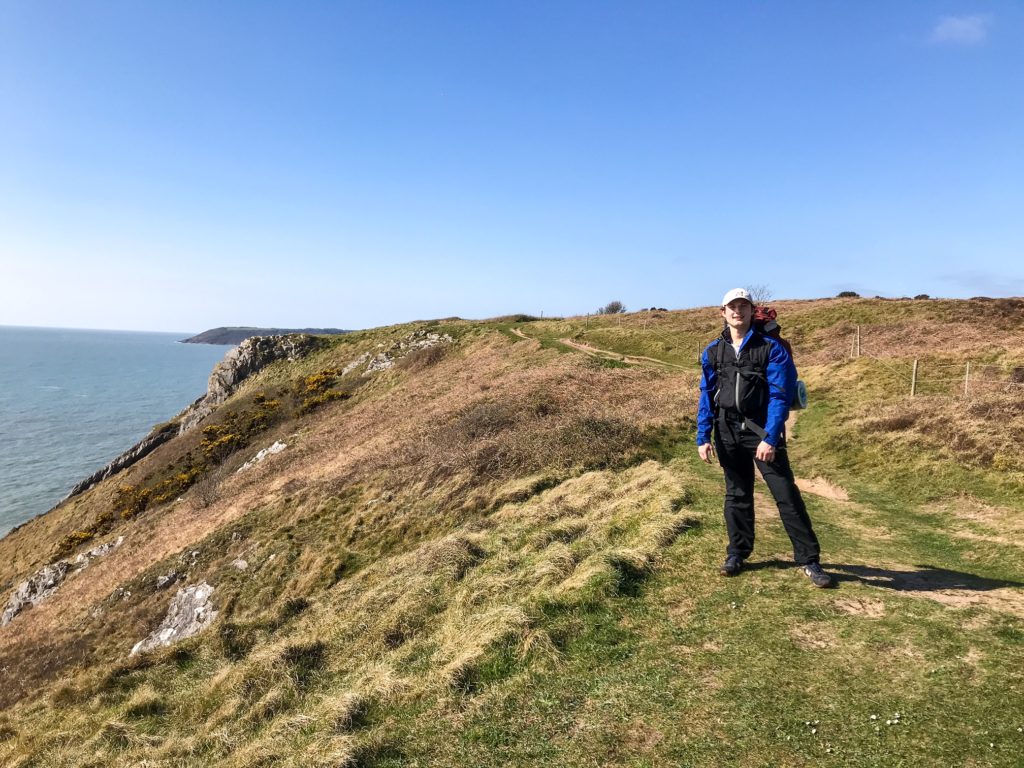
From here, the trail hooks around the headland providing you with your first view of the coastline. This is a beautiful stretch where you weave in and out of coves, beaches, and bays heading west along the coast path.
After a couple hours of walking, you will reach the Three Cliffs Bay. Stop to take a photo of Pennard Castle before you cross over the Pennard Pill.
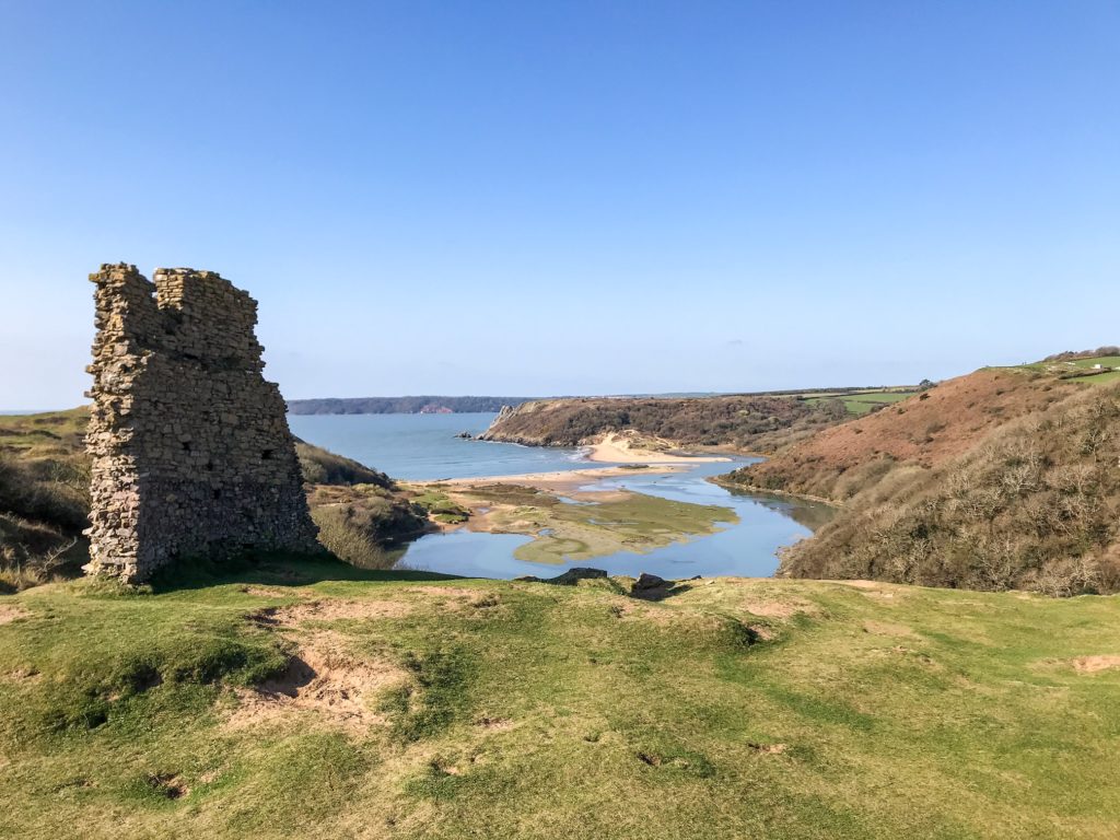
The trail then hugs the coastline along the Three Cliffs Bay. Make sure you stop to admire the views!
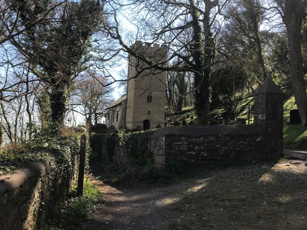
You then have the opportunity to walk along the sand dunes or across the beach at Oxwich Bay, before you pass St Illtyd’s church and stop for the night to wild camp on the headland.
Day 2: Oxwich Headland to Rhossili Beach/Down – 14 Miles
Rise bright and early as today is a busy day on the Gower Peninsula Coast Path! Drop down into Port Enyon and make sure you visit the salt house and Culver Hole on the far edge of the bay.
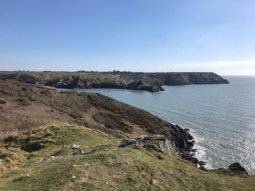
You will now follow the trail along the most remote section of the path. The swathes of rock and craggy headlands are simply stunning. You will curl along the coast path rising up and down over headlands, each offering fantastic views out to sea and along the coastline.
Eventually you will reach the famous Worm’s Head. If the tide is right, be sure to venture out onto the rocks to explore.
To finish the day you can either climb onto Rhossili Down for mesmerising views over the peninsula or head along the beach to get up close to the waves and the Wreck of the Helvetia.
Day 3: Rhossili Beach/Down to Crofty – 13 Miles
Your last day will begin with a walk along the dunes to the edge of the peninsula. Take one last look out to sea before you hook inwards along the saltmarshes.
The trail winds its way through heathland and dunes before reaching a lookout point over Whiteford Sands. You can then walk out along the Whiteford National Nature Reserve or take a short cut over Landimore Marsh.
From here you can either follow the low-tide route along the estuary, or the high-tide route along the hill. The views over the River Loughor are surreal and other-worldly!
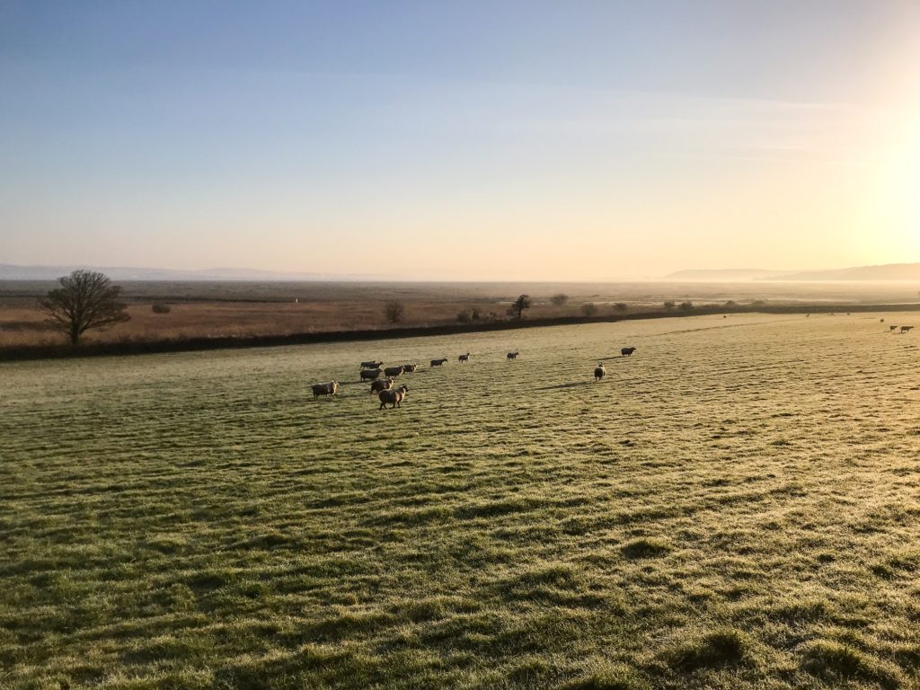
Take your time when crossing through the woodland and along the salt marsh to listen to birds and spot ponies and sheep grazing on the flats.
The trail tucks inland along some country lanes and via small hamlets before finishing in Crofty which marks the end point of the Gower Peninsula Coast Path!
10. Bonus Tips
Here’s a list of things I learnt when hiking the Gower Peninsula Coast Path. These are some bonus tips to help make your trip as enjoyable and successful as possible!
1. Watch Out for the Tides
As I’ve mentioned a couple of times, there are a few areas that are tidal on this hike. The most important is obviously the Worm’s Head.
However, there are a few other places to be wary of too. You may come across low-tide and high-tide diversions along the coast path.
It’s important you note down the tide times before you leave so you know which route to take.
Getting caught out by a rising tide is no laughing matter and it’s something you should be aware of on the Gower Peninsula Coast Path!
2. Don’t Be Afraid of Diversions
The distance you walk on this trail will likely be different to what I have suggested. There are so many places to explore and there’s no need to stick to the exact coast path the whole time.
I walked out to headlands, went down to see hidden coves and caves, and followed different paths up hills and along the coastline.
You don’t need to worry too much about getting lost as chances are, the footpath you follow will unite with the Wales Coast Path again sooner or later!
3. Plan Public Transport in Advance
The Gower Peninsula may be close to Swansea, but it’s still out in the sticks. That’s one of the reasons it’s so special, because it’s an area of wild nature.
This means that transport options are limited. You don’t want to finish the trail and find there are only two busses a day and you just missed one!
If you plan in advance how you’re going to get to and from the trail heads, it will take a weight off your shoulders and allow you to enjoy your hike without the worry of how you’re going to get home at the end.
Before You Go
Thanks for reading this travel guide on how to hike the Gower Peninsula Coast Path. If travel guides like this interest you, head over to my blog page to find out more!
If you’re new to Walk Wild, check out the About Me page to learn who I am and what made me want to be a travel writer.
Please comment below, let me know what you think and if there’s anything else you want information on!
Follow me on Twitter, Instagram, and YouTube to see out more.