A Complete Guide for Walking the 100-Mile South Downs Way in England
25 Minute Read
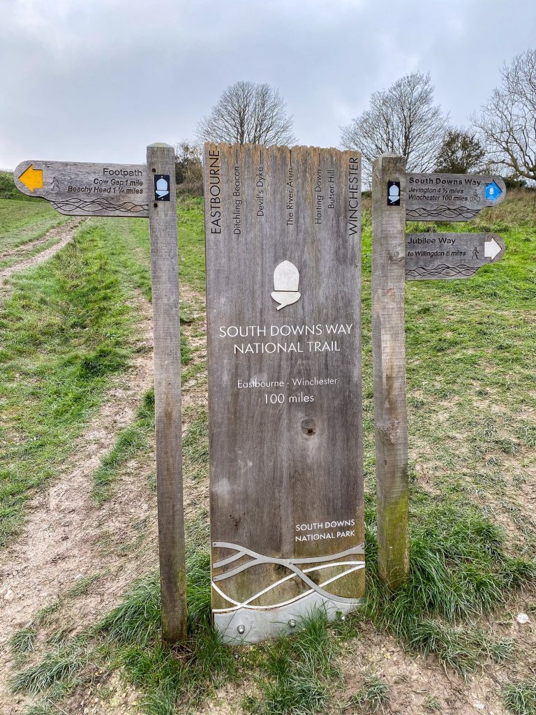
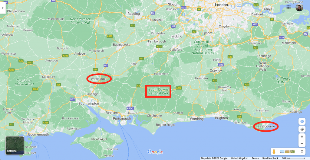
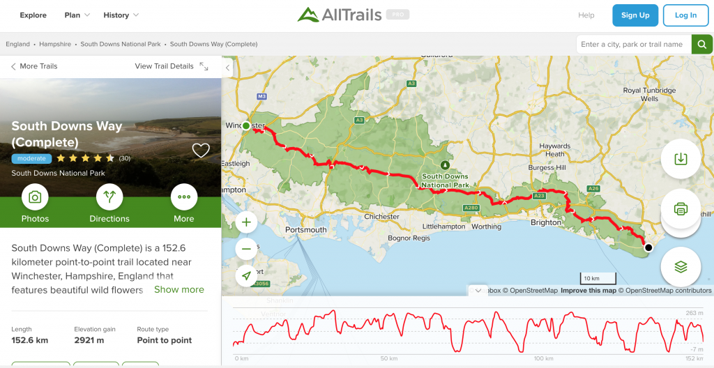
The South Downs Way is a 100-mile National Trails walking path in the UK. It runs from Winchester in Hampshire to Eastbourne in Sussex.
The route covers the length of the South Downs National Park, the UK’s most popular and most visited National Park.
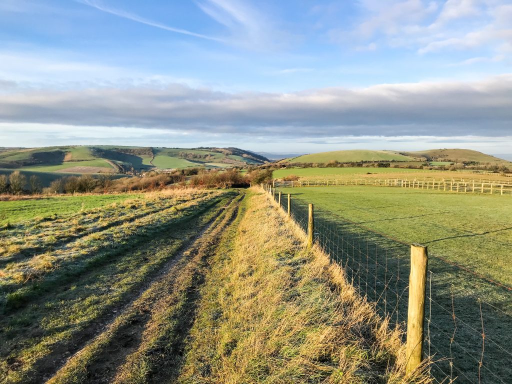
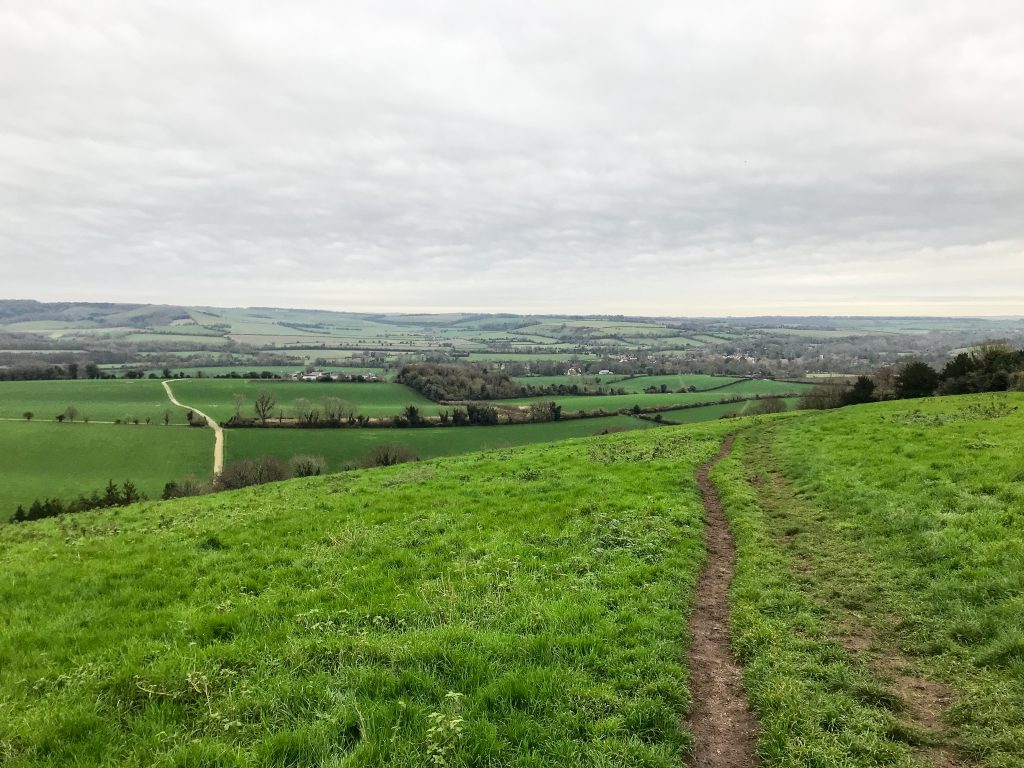
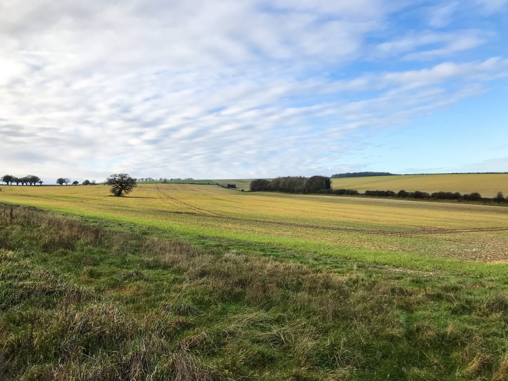
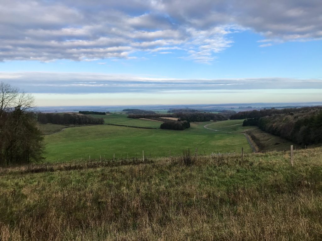
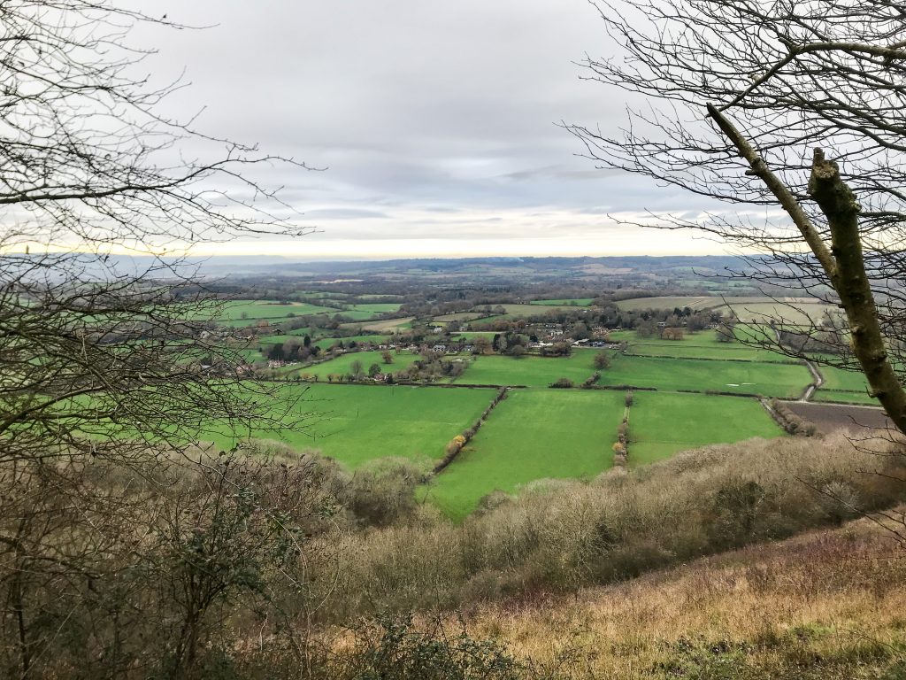
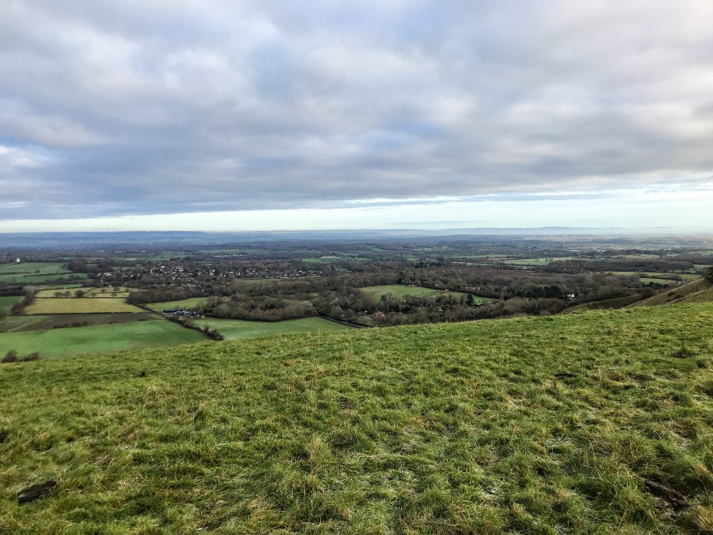
It is renowned for exhibiting the best of southern English countryside with its rolling hills, glassy chalk streams, bucolic farmer’s fields, and magnificent limestone cliffs.
The path takes about 6-7 days to walk. It can be hiked in one week but most people tend to do short sections and day hikes over a longer period of time to complete the trail.
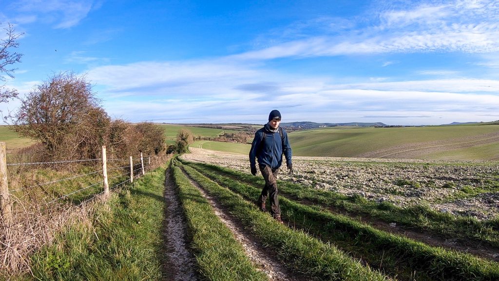
Compared to other National Trails walking paths in the UK – 14 in total – the South Downs Way is considered relatively easy. It has mostly gentle terrain, lots of grass and chalk paths, and fairly good access routes.
This travel guide will tell you everything you need to know for how to walk the South Downs Way yourself.
You can either skip to the sections you need information on, if you want to hike only a portion of the trail, or read the whole travel guide to get details on walking the full South Downs Way in one go.
- Where to Start?
- How to Get There?
- How to Find Your Way Around?
- Where to Stay?
- What to Pack?
- What to See?
- Is it Safe?
- Food & Drink
- Day to Day Itinerary
- Bonus Tips
This page contains affiliate links. This means I make a commission if you buy a product I have recommended (at no extra cost to you). All recommendations I give are genuine and my own. Thanks for the support!
See also:
Top 5 South Downs National Park Walks
Top 5 Best Winchester Walks
How to Train for a Long Distance Hike
1. Where to Start?
There are two trailheads to choose from, one in Eastbourne along the west coast of Sussex, and the other in Winchester, the old Saxon capital of England and the heart of Hampshire.
I recommend starting in Winchester and walking east, as do many other guidebooks. The reasoning for this is that the most dramatic views are when you reach the soaring cliffs of the Seven Sisters Country Park.
In my opinion, it’s much better to finish your walk with this spectacular final view, looking out over the English Channel, rather than beginning with it and working your way inland.
There’s also a point to make about the prevailing wind which blows from west to east in this part of the UK. Walking in this direction allows the wind to be at your back and means you are walking with the good weather rather than having it hit you face on!
If this is your first long distance hiking trail, you’re starting in the right place. I believe the South Downs Way has all the right ingredients to introduce you to the challenges of long-distance hiking. Nothing is so extreme it will put you off forever, and no aspect of the trail is so easy that you won’t consider returning. In effect, it’s the Goldilocks trail.
See also:
Hiking For Beginners: Top 10 Tips
2. How to Get There?
One of the reasons the South Downs National Park is so popular is because it’s within touching distance of London, the biggest transport hub in the UK. There are international and domestic flights to London airports such as Gatwick, Heathrow, Stanstead, and Luton. See flight options on Skyscanner here.
Winchester is only an hour on the train from London Waterloo. It’s also possible to get a direct train from Eastbourne to London Victoria in 1 hour 30 minutes. See train options on National Rail.
However, between the start and finish, the South Downs Way isn’t particularly well connected by trains. If it was it would hardly be a walk in the country after all!
The only other train stations you walk past are at Amberley and Southease. There are train stations close by (Petersfield, Chichester, Brighton, Lewes) but you’ll need to take a bus or taxi to reach them.
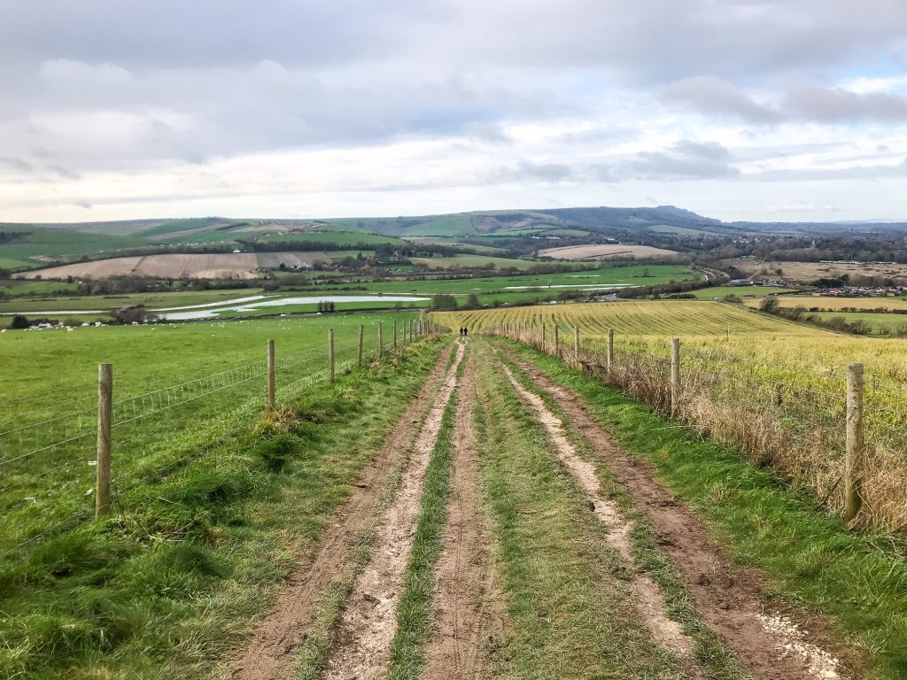
When you walk the South Downs Way, you are up on a ridge for the majority of the 100 miles. Only every 5 or 6 miles do you dip down to cross a busy road or river. It’s at these crossings that you should look for transport to and from the park.
The South Downs Way does cross through a variety of picturesque villages and small hamlets but often they aren’t particularly well connected with transport links. A better option is to catch a bus from one of the A-roads that weave their way through the National Park and head to one of the bigger settlements for transport to and from the trail. For bus options, see Traveline.
There is a South Downs Way bus service that offers a Discovery ticket which allows you to have unlimited bus travel for the day within the National Park and surrounding area. This is very helpful if you are wishing to do a short section day hike.
3. How to Find Your Way Around?
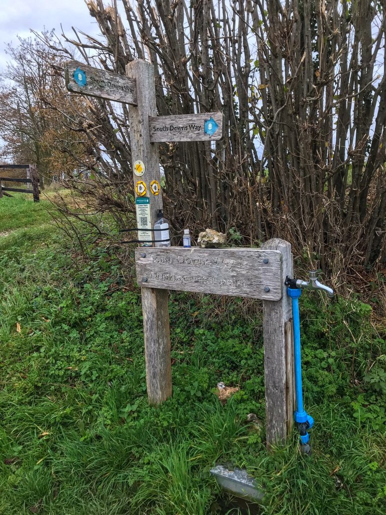
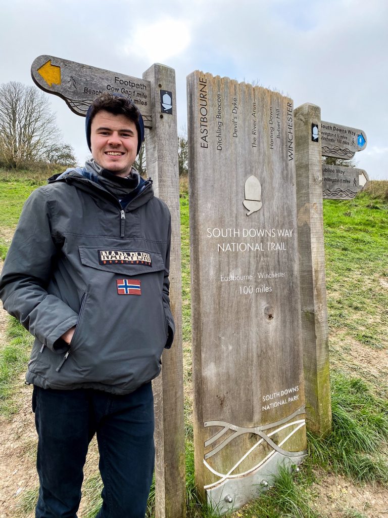
As with all National Trails paths, the best way to find your way around is by following the acorns!
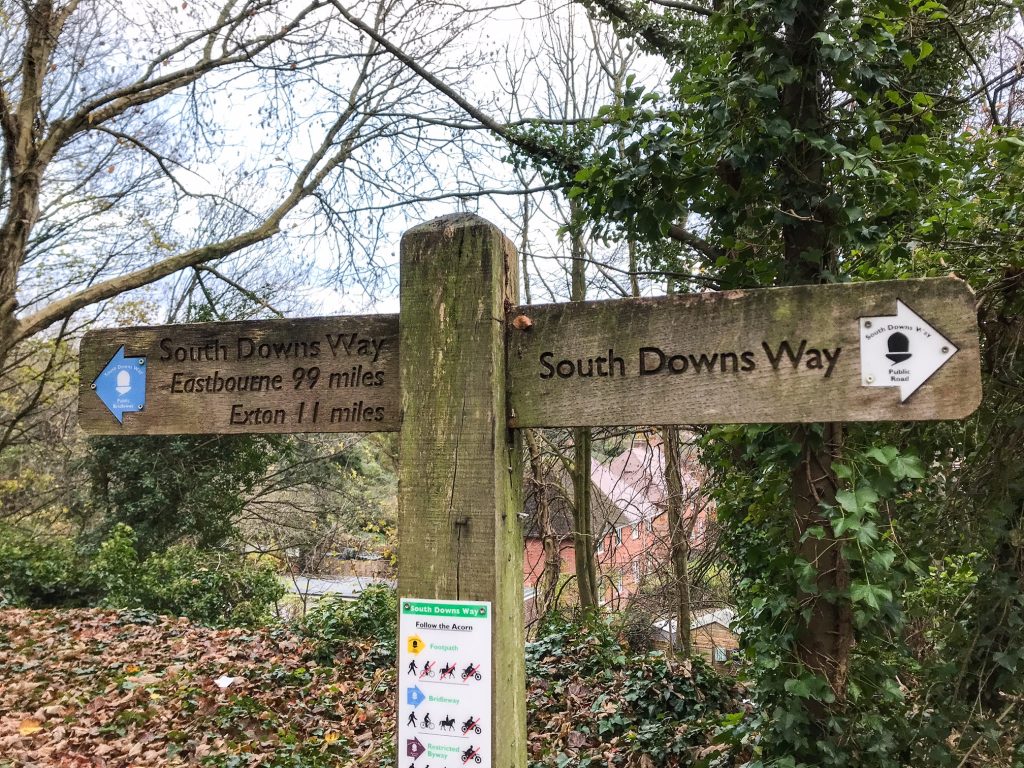
This is the National Trails symbol and they use it on all their signposts to give walkers something to follow. They also maintain and look after the path to make sure it’s safe to use and clear to follow.
They do an incredible job. This is the 3rd National Trails path I’ve hiked and I’ve never had to use a map. (The other two are Hadrian’s Wall Path and Pembrokeshire Coast Path). The trails are so well signposted it’s hard to get lost if you take a moment to read the signs.
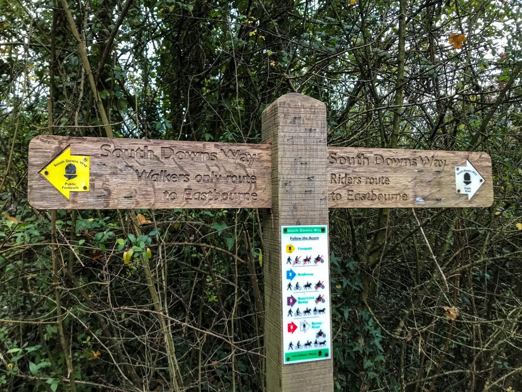
If you get to a road or location with many paths heading in different directions stop for a second and just look around. Those who manage the path know that these spots are tricky for walkers and do their best to signpost it as clearly as possible.
You never have to go far before seeing another sign with an acorn and they continuously point you in the right direction. There are many walking paths you can embark on in the South Downs National Park so it’s worth checking the multi-directional sign posts carefully before you set off again.
The sign posts often have distances and trail types (bridleway, public road, bikes, horses) on them which is informative and useful to look at too. For more info on maps and navigation, see the Trailblazer guide and the Cicerone guide which includes an OS map.
I also use the AllTrails pro app to help with directions. This is mainly to track my walking speed rather than as a navigation tool although of course it doubles up as this too.
4. Where to Stay?
Personally I like to wild camp. This is not technically legal in England and Wales but many people do it in National Parks anyway. Generally, if you keep to yourself, arrive late, leave early, camp discretely, and pitch away from the trail you will be fine.
I like it because I find it’s the most freeing thing to do. It’s cheap, it gives me complete flexibility and I believe it’s the best way to immerse in nature. I always respect the area I’m in and as a general rule, never jump fences or cross into farmer’s fields.
See Also:
How to Wild Camp in the UK
Sometimes when I’m exhausted at the end of the day I still need to keep walking for an extra mile or two to find a suitable spot to pitch. There are obviously no facilities available and you have to carry everything you need with you (tent, sleeping gear, cooking equipment, food, water) which makes your bag much heavier.
But to me that’s all part of the adventure and that’s just the way I prefer to do it!
You can camp in campsites but this requires walking away from the main trail to find your pitch. I did see a few campsites that were on the trail but for the most part they are absent along the ridge. During summer you will need to book in advance as these places do fill up!
National Trails have a guide to campsites here. It’s an old list, but it does contain info on a lot of the hostels and campsites on the trail.
If you’re looking for a roof over your head, Hampshire and Sussex have many lovely villages with cosy pubs and genial BnBs. Many choose to book a night’s stay in accommodation like this. That way you get a soft bed, hot shower, and a good meal, not to mention a pint of local ale after a long day on the trail!
This sort of accommodation will absolutely need to be booked in advance through sites like booking.com and AirBnB. If you don’t, there may well be no place to sleep in the busy summer months.
If you’re looking for a list of towns and settlements near the trail, scroll down to my Day by Day Itinerary section to find their locations and distances from the trail.
5. What to Pack?
The weather is reasonably pleasant in the South Downs National Park – at least by UK standards! In fact, the South Downs Way has some of the lowest rainfall of anywhere in England.
Still, it’s worth preparing for bad weather just incase. Make sure you dress in layers and bring a spare waterproof jacket as well as a zip-on fleece.
It gets cold in the wind on the hill tops so pack a warm hat and gloves. If you know it’s going to be sweltering make sure you bring suncream and a hat/cap as it’s very exposed on the ridges.
I would advise against using hiking boots on this trail. I can’t tell you how many times I’ve read about people complaining from getting terrible blisters on this trail. The South Downs Way has chalk and flint-studded walking paths meaning it’s very hard on the feet.
Water drains well through chalk and as the path follows an elevated ridge you won’t have to deal with many puddles or heaps of mud, definitely no bogs or marshes.
Go for something lightweight with good support such as a trail running shoe or sturdy trainer instead. I only use trail running shoes now and never get blisters anymore – that’s a thing of the past! My favourites are the Altra Lonepeak shoes which are very popular with long-distance thru hikers in America, so I knew I was in safe hands.
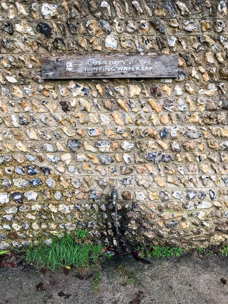
Make sure you bring a water bottle to fill up from the various taps you walk past on the trail. I brought a water filter with me but didn’t actually use it because there was a water point every 5-6 miles.
Carry plenty of snacks and spare food as often the shops are down in the villages below. You don’t want to divert from the trail just to get a snack when you could have brought that with you in the first place!
Most importantly, bring a camera to capture your journey and the beauty of the landsape! I use a GoPro Hero 7 Black to make videos, and then my iPhone 7 for taking photos, but bring whatever suits you.
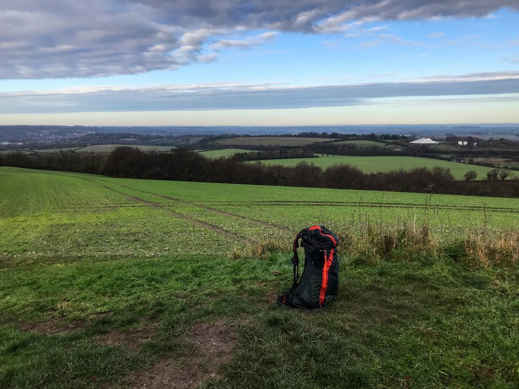
Place all of this in a backpack and you’re ready to go.
See also:
Multi-Day Hike Kit List
Day Hiking Gear Essentials
6. What to See?
I believe this walk is about immersing yourself in the beauty of the English countryside.
Take the time to amble through crop fields, to peer into grain silos, and to watch tractors trundling on the hills in the distance.
Listen out for the magnificent soundscape of songbirds chirping in the blackberry bushes. Stroll down country tracks, hop over old fence styles, and navigate kissing gates.
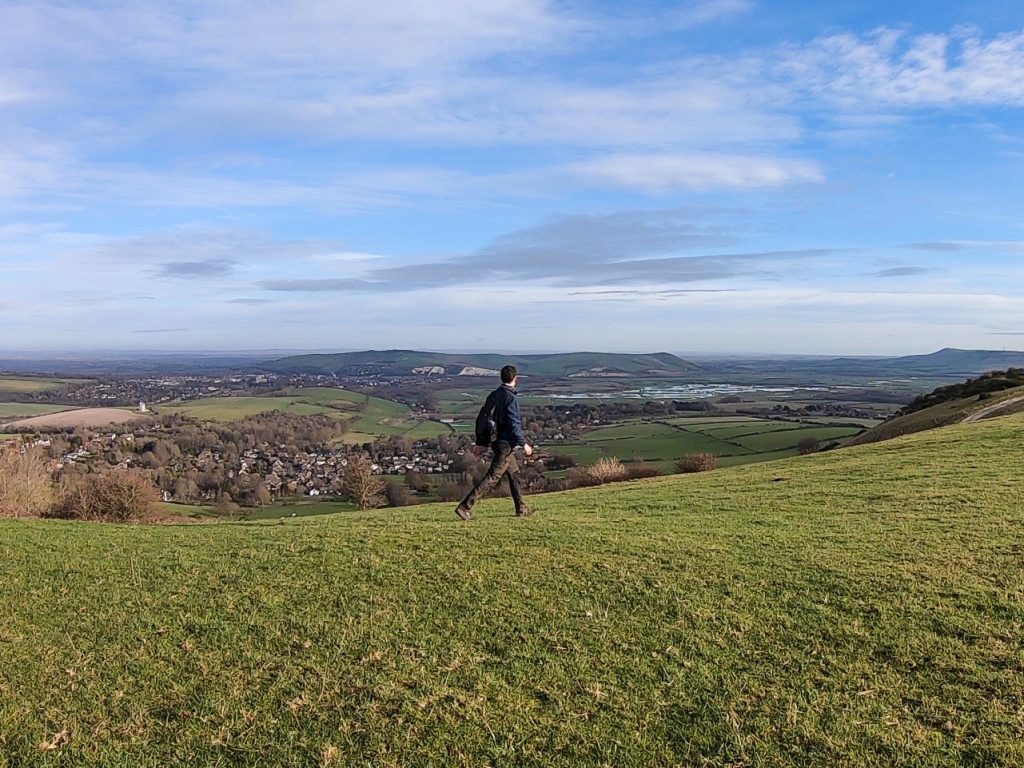
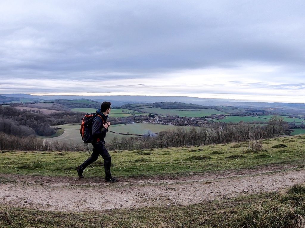
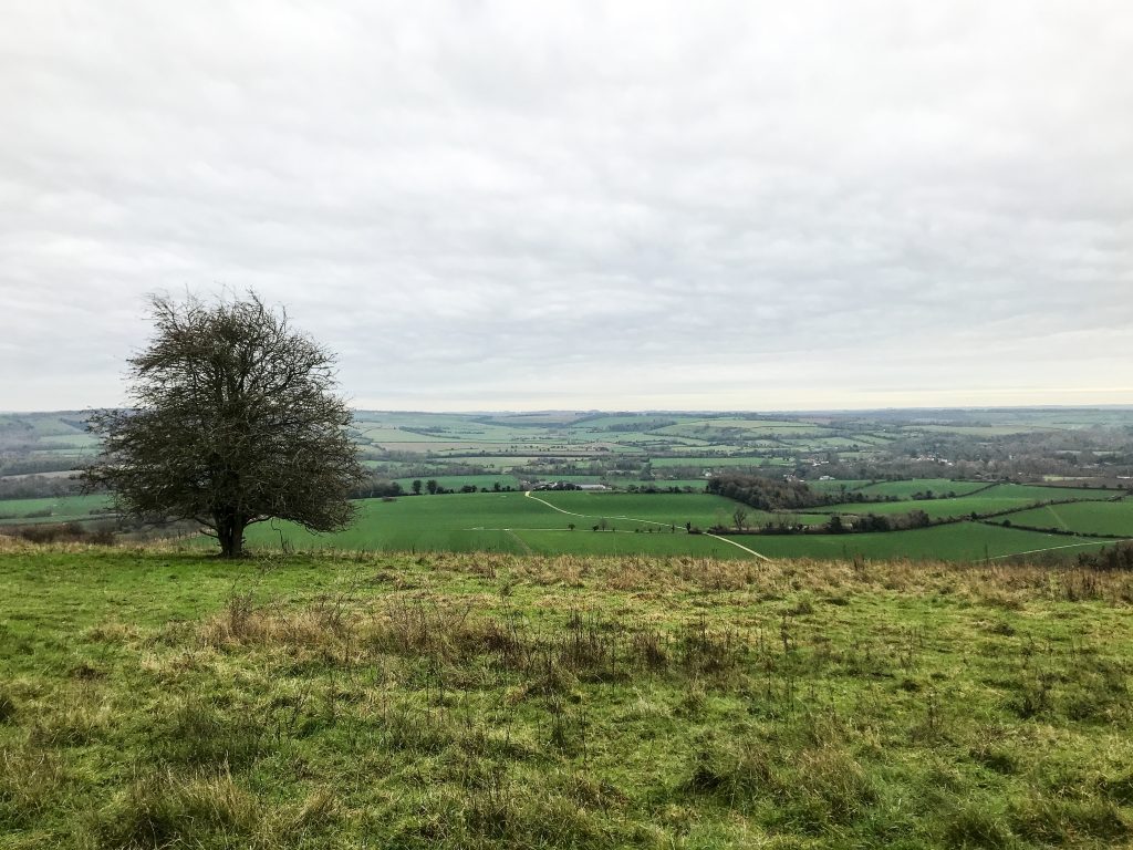
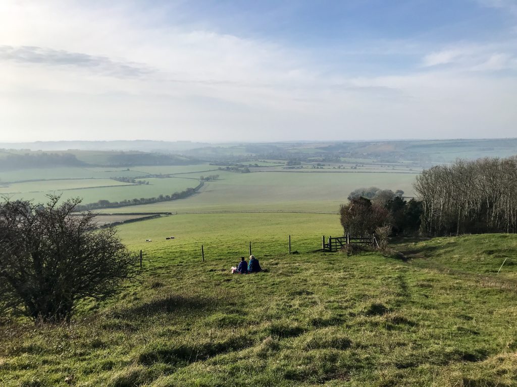
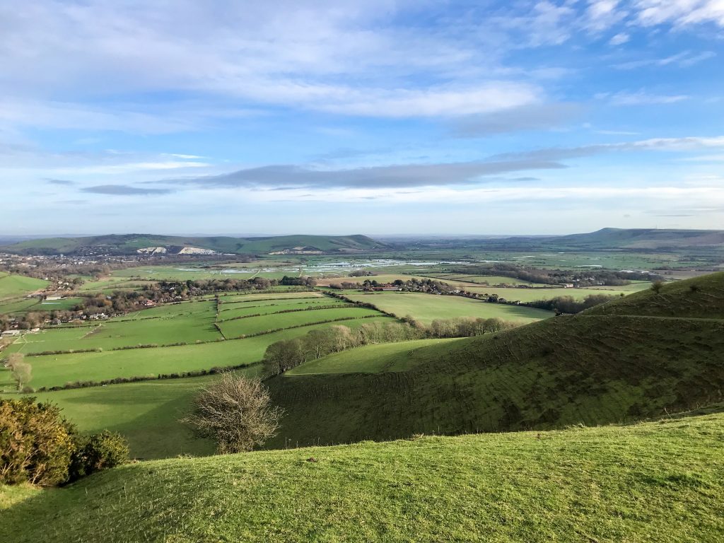
It’s these smaller things that make the South Downs Way such a pleasant walk to do. Luckily, there are also some outstanding features to appreciate too, mostly from the summits of the hills.
My favourite hill-top views in Hampshire were from Harting Down and Old Winchester Hill. In Sussex I loved Devils’ Dyke, Firle Beacon and ambling through the forests of Queen Elizabeth Country Park.
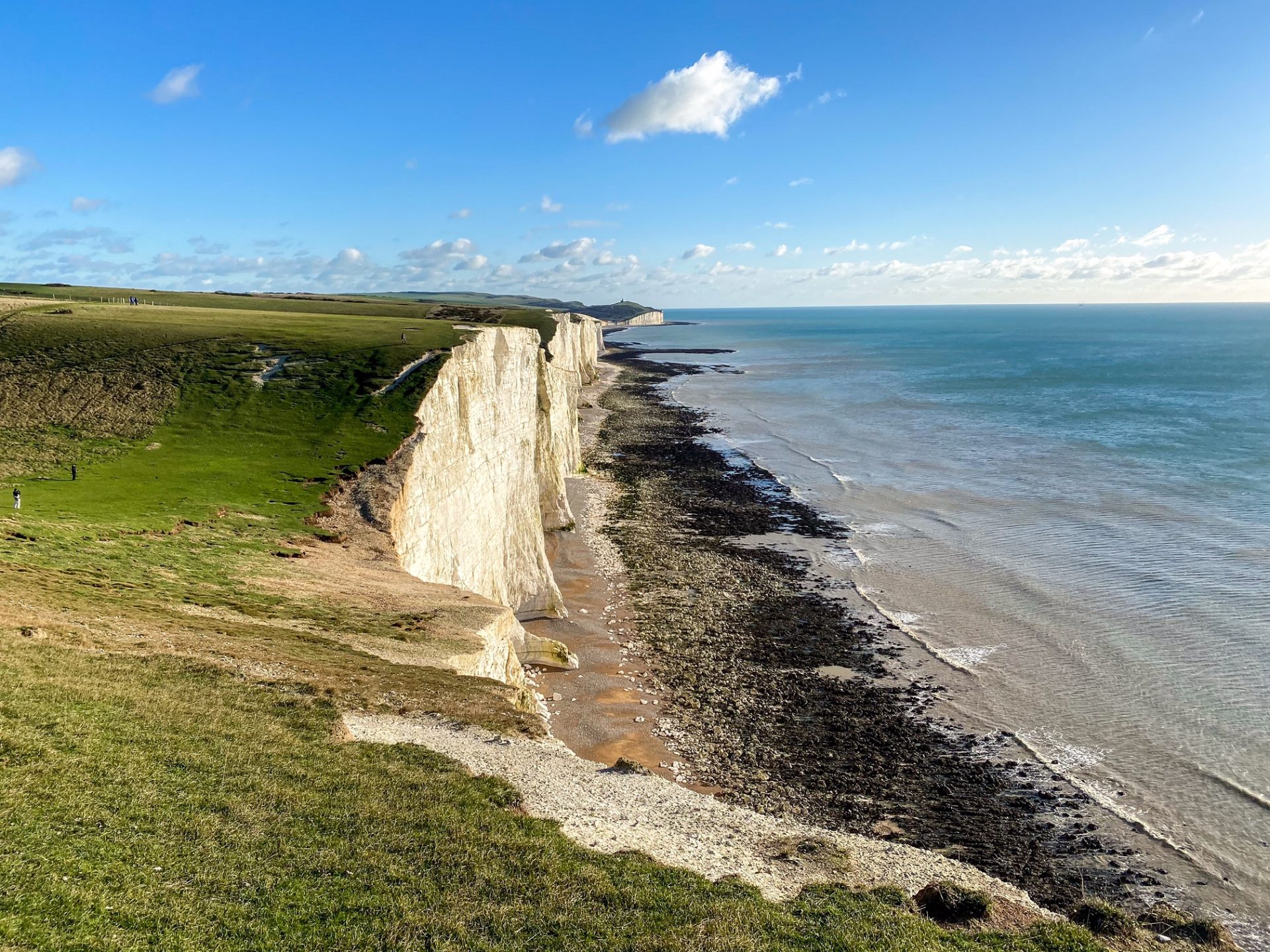
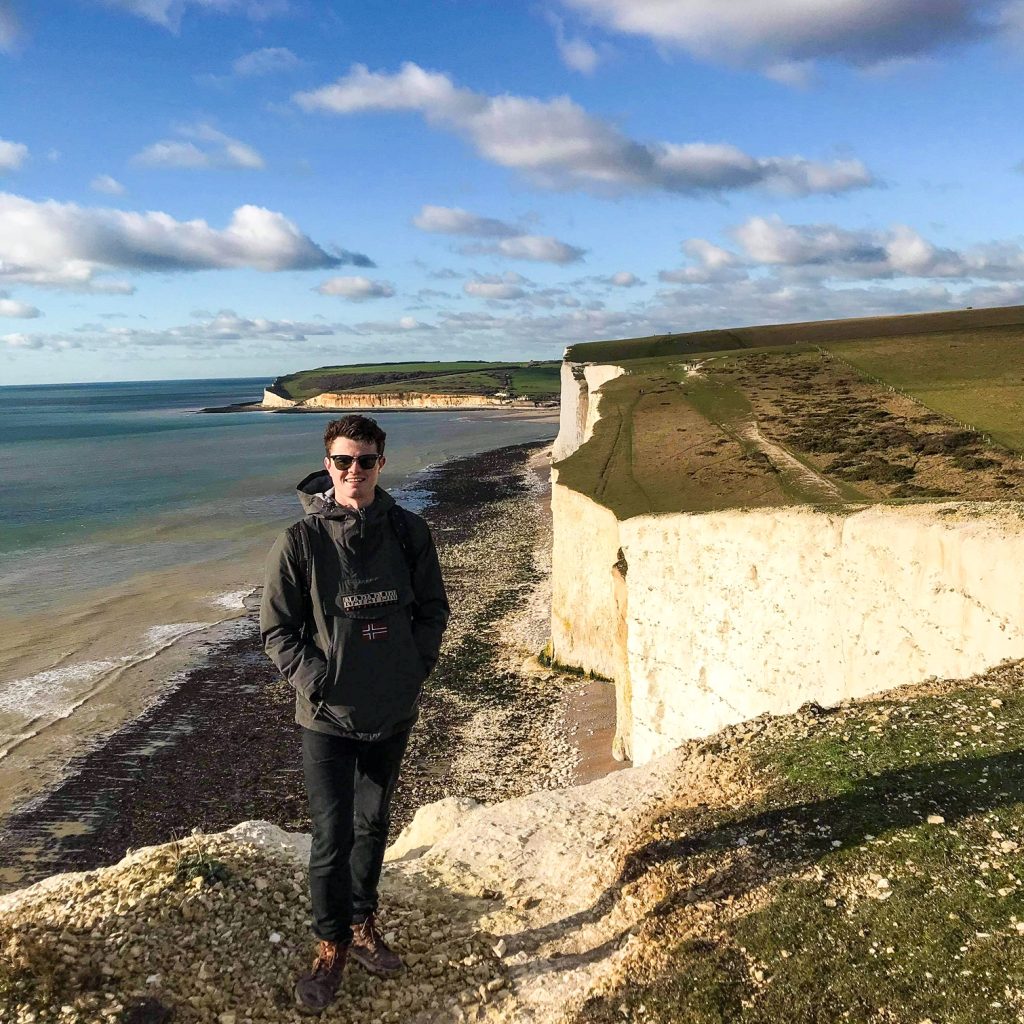
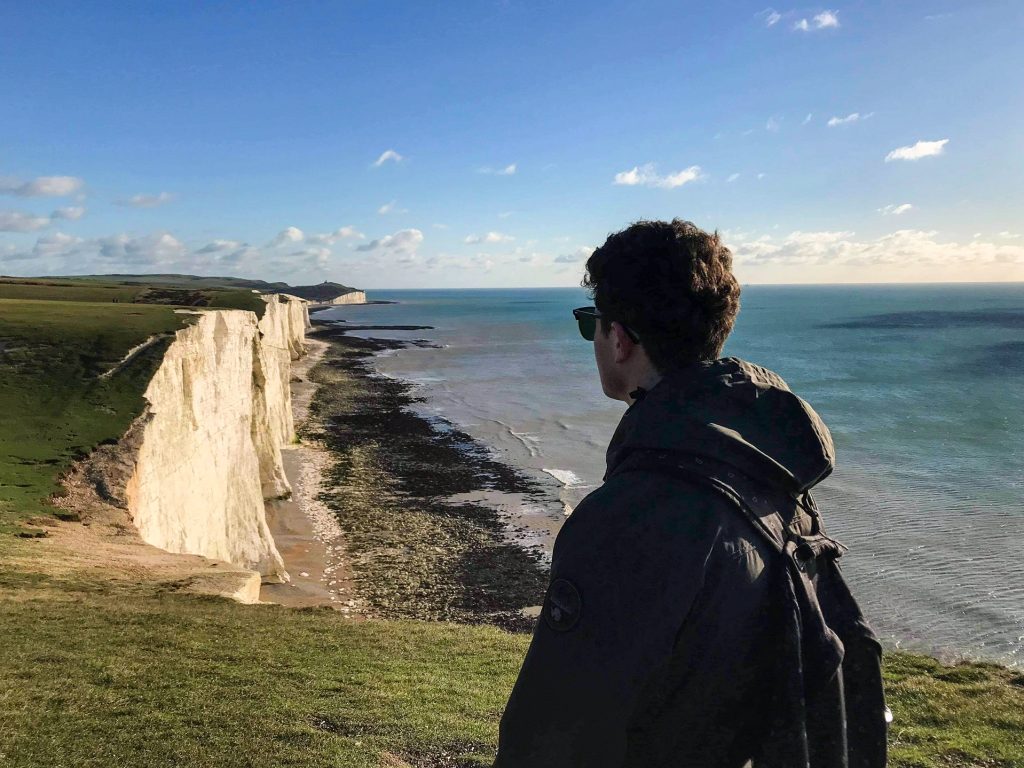
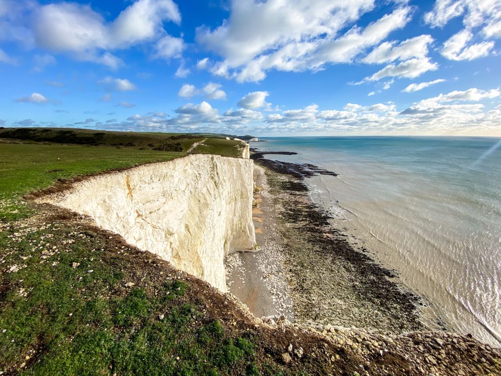
My favourite section is undoubtedly the Seven Sisters Country Park and Beachy Head. Where the chalk cliffs shine bleached between the grassy bluff on the headland and the rolling grey waves of the sea below.
I also loved the walk from Alfriston leading along the Cuckmere River towards the Seven Sisters. The village of Alfriston and the Church of St Andrew are sublime.
The history of the South Downs Way is also quite remarkable. It’s been inhabited since Neolithic times and there are Iron and Bronze Age remains that harken back to an ancient civilisation that ruled this land long ago.
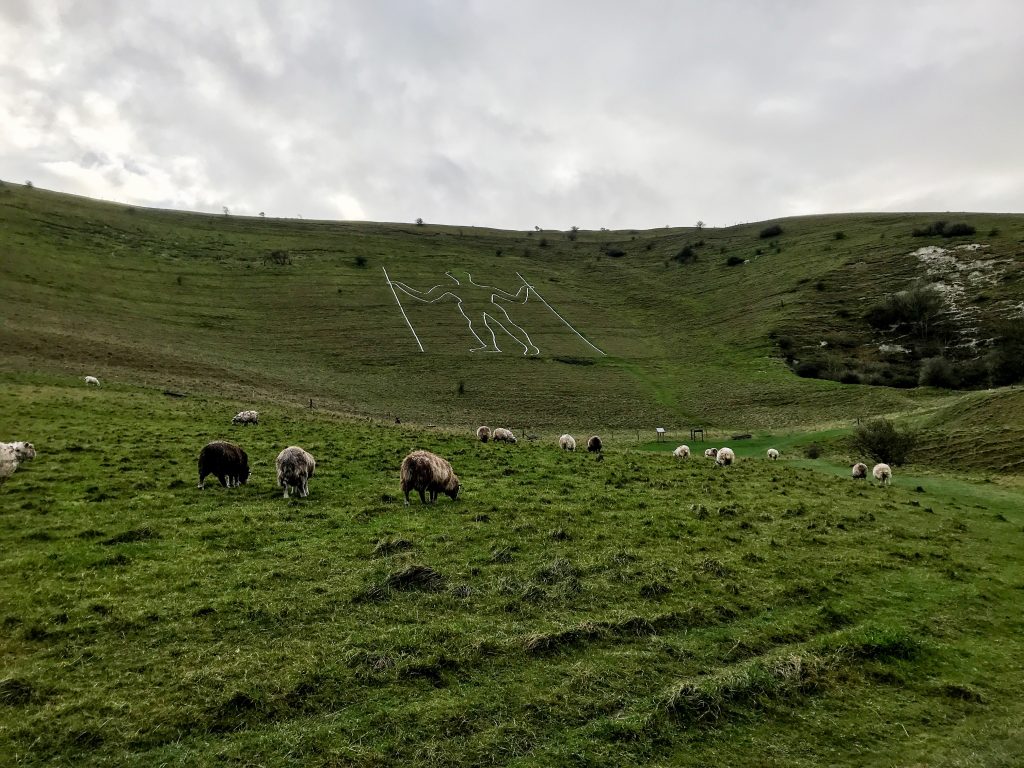
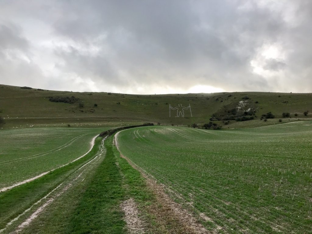
Some of the Bronze Age barrows (burial mounds) at the Devil’s Jump and elsewhere in the park are quite incredible to admire. If you walk the alternative route near the end of the trail, you will get a chance to see the Long Man of Wilmington, a chalk figure with a mysterious past, stamped into the hillside!
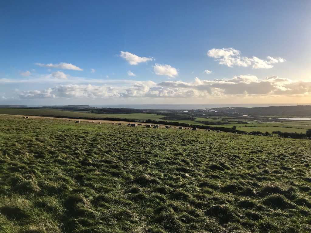
I became very fond of the birds and wildlife along the South Downs Way. Seeing red kites and buzzards arching across the sky and gliding with the valley updrafts on their great wings was a wonderful experience.
I also saw numerous deer, pheasants, grouse, and a variety of songbirds on my walk. All quintessential animals of the English countryside.
7. Is it Safe?
In a short answer: yes, very safe.
I believe it is one of the most gentle long-distance walking paths in the UK. There aren’t many sheer drops or steep verges (other than right at the end of the hike towards Eastbourne). The path is well maintained and not too slippery or crumbling.
I saw plenty of friendly cyclists and frolicking dog walkers along the way. Hampshire and Sussex are both safe places in general and the walking paths reflected this. I never felt nervous or out of my comfort zone.
The distance between settlements isn’t so great that you’re completely isolated should something go wrong. I also had signal on my phone for the majority of the hike – something that’s a relative luxury in a National Park like this!
In addition to this, the water refill points are a big bonus. Generally, there aren’t water taps on the National Trails paths. But on the South Downs Way, thanks to charitable donations, there are plenty. Because of this, I was never afraid of running out of water.
See also:
10 Hiking Safety Tips
If you’re nervous about your safety it’s well worth investing in travel insurance. That way, you have the peace of mind to know you’re covered from injury when hiking and in the outdoors.
As an adventure traveller, I’ve always used World Nomads. I believe they provide the most comprehensive cover at the best price. It’s easy to sign up and they specialise in creating insurance packages for travellers.

8. Food & Drink
The South Downs National Park is known for its local organic produce and free-range farm shops. As such, you can expect to try some delicious and authentic British food. (Think roast lamb, steak and ale pie, fish & chips, a full English breakfast, and cream teas).
Although you only walk past a few pubs and cafes on the trails there are many more within walking distance of the main hiking trail. Often farms double up as campsites and cafes run by either the National Trust or YHA.
Here are a few of the establishments I walked past directly on the trail (from west to east):
- The Milburys
- Sustainability Centre
- Queen Elizabeth Country Park Centre
- Wildflour Cafe
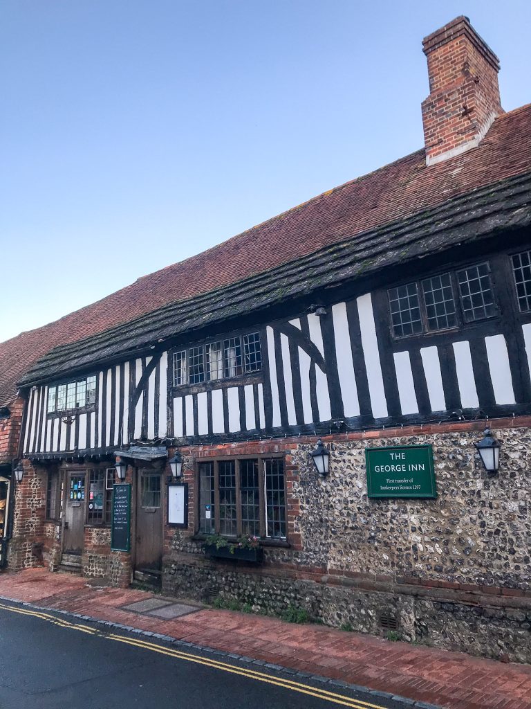
The George Inn - Saltmarsh Rooms & Cafe Just Around the Corner
- Birling Gap Cafe
- The Beachy Head
The numerous water taps on the trail are an exceptionally helpful feature. They are free to use and many are positioned on the side of farm buildings.
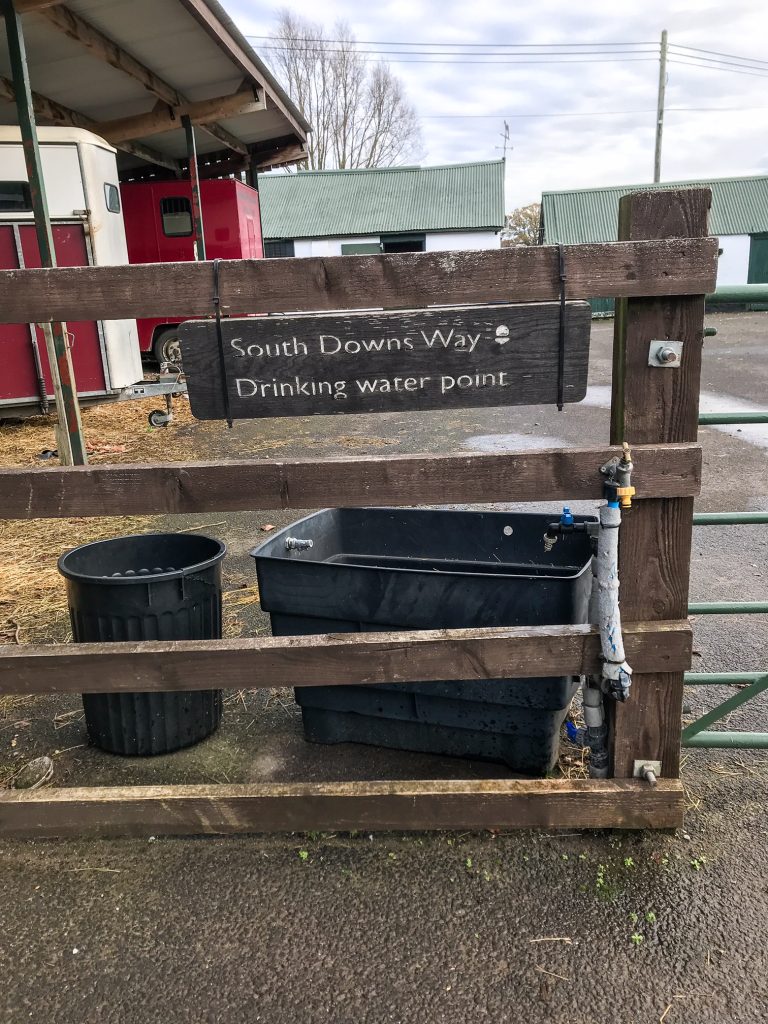
Below is a list of locations where I walked past taps. As I may have missed some, this website has more information (although I’ve noted down some extras not on the website and some of the locations on the website may be out of date).
- Holden Farm
- Lomer Farm
- Meon Springs Fly Fishery
- Washington (opposite Findon Executive Tire)
- Botolphs (between the River Ardur, A283, and The Southdown Hunt Pony Club)
- YHA Truleigh Hill Hostel
- Saddlescombe Farm
- Housedean Farm
- Southease Church
If you are staying in BnBs each night in the villages, you will likely have great pubs nearby that serve food. Some of the pubs even offer accommodation, two birds with one stone! You can’t be in the UK and not go to a countryside pub. Luckily, in Hampshire and Sussex, there are plenty of good ones. Make sure you sample some delicious local ales, dry English ciders, and regional craft bitters.
See also:
Hiking Food For a Week – What to Eat
9. Day to Day Itinerary
I walked the South Downs Way quite fast and managed to complete it in 6 days. I camped for the first night but due to bad winter weather decided to walk the rest of the path on day hikes.
Below are my daily distance splits. However, I’d recommend taking this hike at a slower pace to reduce the chance of injury and to ensure you get the most out of your time in the South Downs National Park. I walked most of the route in day sections and was forced to do some of these longer splits due to transport and accommodation issues related to the virus.
- Day 1 – Winchester to Butser Hill (22 miles)
- Day 2 – Butser Hill to Cocking (15.5 miles)
- Day 3 – Cocking to Amberley (12 miles)
- Day 4 – Amberley to Pyecombe (19 miles)
- Day 5 – Pyecombe to Southease (15 miles)
- Day 6 – Southease to Eastbourne via Seven Sisters (17 miles)
Here are the the full list of distances between key locations to help you plan your trail:
- Winchester City Bridge – 0
- Chilcomb Village – 2.5
- Cheriton – 1.5 miles off trail – 8.5
- The Milburys Inn, Beauworth – 9
- Exton – 12.5
- East Meon – 1 mile off trail – 17.5
- Queen Elizabeth Country Park Visitors Centre 23.5
- Buriton – 0.5 miles off trail – 26
- Petersfield Railway Station – 2.5 miles off trail – 28
- South Harting village – 1 mile off trail – 29.5
- Harting Down – 29.5
- Cocking Hill – 36.5
- Cocking village – 1 mile off trail – 37.5
- Bignor Hill – 44
- Amberley Railway Station – 48.5
- Storrington – 1.5 miles off trail – 54
- Washington – 55
- Steyning – 1 mile off trail – 60
- River Adur (upper Beeding) – 62
- Truliegh Hill – 64
- Devil’s Dyke – 66.5
- Pyecombe – 68
- Hassocks Railway Station – 1.5 miles off trail – 70.5
- Ditchling Beacon – 71
- Ditchling Village – 1.5 miles off trail – 72.5
- Lewes Railway Station (via Blackcap) – 3.5 miles off trail – 76.5
- Housedean Farm (A27) – 76
- Kingston – 0.5 miles off trail – 80
- Lewes Railway Station (via Kingston) – 2.5 miles off trail – 82
- Southease Railway Station – 83
- Firle – 1.5 miles off trail – 87.5
- Alfriston – 90
- Litlington – 91
- Seven Sisters Country Park Visitors Centre – 93
- Birling Gap – 96.5
- East Dean – 1 mile off trail – 97.5
- Beachy Head Visitors Centre – 99
- Eastbourne Seafront – 100.5
Please note: These distances may not be 100% accurate – some may be slightly shorter or longer than is mentioned here. Use these distances as a general guide and double check them with the labelled signposts and maybe a map when you’re walking the trail yourself.
The best way to use this distance map is to consider your requirements when on the trail. If you’re wild camping each night then you can look only at the bold figures to gauge distances along the trail.
If you’re staying in BnBs or hotels, or if you require transport options at the end of each hiking day, then you must factor in these extra distances shown in italics. Some of them are a couple of miles walk from the trail and you don’t want to forget to include this distance in your walking plans for each day!
Using my walking route as an example below are some of things you can expect to see on each day of the trail.
Day 1 – Winchester to Butser Hill (22 miles)
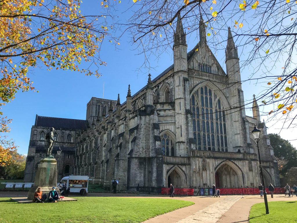
Your journey begins at the bridge crossing leading up to the King Alfred’s statue and into Winchester. A plinth beside the Old City Mill marks the starting point of the trail. From here, follow the signs along The Weirs indicating the direction of the South Downs Way and Viaduct Way!
I highly recommend spending some time exploring the city of Winchester which is an incredible place in its own right. Some of the walks in this area are spectacular and the history of this ancient capital is not to be missed. Make sure you at least visit the world famous Winchester Cathedral – one of the largest in Europe and the longest Gothic Cathedral in the world.
See also:
Top 5 Best Winchester Walks
After leaving Winchester you head out east, crossing over the M3, and are greeted with the first of many sweeping fields you’ll encounter on your journey. The path is nice and flat leading you up through Chilcomb – consider a 15-minute detour to see the quaint St Andrews C Of E Church perched on the edge of the valley.
From here you embark on your first hill climb up a long tarmac road before joining a track that takes you onto the ridge leading east out of Winchester. The curious white pyramid down below is the Winchester Science Centre & Planetarium.
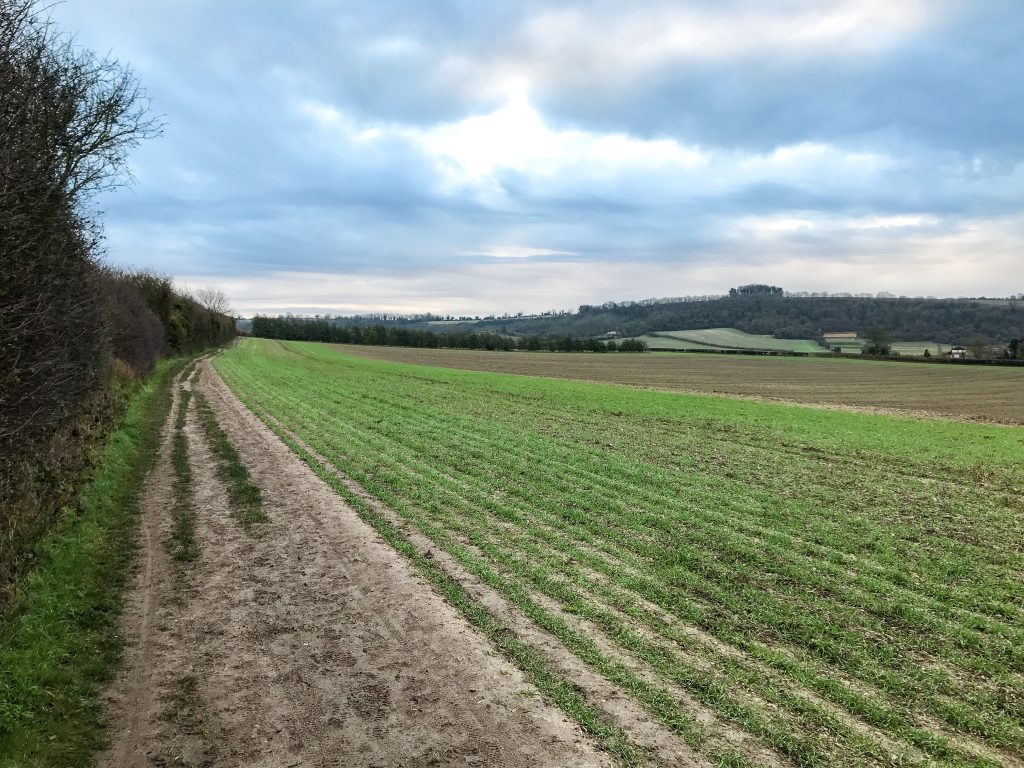
Next you will cross over the A272 and beside Cheesfoot Head a.k.a The Matterley Bowl, home to the famous Boomtown Fair every summer. The road falls away behind you as your cross through a woodland and out onto an expanse of farmers fields.
For a few miles you’ll walk past corn fields, crops of barely, cattle farms, and many other agricultural features famous in the UK. It was around this point on the walk I spotted my first red kite, so keep your eyes peeled for their magnificent forked tails sweeping through the sky above you!
Upon reaching Beacon Hill you will be greeted with one of your first viewpoints of the trail. Confusingly, there are 2 Beacon Hills on the trail and this is the smaller one. Take in the views of the valley from this nature reserve and get used to it because the panoramas only get more impressive from here on out.
Next you will climb up Old Winchester Hill for what is one of my favourite view points in Hampshire. It’s the site of an Iron Age hill fort and also contains a variety of Bronze Age barrows, a feature you will see repeatedly in the South Downs National Park.
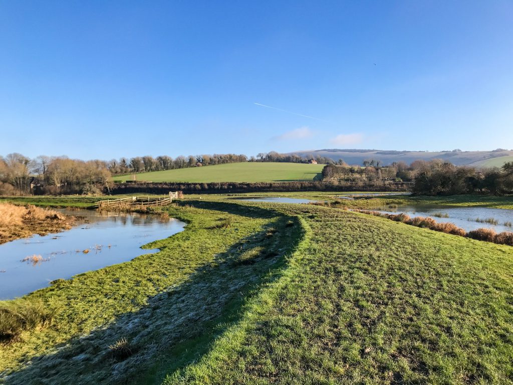
The trail dips down through Meon Valley and alongside the River Meon where the path winds along lowland areas with streams, bridge crossings, and copses of oak, elm, and beech trees.
Towards the end of the day I passed the Sustainability Centre (where I would have camped if it wasn’t closed for COVID) before pressing on towards Butser Hill to wild camp for the night.
Day 2 – Butser Hill to Cocking (15.5 miles)
Day 2 started with a sunrise walk along the ridge leading to Butser Hill accompanied by the shrill cry of pheasants in the undergrowth and the weary eyes of a pair of deer as they scampered off, startled by my footsteps.
Upon reaching Butser Hill I was a little disappointed by the large, ugly telecoms pylons on top of the hill and the loud roar of the A3. But fear not, there are still better views to come the farther east you walk.
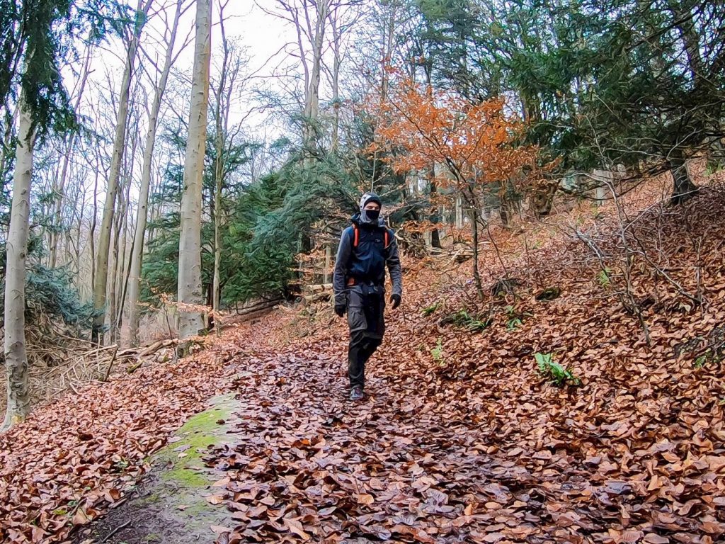
Head down the hill and cross over the A3 into Queen Elizabeth Country Park. Take it slow through this section and enjoy being in the forest because you don’t see another area of woodland this big on the whole of the trail.
This is the boundary between Hampshire and West Sussex. From here to the coast, you’re now walking through Sussex!
I hope your muscles are feeling warm by this point because there are a couple of big hill climbs that you’re about to face. The first takes you over the National Trust owned Harting Down. Here the valley falls away below you and there’s a lovely long walk along the chalk path ridge which allows you to take in the best of these views.
Following this you will be confronted by a very steep climb indeed – the steepest I came across other than the last stretch at the Seven Sisters. Now, the South Downs Way technically goes around Beacon Hill (the second hill, the first one was in Hampshire), but you’re not doing this walk because it’s easy; you’re doing it for the adventure and to see the views!
I advise you to get stuck in and climb the sharp hill. The view from the top is more than worth it, as is the sense of accomplishment. It’s not a long climb but it is undeniably tiring. However, this will be your last hill climb of the day and from here to Cocking it’s all down hill. So when you reach the top, take a breather. You’ve earned it.
Day 3 – Cocking to Amberley (12 miles)
After crossing over the A286 the trail leads up through an area of woodland around Cocking Hill. The route continues to climb up towards Charlton Forest. There are a number of reserves managed by the Murray Downland Trust and the Graffham Downland Trust in this area making for good wildlife viewing opportunities.
You may here the rattling beak of a green woodpecker or the mournful hoot of a barn owl if you are walking through the woodland at dusk. Keep an eye out for the 11 different orchids or 39 species of butterfly that call the National Park home. You might see evidence of badgers by the large mounds of earth marking their sett’s.
The trail then skirts past a number of Bronze Age barrows that are highly characteristic of the South Downs National Park before dropping down and passing over the A285. Following another gradual ascent, the trail will then take you onto Bignor Hill which marks the location of an ancient Roman road.
Pushing on, the hills will open up in front of you revealing excellent views of the Arun Valley. The path descends into the valley crossing over the A29 and entering the village of Amberley. The trail then forks, one side heading towards the village, and the other to Amberley train station – the path reconnects on the other side of Amberley.
This marks the halfway point of the South Downs Way and is the location of another one of the South Downs National Park’s rivers: the River Arun. As today is a short one, it might be worth visiting Amberley to see some of the cafes and pubs or to walk along the river and admire some of the wetland scenery.
Day 4 is a long one so rest up while you can!
Day 4 – Amberley to Pyecombe (19 miles)
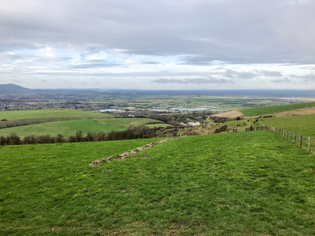
From here on out the trail is sublime. You climb a ridge and for the most part, stay at that height. The valley flattens out below you on one side with stunning views across the countryside. On the other side of the ridge the coastal plain leads out to the sea which only becomes more prominent the farther east you go.
For 6 or 7 miles after leaving Amberley it’s vintage South Downs Way. There isn’t much I can say about this section other than, enjoy the views. Enjoy the wildlife and being in this wonderful area of the world. The terrain isn’t particularly challenging nor is the ascents or descents.
The trail dips down over the A24 as you pass Washington before climbing onto the ridge and continuing the same as before. You will approach a curious loop of beech trees known as Chanctonbury Ring. Here lies the the remains of a prehistoric hill fort and many other historical features including more Bronze Age barrows.
The path descends again to cross over the River Ardur and the A283. I recommend resting for a while at the river to watch for some of the birds and wildlife that inhabit this wetland area – ducks, otters, swans, and stoats to name a few.
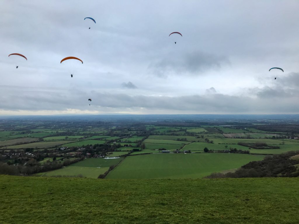
This next section is extremely popular with paragliders, so don’t be surprised if you see figures suspended beneath large kites soaring in the sky above you. The path will likely be busy as you approach the National Trust owned Devil’s Dyke, one of the most popular walking spots on the trail.
Devil’s Dyke is a Site of Special Scientific Interest with fantastic views along the v-shaped funnel of the valley. After crossing through Devil’s Dyke there is a steady descent down towards Pyecombe and the A23 where you will finish your walk for the day.
Day 5 – Pyecombe to Southease (15 miles)
As usual, it doesn’t take long to climb from the dips in the valleys up to the ridges where the landscape becomes inundated with rolling hills and magnificent views. On this occasion the bleached chalk path takes you through Pyecombe Golf Club before opening up to the expansive landscape on Ditchling Beacon Nature Reserve.
If you haven’t already spotted it, you should be able to make out the matchstick figure of the BA Viewing Tower to the south signifying Brighton Pier and Beach. After leaving Ditchling Beacon the path hooks round to the south following the shape of the National Park as it curves up against the coast.
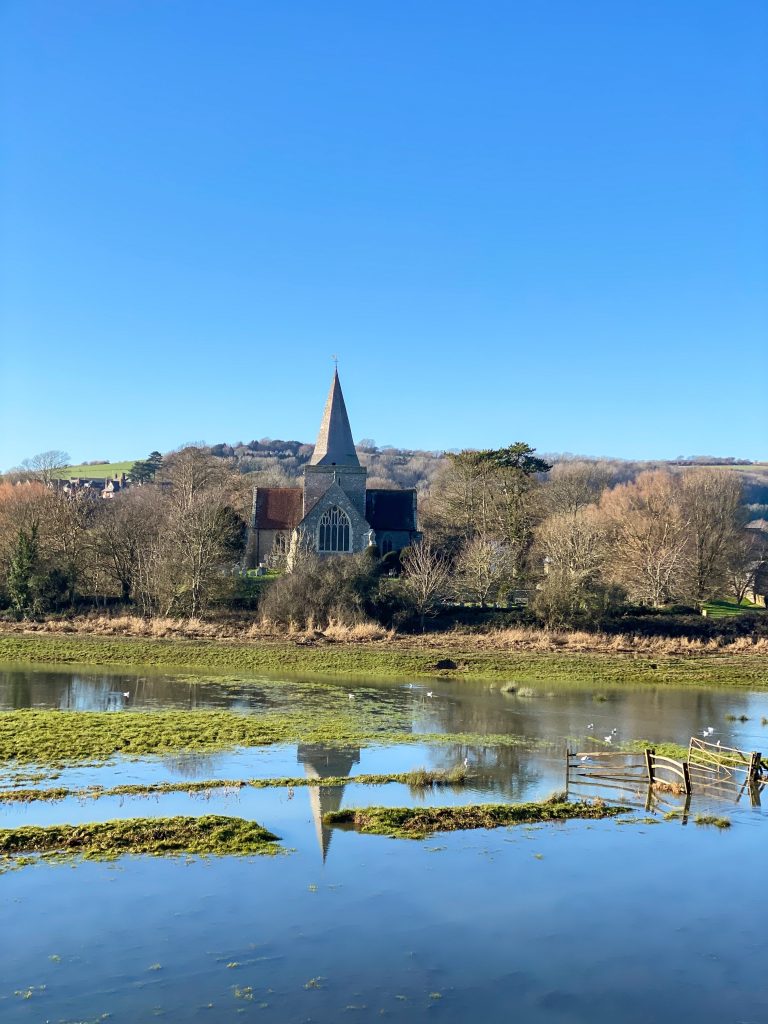
I walked this section after heavy rainfall and it was incredible seeing the flood plains full of silvery water and I spent a lot of time tracing the line of the River Ouse as it flowed towards the sea. You should also be able to make out the historic town of Lewes in the valley below.
Next you will cross the A27 and the lowland flood plains around Southease. There are some lovely churches in this hamlet that are well worth a visit such as the Church of St Peter, Southease. Again, take some time to appreciate crossing the River Ouse as there aren’t many of these on the South Downs Way.
Day 6 – Southease to Eastbourne via Seven Sisters (17 miles)
It’s possible to take an alternative route inland past the Long Man of Wilmington but, in my opinion, there is only one true end to this route and that’s via the Seven Sisters. Not going that way would be a bit like going to Paris and not seeing the Eiffel Tower. It’s one of the key highlights of the South Downs Way and although the trail is tough, it simply can’t be missed.
After leaving Southease, the path rises up over Firle Beacon where the coast should feel closer than at any other point on the trail so far. As you walk you should be able to make out the mounds of the Seven Sisters in front of you and the edge of Eastbourne off to the side. You’re nearly in the home run now, but there’s some of the best views still to come!
You have quite a treat ahead of you as you dip down into the gorgeous village of Alfriston. It must be one of the most quaint and pretty villages I’ve seen in England. Have a walk around the Church of St. Andrew and visit some of the pubs and cafes if you have time. This could be a lovely place to spend the night if you wish to break up the distance of this challenging final day.
Leaving Alfriston you will cross over a bridge and the route will diverge. Ignore the South Downs Way signs heading inland and instead follow the path along the Cuckmere River. I adored this section as the path hugs the banks of the river and crosses right through the wetland.
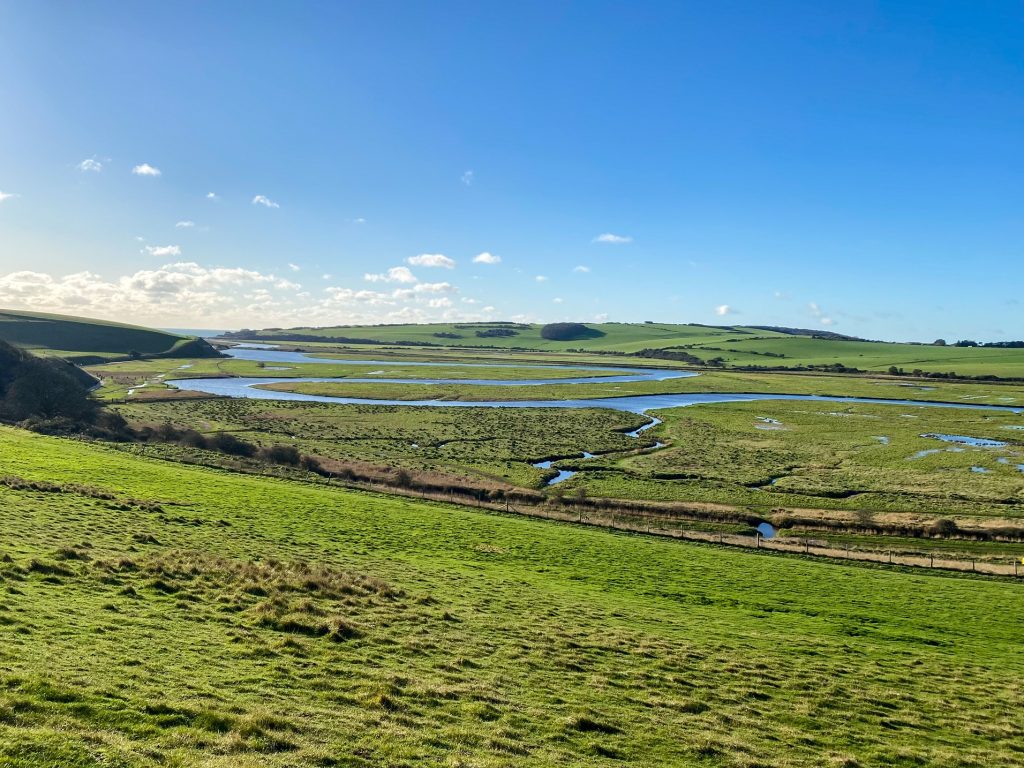
Following the river for a few miles you will soon reach the Seven Sister Country Park where you will get your fist close up view of the coast! Stick on the east bank of the river and follow the path as it leads up the rising chalk mounds away from Cuckmere Haven. (You’re welcome to add a small diversion to the beach if you want to get up close to the waves but there are other opportunities to do so later in the trail).
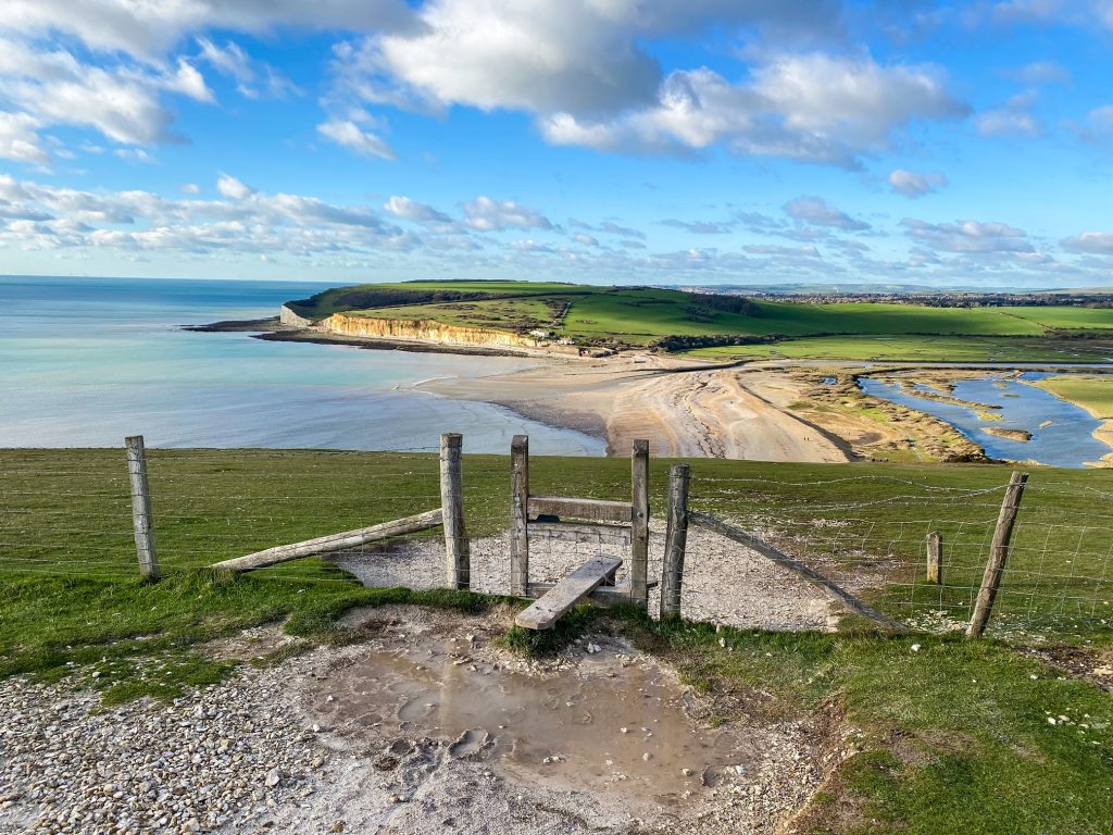
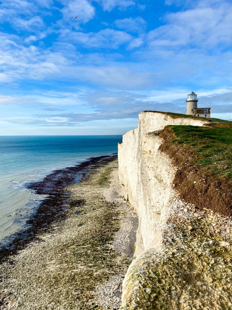
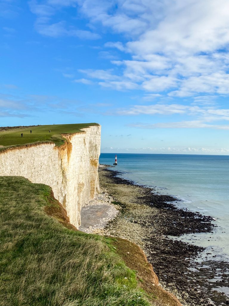
At last you’re here. You’ve made it to the English Channel! From here the path traces the precipitous cliff edge rolling up and down towards Birling Gap where you can amble onto the beach. Be sure to spend some time examining the magnificent limestone rock and fossilised layering of the cliffs as you walk along them.
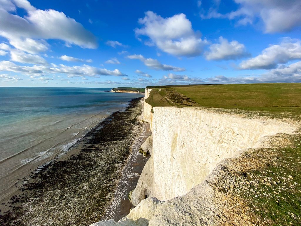
If you dare, peer over the edge and down to the waves below, but be warned, these cliffs are constantly crumbling and you don’t want to get too close! The path continues past Belle Tout Lighthouse perched on the headland and alongside the famous red and white Beachy Head Lighthouse nestled at the base of the cliffs amongst the tidal surf.
Take your time ambling along this final section before the slatted groins and busy beachfront of Eastbourne begin to open out below you. A short walk down the hill will lead you to the finish line where a plinth beside The Kiosk marks the end of the trail.
Congratulations – you’ve done it! You have just conquered the South Downs Way!
10. Bonus Tips
Plan Your Water Refill Points
Although water is easy to find, there are still sections where you walk miles before there’s any refill points. If you’re walking in mid-summer and the heat is in the upper 20 degrees, you might get through your reserves faster than expected!
I usually carry at least 1.5 – 2 litres per person and 2.5 if I’m camping and need water to cook with. But you probably don’t need to carry as much as this. The refill taps are close enough together that you aren’t in dire trouble if you run out. Just make sure you refill every time you go past a tap to ensure you do have water to hand.
Save the Number of a Taxi Company
The South Downs Way isn’t always easy to access. When you’re up on a ridge, away from towns and villages, you only cross a few train stations and main roads. On these roads there is usually a bus station you can walk to but they can be infrequent and only serve to get you out of the park to a town where you change to another bus or train.
If you have the number of a few taxi companies, you can call them and get them to pick you up from any road whenever you feel tired. You might not make it to your destination and may find yourself needing to be picked up from some quiet country road or hill-top car park. It’s good to have the taxi option up your sleeve just in case you need to use it.
Don’t Walk it in Winter
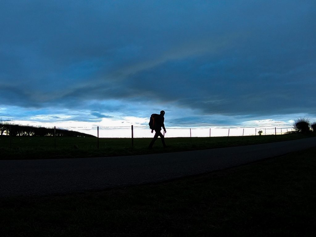
This may seem obvious, but it’s exactly what I did. It’s cold and dark in winter and you’re limited with your hours of daylight. It’s not dramatic like you might find in Snowdonia or the Lake District with snow and frost, and generally the conditions are quite grey and mild.
That’s not to say I didn’t have some nice walking weather, because I did. It’s just that the South Downs Way will be at its glorious best in the summer when it’s basking in sun, or during the fringe seasons of late spring and early autumn if you want quieter trails.
I walked the route in winter but that’s okay, it’s my job and I can’t wait all winter without doing any hiking! I do it so I can make these guides for you to use! If you’re walking the trail for leisure purposes, as most people are, definitely wait for the good weather in the summer.
Consider Going on Bike
I don’t use bikes and I never really have. I prefer the pace of walking, but with the South Downs Way I could definitely see the allure. It is perfect for cycling! I saw hundreds of cyclists racing across the ridge on all sorts of bikes, doused in mud, with gleeful looks on their faces.
The route remains relatively flat for long distances along the ridges. The paths are compact and fairly smooth. These are perfect conditions for bikes and it’s easy to see why so many people cycle this route.
Queen Elizabeth Country Park also has some mountain biking trails which could also be worth visiting for the day. There are plenty of options to explore!
Bring a Medical Kit
As mentioned, there are a lot of chalk and flint paths to walk along. In one sense this is great because over short distances it’s secure underfoot and easy to walk on. In another sense, over long distances, the hard ground acts as a tenderiser on your feet which causes them to swell up terribly.
My trick for combatting this was to prop my feet up every evening and to take some anti-inflammatory pills such as ibuprofen to reduce the swelling each evening. This seemed to do the trick quiet nicely but there’s no denying this walk – and any other hike of this distance – is hard on the feet.
Your medical kit should include plasters, blister plasters, ibuprofen/paracetamol (painkiller and anti-inflammatory), and allergy relief pills. It’s also worth carry diarrhoea relief pills, big bandages, gauze, tape, rehydration salts, and extra strength painkillers just in case.
See also:
10 Hiking Safety Tips
Before You Go
Thanks for reading my travel guide on the South Downs Way. If travel guides like this interest you, head over to my blog page to find out more!
If you’re new to Walk Wild, check out the About Me page to learn who I am and what made me want to be a travel writer.
Please comment below, let me know what you think and if there’s anything else you want information on!
Follow me on Twitter, Instagram, and YouTube to see out more.